Inner Harbor in Baltimore, Maryland — The American Northeast (Mid-Atlantic)
Water Power: Baltimore's Economic Engine
Jones Falls Trail and the Seven Foot Knoll Lighthouse
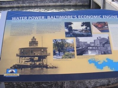
Photographed by Don Morfe, April 10, 2011
1. Water Power: Baltimore's Economic Engine Marker
The best-known and least-appreciated fresh waterway in Baltimore, the Jones Falls River is an important tributary of the Chesapeake Watershed, and the largest of several waterways that empty into Baltimore Harbor. From the time of the first colonial settlements, the Jones Falls River has served Baltimore City as a transportation corridor, a power source for early industry, and a source of drinking water. In fact, the mills powered by the swift-flowing Jones Falls played a key role in making Baltimore an industrial giant in the 19th century. Sadly, much of the natural beauty of this Bay tributary has been obscured by road construction, including the elevated Jones Falls Expressway. One result of the many efforts now underway to restore the Jones Falls is the new Jones Falls Trail, a hiking and biking Trail that follows the river, passing historic mills and the Baltimore Streetcar Museum, and winding through the 745-acre Druid Hill Park. When completed, the Trail will extend 12 miles from the Inner Harbor to Mt. Washington Village.
Seven Foot Knoll Lighthouse
For 133 years, the Seven Foot Knoll Lighthouse and its beacon
this page online
Chesapeake Connection
With access to worldwide distribution via the Chesapeake Bay, by 1827 Baltimore was the nation’s largest exporter of flour, ground by dozens of mills along the Jones Falls. In addition, by 1840, textile mills in the Jones Falls valley produced 80% of the nation’s cotton duck, or sail cloth.
Topics and series. This historical marker is listed in this topic list: Waterways & Vessels. In addition, it is included in the Lighthouses series list. A significant historical year for this entry is 1856.
Location. This marker has been replaced by another marker nearby. It was located
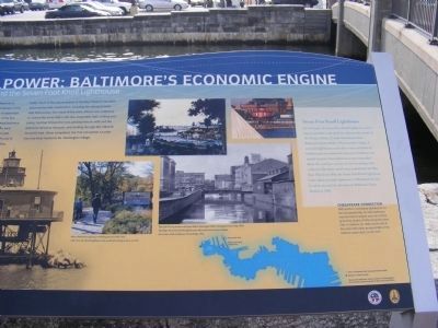
Photographed by Don Morfe, April 10, 2011
2. Water Power: Baltimore's Economic Engine Marker
Right side of the marker above where it was cut off.

Regionally, this marker was in Central Maryland. It was also in the American Mid-Atlantic, in the Chesapeake Bay Region, and on the Eastern Seaboard. Globally, it was in the North Atlantic Region, North America, the Western Hemisphere, the Western World, and the Anglosphere. Historically, it found itself in what was once one of the original Thirteen Colonies and also the Antebellum South.
Other nearby markers. At least 7 other markers are within walking distance of this location: Jones Falls (a few steps from this marker); Baltimore Riot Trail (about 300 feet away, measured in a direct line); Baltimore Public Works Museum (about 300 feet away); The Last Pearl Harbor Survivor (about 600 feet away); a different marker also named Seven Foot Knoll Lighthouse (about 600 feet away); On to Yorktown
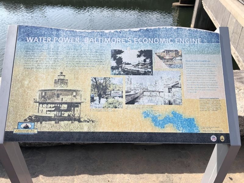
Photographed by Devry Becker Jones (CC0), February 17, 2020
3. Water Power: Baltimore's Economic Engine Marker
Marker has significant weather damage.
Other markers no longer nearby. Christopher Columbus Memorial (was within shouting distance of this marker but has been permanently removed); a different marker also named Baltimore Riot Trail (was about 300 feet away but has been replaced with another marker now near it); Coast Guard Cutter Taney - WHEC-37 (was about 500 feet away but has been replaced with another marker now near it); The Coast Guard Cutter Taney (was about 600 feet away but has been replaced with another marker now near it); Seven Foot Knoll Lighthouse (was about 600 feet away but has been replaced with another marker now near it); Seven-Foot Knoll Lighthouse (was about 600 feet away but has been replaced with another marker now near it); The Inner Harbor Water Wheel (was about 600 feet away but has been replaced with another marker now near it); Living Classrooms Foundation (was about 600 feet away but has been permanently removed); a different marker also named Baltimore Riot Trail (was about 600 feet away but has been replaced with another marker now near it).
Related marker. Click here for another marker that is related to this marker. This marker has been replaced with the linked marker.
Credits. This page was last revised on March 15, 2025. It was originally submitted on November 8, 2012, by Don Morfe of Baltimore, Maryland. This page has been viewed 748 times since then and 17 times this year. Last updated on January 22, 2019, by Devry Becker Jones of Washington, District of Columbia. Photos: 1, 2. submitted on November 8, 2012, by Don Morfe of Baltimore, Maryland. 3. submitted on February 17, 2020, by Devry Becker Jones of Washington, District of Columbia. • Andrew Ruppenstein was the editor who published this page.
