Les moyens de comunication
⎯⎯⎯
Methods of Communication
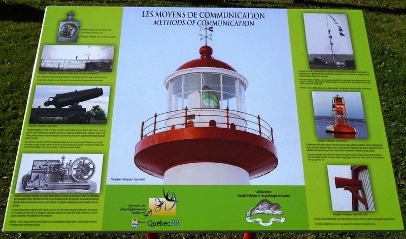

[Côté gauche du marqueur]
• Modèle de lanterne que l'on fixait à un mât.
• Une simple lanterne au bout du quai fixée à un mât guidait les navires pour entrer dans le havre.
• Pendant longtemps, il y avait ici et là sur les pointes avançant dans la mer, le long du Saint-Laurent, un canon que l'on tirait à intervalle pour signaler la présence de navires par temps brumeux. À Matane, au bout de la Pointe, près du premier manoir des seigneurs, se trouvait l'un de ces petits canons qui permettait d'annoncer l'entrée du havre.
• Modèle de télégraphe électrique de Samuel Morse utilisé en Amérique du Nord au XIXe siècle. Les informations sur la navigation étaient transmises deux fois par jour à Québec par lien télégraphique. Les armateurs pouvaient ainsi être avisés du mouvement de leur navire comme les dépêches télégraphiques étaient publiées dans les journaux.
[Côté droit du marqueur]
• À compter de 1884, le gardien de phare s'occupait du fonctionnement des pavillons du sémaphore. La combinaison de 18 pavillons différents permettait de communiquer avec les navires. Les messages étaient ensuite acheminés à Quebec
this page online
• À l'embouchure de la rivière Matane se trouvait cette bouée pour guides les navigateurs. Selon le mouvement des vagues, on pouvait entendre la cloche sonner. Les plus jeunes se souviendront que, dans les années 60-70, lors de brouillard et de mauvais temps, le son du criard de brume retentissait. Il était situé sur le quai, à l'ouest.
• Le criard de brume était tourné vers le large. Il était actionné par de l'air comprimé emmagasiné dans un réservoir.
[Left side of marker]
• A single lantern attached to a [mast] at the end of the pier guided ships, bringing into the harbour safely.
• For a long time, cannons were fired at various points jutting in to the St. Lawrence right along the coast to signal the presence of ships in foggy weather. We had one of these [cannons] here in Matane, at the end of La Pointe, close to the first Lord's Manor. It was used to announce a ship's arrival into the harbour.
• A Samuel Morse electric telegraph used in North America in the 19th century. Navigation information was transmitted to Quebec City twice daily via telegraphs. Shipowners could find out about their ship's movement, as the telegraphic despatches were published in the newspaper.
[Right side of marker]
• This buoy was located at the mouth of the Matane River to guide sailors. In choppy currents, the bell would ring. Some locals might remember hearing the foghorn during foggy weather in the 1960s and 1970s. It was located on the west side of the pier.
• The foghorn faced the open river. It was operated by compressed air stored in a tank.
• Lantern that was attached to a [mast].
• From 1884 onwards, the lighthouse keeper was also responsible for the semaphore flag signalling system. The combination of 18 different flags allowed the lighthouse keeper to communicate [with] ships. The messages were then transmitted to Quebec City via telegraph.
Erected by Ville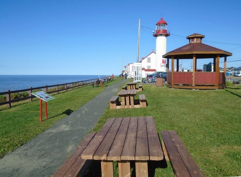
Topics and series. This historical marker is listed in these topic lists: Communications • Waterways & Vessels. In addition, it is included in the Lighthouses series list. A significant historical year for this entry is 1884.
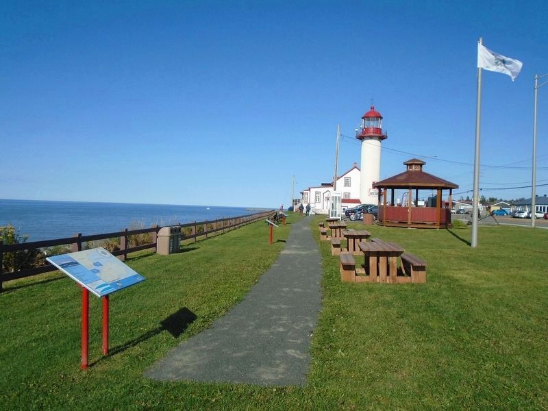
Location. 48° 50.993′ N, 67° 32.979′ W. Marker is in Matane, Québec, in Bas-Saint-Laurent. It is on Avenue du Phare Ouest (Québec Route 132) just east of boulevard Dion, on the left when traveling east. Marker is in Parc Octavia-Roy-Desjardins, on the grounds of the former Matane Lighthouse. Touch for map. Marker is at or near this postal address: 968 avenue du Phare Ouest, Matane QC G4W 3M6, Canada. Touch for directions.
Regionally, this marker is in Eastern Québec & Gaspésie. It is also in Central Canada. Globally, it is in the North Atlantic Region, North America, the Western Hemisphere, and the Western World. Historically, it finds itself in what was once a British colony, the Viceroyalty of New France, the Haudenosaunee (Iroquois) Confederacy, and Rupert’s Land.
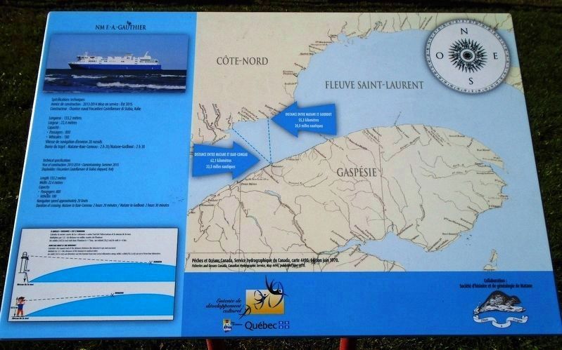
Other nearby markers. At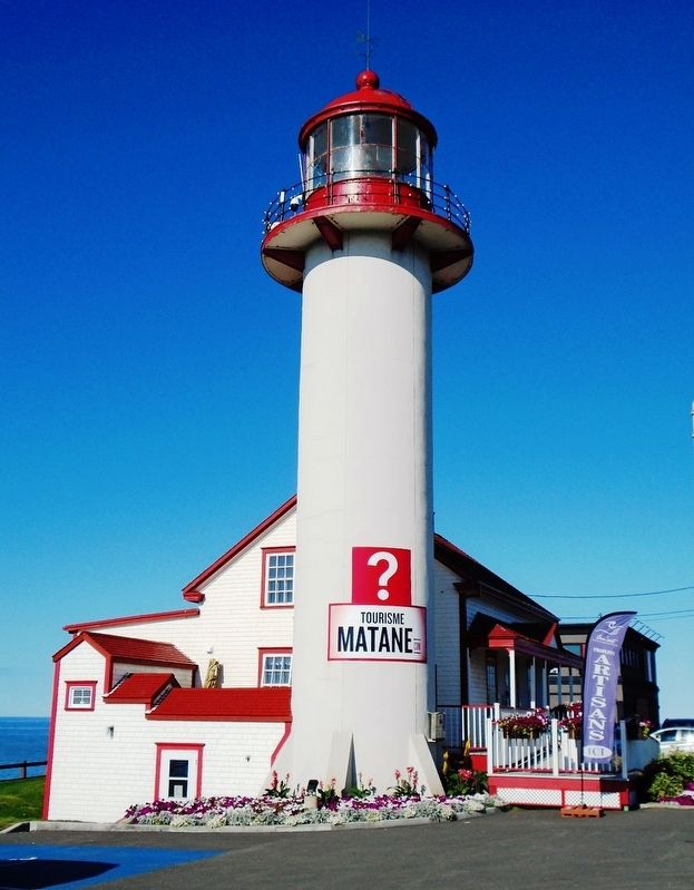
Related marker. Click here for another marker that is related to this marker.
Also see . . .
1. Matane Lighthouse History. Lighthouse Friends website entry (Submitted on January 23, 2019, by William Fischer, Jr. of Reynoldsburg, Ohio.)
2. The Lighthouse Trail (from Rivière-du-Loup to Tadoussac). Quebec by the Sea website entry (Submitted on January 23, 2019, by William Fischer, Jr. of Reynoldsburg, Ohio.)
Credits. This page was last revised on November 24, 2023. It was originally submitted on January 23, 2019, by William Fischer, Jr. of Reynoldsburg, Ohio. This page has been viewed 198 times since then and 11 times this year. Photos: 1, 2, 3, 4, 5. submitted on January 23, 2019, by William Fischer, Jr. of Reynoldsburg, Ohio.
