Un feu dans la nuit
⎯⎯⎯
A Light in the Night

[Côté gauche du marqueur]
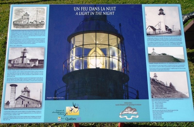
• Le premier phare de Matane s'intégrait dans un réseau de phares construits sur les rives de l'estuaire et du golfe du Saint-Laurent en Gaspésie. Comme l'architecture du phare était simple et la construction en bois peu coûteuse, on a pu en ériger plusieurs pour améliorer la navigation dans les environs. Mis en opération le 1er octobre 1873, le haut bâtiment se situait près de l'emplacement du phare que l'on peut voir aujourd'hui, soit à environ 1,4 km à l'ouest de la rivière Matane. Avec l'érosion, il a dû être déplacé environ au même endroit que l'actuel phare.
• De la base à la girouette, le phare se situait à 65 pieds (environ 20 mètres) au-dessus du niveau des eaux à marée haute et par temps clair, la lumière était visible à 10 milles (16 kilomètres). Une bande verticale et horizontale de couleur noire, côté mer, permettait de le rendre plus distinct en tant que point de repère le jour.
• Le nouveau phare en béton est prêt à recevoir sa lanterne et son système d'éclairage. Sa hauteur est de 48 pieds (près de 15 mètres), de la base jusqu'à l'emplacement du feu. Ici, on voit
this page online
[Côté droit du marqueur]
• Le deuxième phare a fonctionné du 10 novembre 1907 jusqu'en 1951. Celui-ci a une hauteur de 67 pieds (20 mètres) de la base à la girouette et 56 marches. C'est en juin 1951 que l'on met fin aux opérations de ce phare à la suite de l'installation d'une lumière verte dignotante sur le quai ouest, dans l'ancien havre de Matane.
• Peu se souviennent de ce vaste espace de plus de 150 pieds (45 mètres) qui se trouvait derrière le phare, permettant au gardien de cultiver un grand potager et de garder des animaux de ferme.
• Vue de l'érosion du terrain en juillet 1957 avant l'enrochement dans les années 60.
Distance entre le phare et le bas de la falaise:
1915 plus de 100 pieds (30 mètres)
1940 65 pieds (19 mètres)
1945 52 pieds (15 mètres)
1950 33 pieds (10 mètres)
2017 moins de 20 pieds (6 mètres)
[Left side of marker]
• From the base of the weathervane, the lighthouse was positioned 65 feet (approximately 20 metres) above the water level at high tide. In clear weather, the light was visible from 16 kilometres (10 miles). A vertical and horizontal black stripe, on the sea-facing side of the building, made the lighthouse a clear point of reference during the day.
• The new concrete lighthouse [readied to receive its lantern and lighting system. This lighthouse was 48-feet-tall (approximately 15 metres) from the base to the beacon. Here, you can clearly see the lighthouse keeper's lodge, built in 1882.
[Right side of marker]
• Not many people remember this vast space behind the lighthouse. The lighthouse keeper had 150 feet (45 metres) where he could plant a vegetable garden and keep livestock.
• View of the erosion of the land in July 1957 before the riprap in the 1960s.
• Matane's first lighthouse was part of a network of lighthouses built along the Gaspé Peninsula, on the banks of the estuary and the gulf of the St. Lawrence River. The simple architecture and inexpensive wooden structure meant that many lighthouses could be erected. Commissioned on October 1, 1873, the tall building was located close to the current lighthouse's position, approximately 1.4 kilometres west of Matane River. Due to erosion, the lighthouse was repositioned at the site of the current lighthouse.
• The second lighthouse was operational from November 10, 1907 until 1951. This lighthouse was 67-feet-tall (20 metres) from the base of the weathervane and had 56 steps to climb. In June 1951, this lighthouse stopped operating, following the installation of a green flashing light on the west pier, in the former Harbour of Matane.
Distance between the lighthouse and the base of the cliff:
1915 Over 100 feet (30 metres)
1940 65 feet (19 metres)
1945 52 feet (15 metres)
1950 33 feet (10 metres)
2017 under 20 feet (6 metres)
Erected by Ville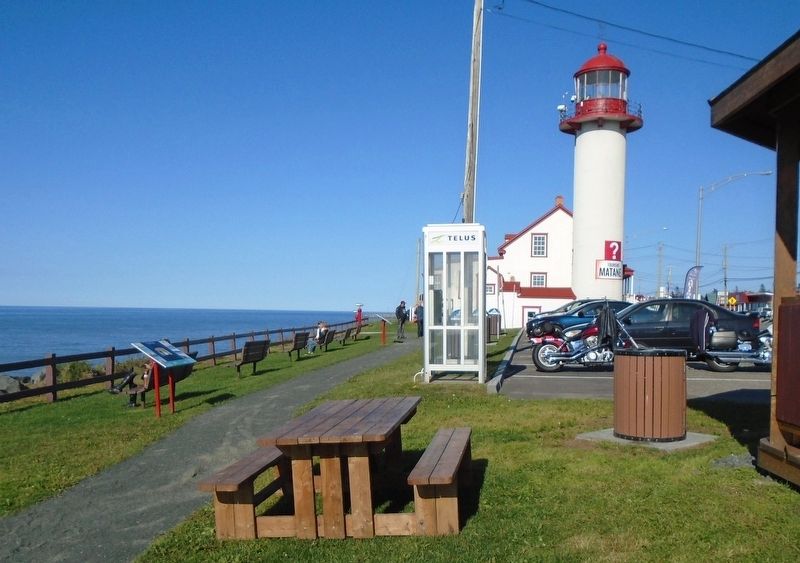
Topics and series. This historical marker is listed in these topic lists: Communications • Waterways & Vessels. In addition, it is included in the Lighthouses series list. A significant historical year for this entry is 1873.
Location. 48° 50.997′ N, 67° 32.966′ W. Marker is in Matane, Québec, in Bas-Saint-Laurent. It is on Avenue du Phare Ouest just east of boulevard Dion, on the left when traveling east. Marker is in Parc Octavia-Roy-Desjardins, on the grounds of the former Matane Lighthouse. Touch for map. Marker is at or near this postal address: 968 avenue du Phare Ouest, Matane QC G4W 1V7, Canada. Touch for directions.
Regionally, this marker is in Eastern Québec & Gaspésie. It is also in Central Canada. Globally, it is in the North Atlantic Region, North America, the Western Hemisphere, and the Western World. Historically, it finds itself in what was once a British colony, the Viceroyalty of New France, the Haudenosaunee (Iroquois) Confederacy, and Rupert’s Land.
Other nearby markers. At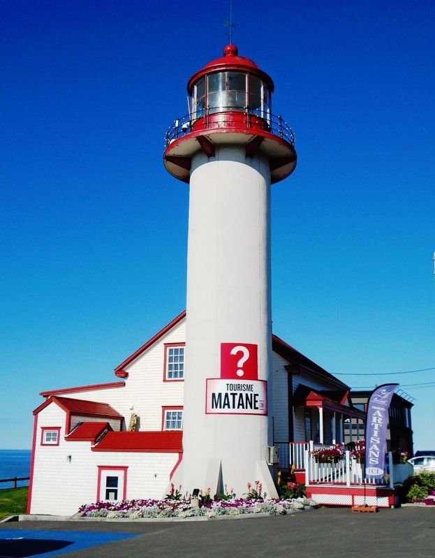
Also see . . .
1. Matane Lighthouse History. (Submitted on January 24, 2019, by William Fischer, Jr. of Reynoldsburg, Ohio.)
2. The Lighthouse Trail (from Rivière-du-Loup to Tadoussac). (Submitted on January 24, 2019, by William Fischer, Jr. of Reynoldsburg, Ohio.)
Credits. This page was last revised on January 20, 2020. It was originally submitted on January 23, 2019, by William Fischer, Jr. of Reynoldsburg, Ohio. This page has been viewed 248 times since then and 15 times this year. Photos: 1, 2, 3. submitted on January 23, 2019, by William Fischer, Jr. of Reynoldsburg, Ohio.
