Near Silcott in Asotin County, Washington — The American West (Northwest)
Temuut'su
(Chief Timothy)
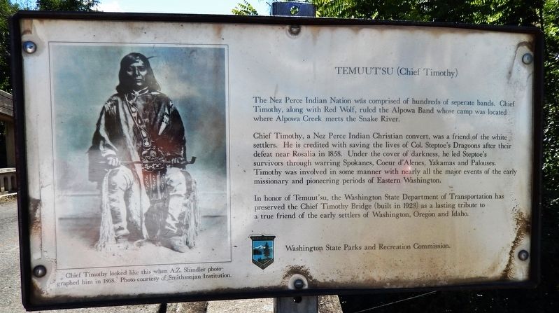
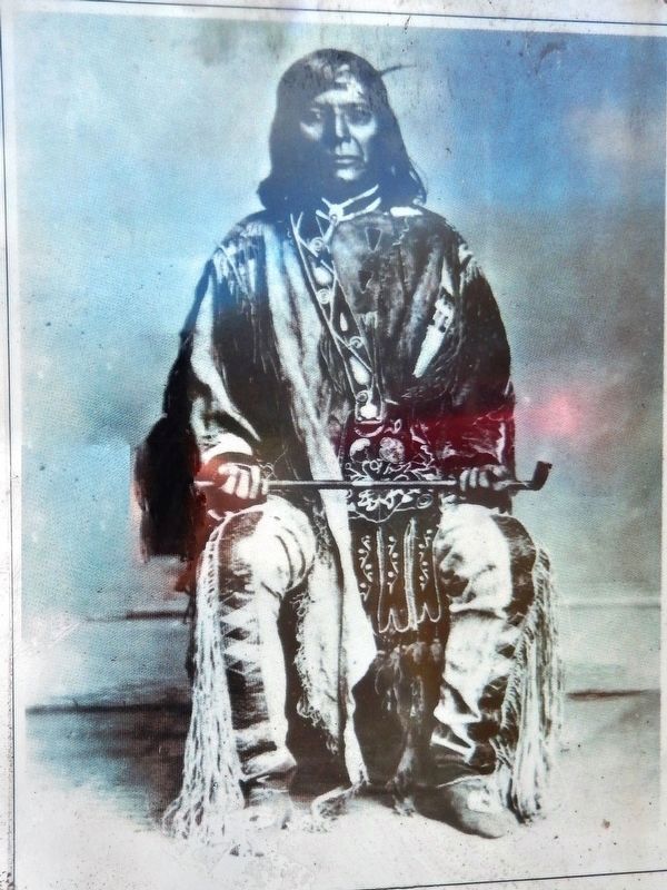
The Nez Perce Indian Nation was comprised of hundreds of separate bands. Chief Timothy, along with Red Wolf, ruled the Alpowa Band whose camp was located where Alpowa Creek meets the Snake River.
Chief Timothy, a Nez Perce Indian Christian convert, was a friend of the white settlers. He is credited with saving the lives of Col. Steptoe's Dragoons after their defeat near Rosalia in 1858. Under the cover of darkness, he led Steptoe's survivors through warring Spokanes, Coeur d'Alenes, Yakamas and Palouses. Timothy was involved in some manner with nearly all the major events of the early missionary and pioneering periods of Eastern Washington.
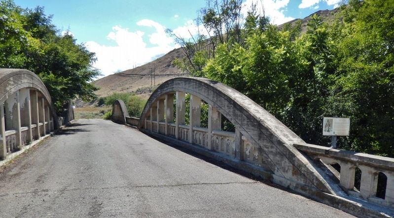
In honor of Temuut'su, the Washington State Department of Transportation has preserved the Chief Timothy Bridge (built in 1923) as a lasting tribute to a true friend of the early settlers of Washington, Oregon and Idaho.
Erected by Washington State Parks and Recreation Commission.
Topics. This historical marker is listed in these topic lists: Bridges & Viaducts • Native Americans.
Location. 46° 24.723′ N, 117° 12.785′ W. Marker is near Silcott, Washington, in Asotin County. Marker can be reached from U.S. 12, 0.1 miles east of Westlake Drive, on the right when traveling east. Marker is mounted on the railing at the east end of the Indian Timothy Memorial Bridge. Bridge and marker are accessible via a turn-out on the south side of the highway just east of Alpowa Creek. Touch for map. Marker is in this post office area: Clarkston WA 99403, United States of America. Touch for directions.
Other nearby markers. At least 8 other markers are within 9 miles of this marker, measured as the crow flies. Álpáwayma Village (approx. one mile away); Snake River Passage & Columbia Plains Crossing (approx. one mile away); Lewis & Clark Historic Trail (approx. 2.7 miles away); Lewis and Clark Enter Washington (approx. 6.2 miles away); Lewis and Clark (approx. 7.8 miles away); Granite Lake Park (approx. 7.9 miles away); Lewis & Clark Almost Slept Here (approx. 7.9 miles away); Nimiipuu Homelands (approx. 8.3 miles away).
More about this marker. Marker is a framed, painted metal sign, mounted atop the bridge railing.
Also see . . . Indian Timothy Memorial Bridge. Wikipedia entry:
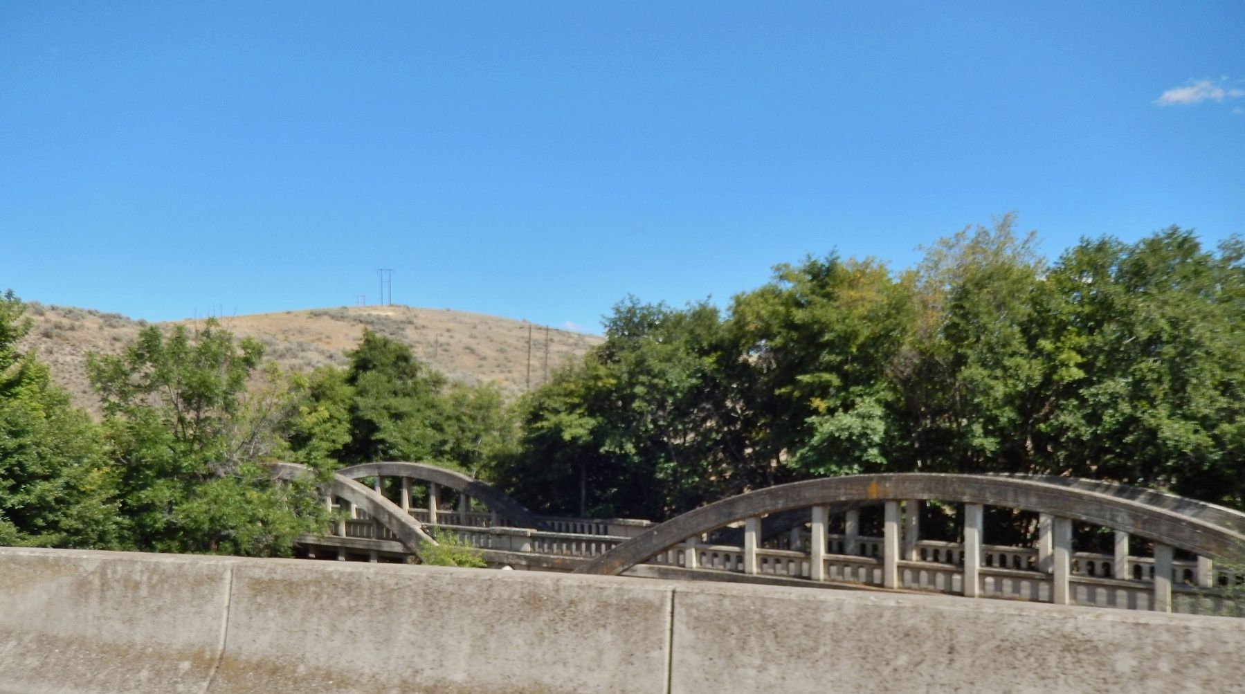
The Indian Timothy Memorial Bridge is a tied-arch bridge which spans Alpowa Creek less than half a mile before that creek joins the Snake River, about 8 miles west of Clarkston, Washington. It was built by the Washington State Department of Transportation in 1923 and was listed on the National Register of Historic Places in 1982.
It is the only two-span tied arch bridge in the state, and one of only five concrete tied arch bridges. It has two 100 feet arches, each of which has 20 feet rise. (Submitted on January 24, 2019, by Cosmos Mariner of Cape Canaveral, Florida.)
Credits. This page was last revised on July 11, 2021. It was originally submitted on January 24, 2019, by Cosmos Mariner of Cape Canaveral, Florida. This page has been viewed 486 times since then and 60 times this year. Photos: 1, 2, 3, 4, 5. submitted on January 24, 2019, by Cosmos Mariner of Cape Canaveral, Florida. • Andrew Ruppenstein was the editor who published this page.


