Santiago de Querétaro in Querétaro, Mexico — The Central Highlands (North America)
The Main Water Canal
La Acequia Madre
La Acequia Madre
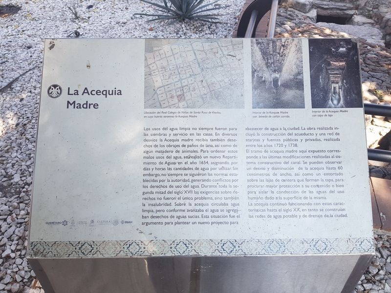
Los usos del agua limpia no siempre fueron para las siembras y servicio en las casas. En diversos desvíos la Acequia madre recibía también desechos de los obrajes de paños de lana, así como de algún matadero de animales. Para ordenar estos malos usos del agua, se realizó un nuevo Repartimiento de Aguas en el año 1654, asignando por días y horas las cantidades de agua por utilizar. Sin embargo, no siempre se siguieron las normas establecidas por la autoridad, generando conflictos por los derechos de uso del agua. Durante toda la segunda mitad del siglo XVII las exigencias sobre derechos no fueron el única problema, sino también la insalubridad. Sobre la acequia circulaba agua limpia, pero conforme avanzaba el agua se agregaban desechos de aguas sucias. Esta situación fue el argumento para plantear un nuevo proyecto para abastecer de agua a la, ciudad. La obra realizada incluyó la construcción del acueducto y una red de atarjeas y fuentes públicas y privadas, realizada entre los años 1720 y 1738.
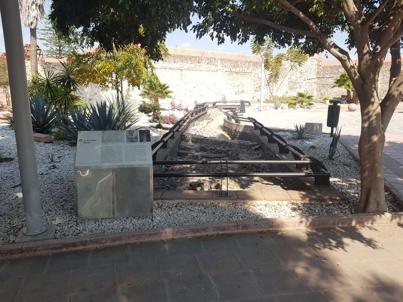
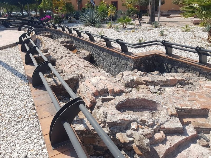
El tramo de acequia madre aquí expuesto corresponde a las últimas modificaciones realizadas al sistema constructivo del canal. Se pueden observar un desvió y disminución de la acequia hasta 60 centímetros de ancho, así como un entortado sobre las lajas de cantera que forman la tapa, para procurar mayor protección a su contenido o bien para aislar la conducción de las aguas del uso humaño dado a la superficie de la misma.
La acequia continuó funcionando con estas características hasta el siglo XX, en tanto se construían las redes de agua potable y de drenaje de la ciudad.
Pie de dibujos:
Ubicación del Real Colegio de Niñas de Santa Rosa de Viterbo, en cuyo huerto atraviesa la Acequia Madre
Interior de la Acequia Madre con bóveda de cañón corrido
Interior de la Acequia Madre con tapa de laja
English translation:
The Main Water Canal
Clean water was not only used for irrigation and domestic uses. The Main Water Canal also received wastewater from the many wool mills, as well as from animal slaughterhouses. In order to limit these sources of contaminated water, a new water distribution plan was implemented in 1654, assigning the days, hours and the quantities of water to be used. However, the rules established by the authorities were not always followed, generating conflicts over the rights to use the water. Throughout the second half of the 17th century the demands on rights were not the only problem, but also
the unhealthiness of the water supply. Clean water circulated in the canal, but as the water progressed through the system, wastewater was added. This situation led to the proposal of a new project to supply water to the city. The work carried out included the construction of the aqueduct and a network of sewers and public and private fountains, made between 1720 and 1738.
The section of the Main Water Canal exposed here corresponds to the last modifications made to the construction system of the canal. You can see a deviation canal from the main system and a portion where the canal decreases in width to 60 centimeters, as well as a covering made of slabs of quarried stone that form a type of lid that sought to provide greater protection to its clean water or to isolate the water from the surface.
The water canal continued to operate with these characteristics until the 20th century, while the drinking water and drainage networks of the city were being built.
Captions:
Location of the Royal College of Girls of Santa Rosa de Viterbo, with the Main Water Canal crossing its garden
Interior of the Main Water Canal showing its interior covered by a vault
Interior of the Main Water Canal with its covering made of quarried stone
Erected by Instituto Nacional de Antropología e Historia
(INAH) y otras organizaciones.
Topics. This historical marker is listed in these topic lists: Colonial Era • Industry & Commerce • Man-Made Features. A significant historical year for this entry is 1654.
Location. 20° 35.266′ N, 100° 23.756′ W. Marker is in Santiago de Querétaro, Querétaro. Marker can be reached from José María Arteaga just west of Melchor Ocampo, on the left when traveling west. The marker and remains of the acequia are in the large open courtyard on the grounds south of the Santa Rosa de Viterbo Catholic Church. Touch for map. Marker is in this post office area: Santiago de Querétaro QUE 76000, Mexico. Touch for directions.
Other nearby markers. At least 8 other markers are within walking distance of this marker. Water Storage Tank and Wash Basins (a few steps from this marker); a different marker also named The Main Water Canal (within shouting distance of this marker); Church of Santa Rosa de Viterbo (within shouting distance of this marker); Royal College and Convent of Santa Rosa de Viterbo (within shouting distance of this marker); General José María Arteaga Magallanes (about 90 meters away, measured in a direct line); Fountain of Santa Rosa de Viterbo (about 90 meters away); Chapel of the Holy Spirit (about 90 meters away); Ezequiel Montes Ledesma (about 120 meters away). Touch for a list and map of all markers in Santiago de Querétaro.
Credits. This page was last revised on January 28, 2019. It was originally submitted on January 28, 2019, by J. Makali Bruton of Accra, Ghana. This page has been viewed 82 times since then and 2 times this year. Photos: 1, 2, 3. submitted on January 28, 2019, by J. Makali Bruton of Accra, Ghana.


