Emigrant Gap in Placer County, California — The American West (Pacific Coastal)
Nyack Lodge
Hwy 40 Scenic Bypass
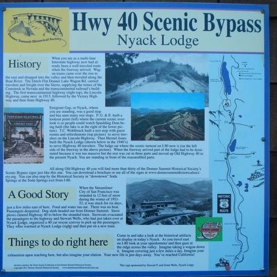
What you see as a multi-lane Interstate highway now had already been a well-traveled route when the freeway arrived. Wagon trains came over the rise to the east and dropped into the valley and then travelled along the Bear River. The Dutch Flat Donner Lake Wagon Rd. carried travelers and freight over the Sierra, supplying the mines of the Comstock in Nevada and the transcontinental railroad's building. The first transcontinental highway (right top), the Lincoln Highway, came next in 1913, followed by the Victory Highway and then State Highway 40.
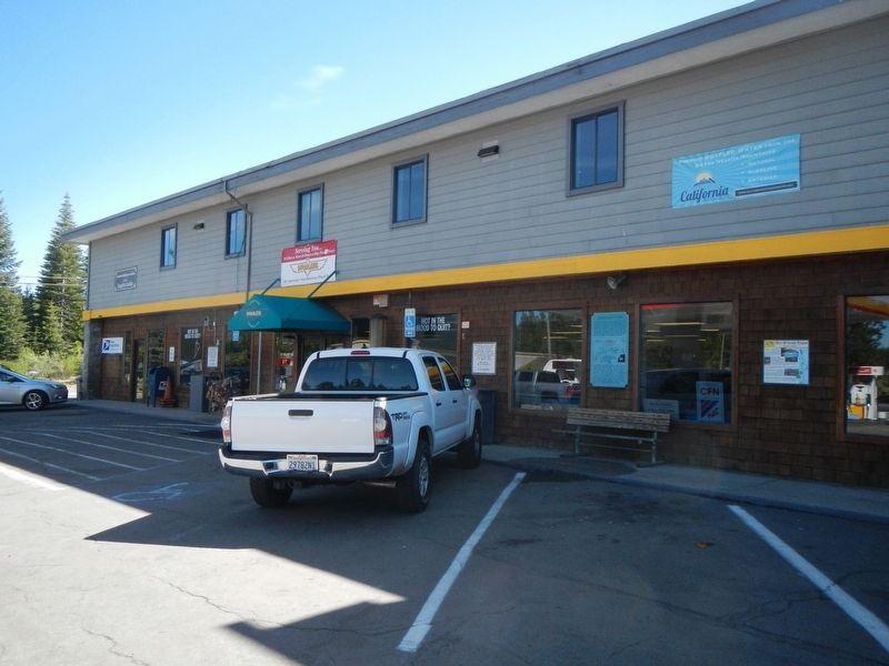
Emigrant Gap, or Nyack, were you are standing, was a good stop and has seen many rest stops. P.G. & E. built a lookout point (left) where the current scenic overlook is so people could watch Spaulding Dam being built. (the lake is at the right of the lower picture). T.C. Wohlbruck built a rest stop with guest rooms and refreshments (top picture) to serve travelers on the Lincoln Highway. Then Herstel Jones built the Nyack Lodge (shown in the 1940's) to serve Highway 40 travelers. The lodge sat where the scenic turnout on I-80 now is (on the left side of the freeway in the above picture). When the freeway arrived part of the lodge had to be dynamited because it was too massive but the rest was cut in three parts and moved up Old Highway 40 to the present Nyack. You are standing in front of the reassembled parts.
All along Old Highway 40 you will find more than thirty of the Donner Summit Historical Society's Scenic Bypass signs like this one. You can download or see all of the signs at www.donnersummithistoricalsociety.org. You can also stop by the Historical Society in "downtown" Soda Springs at the the Soda Springs exit from I-80.
A Good Story
When the Streamliner City of San Francisco was stranded in 12 feet of snow during the winter of 1951-52, it was stuck for six days, just a few miles east of here. Food and water ran out. There was no heat. Passengers despaired. Dog sleds headed out from Donner Summit. Snow plows cleared Highway 40 to below the stranded train. Snowcats evacuated the passengers to the highway and Stewart Wells, who had just taken over at Nyack Lodge, organized a 40 car rescue convoy to pick up the passengers. They were warmed at Nyack Lodge (right) and then put on a new train.
Things to do right here
Come in and take a look at the historical artifacts on display in today's Nyack. As you travel east on I-80 look at you speedometer and the gaze a the ridge across the valley. Imagine taking a wagon down it. Imagine covering just a few miles a day. Imagine your exhaustion upon reaching here, but also imagine you elation. Your new life is just days away. You've reached California!
Erected by Donner Summit Historical Society.
Topics and series. This historical marker is listed in this topic list: Roads & Vehicles. In addition, it is included in the Donner Summit Historical Society series list. A significant historical year for this entry is 1913.
Location. 39° 17.52′ N, 120° 40.711′ W. Marker is in Emigrant Gap, California, in Placer County. Marker is on Nyack Road near Interstate 80, on the left when traveling north. Touch for map. Marker is at or near this postal address: 42180 Nyack Road, Emigrant Gap CA 95715, United States of America. Touch for directions.
Other nearby markers. At least 8 other markers are within 7 miles of this marker, measured as the crow flies. Emigrant Gap (a few steps from this marker); a different marker also named Emigrant Gap (approx. 0.6 miles away); Nevada City Road - Washington Ridge Summit (approx. 4.3 miles away); Alpha and Omega (approx. 4.3 miles away); Ormonde (approx. 6 miles away); Truckee Trail - Ascent to Lake and Valley (approx. 6.4 miles away); Nevada City Road - Opposite Washington Diggings (approx. 6.4 miles away); Meadow Lake (approx. 6.6 miles away).
Credits. This page was last revised on February 2, 2019. It was originally submitted on February 2, 2019, by Barry Swackhamer of Brentwood, California. This page has been viewed 482 times since then and 55 times this year. Photos: 1, 2. submitted on February 2, 2019, by Barry Swackhamer of Brentwood, California.

