Rosslyn in Arlington in Arlington County, Virginia — The American South (Mid-Atlantic)
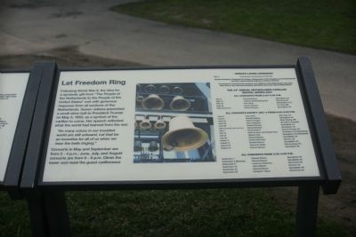
Let Freedom Ring
Photographed by Tom Fuchs, January 19, 2008
1. Let Freedom Ring Marker
"So many voices in our troubled world are still unheard. Let that be an incentive for all of us when we hear the bells ringing."
Concerts in May and September are from 2 - 4 p. m.; June, July and August concerts are from 6 - 8 p. m. Climb the tower and meet the guest carilloneur.
Topics and series. This historical marker is listed in these topic lists: Arts, Letters, Music • Peace • War, World II • Women. In addition, it is included in the Former U.S. Presidents: #33 Harry S. Truman series list. A significant historical month for this entry is May 1763.
Location. Marker has been reported permanently removed. It was located near 38° 53.3′ N, 77° 4.152′ W. Marker was in Arlington, Virginia, in Arlington County. It was in Rosslyn. It was on Marshall
this page online
We have been informed that this marker is no longer there and will not be replaced. This page is an archival view of what was.
Regionally, this marker was in the Washington Metropolitan Area and in Northern Virginia. It was also in the American South, specifically in the Upper South, in the Mid-Atlantic, and on the Eastern Seaboard. Globally, it was in the North Atlantic Region, North America, the Western Hemisphere, the Western World, and the Anglosphere. Historically, it found itself in what was once the territory of the Mississippian Culture, one of the original Thirteen Colonies, one of the Confederate States of America, and the Antebellum South.

Other nearby markers. At least 8 other markers are within walking distance of this location: A Song of Thanks (here, next to this marker); a different marker also named Harmony of Friendship (here, next to this marker); "Lest We Forget - We Stand on Your Shoulders" (about 300 feet away, measured in a direct line); A Place Where Memories Are Made
Photographed by Tom Fuchs, January 19, 2008
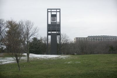
2. Netherlands Carillon
Other markers no longer nearby. Symbol of Friendship (was here, next to this marker but has been reported to have been replaced with another marker now near it); Modern Liberation (was here, next to this marker but has been replaced with another marker now near it); Harmony of Friendship (was here, next to this marker but has been replaced with another marker now near it).
Photographed by Tom Fuchs, January 19, 2008
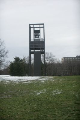
3. Netherlands Carillon
Photographed by Tom Fuchs, January 19, 2008
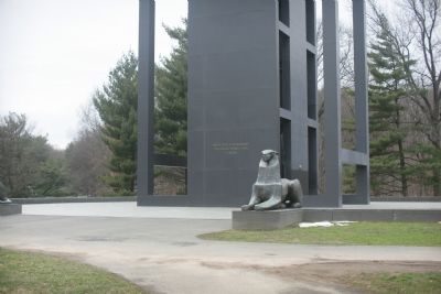
4. Netherlands Carillon
The inscription at the base of the carillon reads; "From the people of the Netherlands to the people of the United States of America"
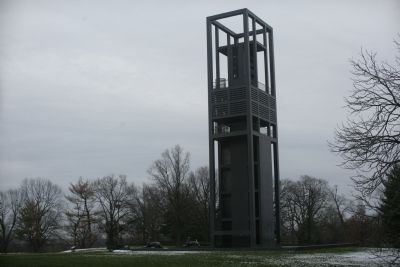
Photographed by Tom Fuchs, January 19, 2008
5. Netherlands Carillon
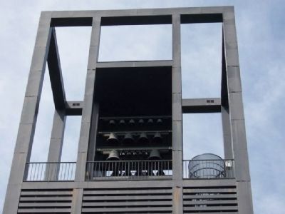
Photographed by Denise Boose, April 2011
6. Netherlands Carillon
Credits. This page was last revised on February 1, 2023. It was originally submitted on January 22, 2008, by Tom Fuchs of Greenbelt, Maryland. This page has been viewed 1,256 times since then and 20 times this year. Last updated on February 2, 2019, by Devry Becker Jones of Washington, District of Columbia. Photos: 1, 2, 3, 4, 5. submitted on January 22, 2008, by Tom Fuchs of Greenbelt, Maryland. 6. submitted on July 22, 2012, by Denise Boose of Tehachapi, California. • Bernard Fisher was the editor who published this page.
