Tybee Island in Chatham County, Georgia — The American South (South Atlantic)
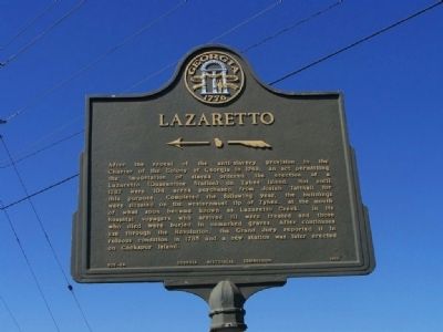
Lazaretto
←—«
After the repeal of the anti-slavery provision in the Charter of the Colony of Georgia on 1749, an act permitting the importation of slaves ordered the erection of a Lazaretto (Quarantine Station) on Tybee Island. Not until 1767 were 104 acres purchased from Josiah Tattnall for this purpose. Completed the following year, the buildings were situated on the westernmost tip of Tybee, at the mouth of what soon became known as Lazaretto Creek. In its hospital voyagers who arrived ill were treated and those who died were buried in unmarked graves. After continuous use through the Revolution, the Grand Jury reported it in ruinous condition in 1785 and a new station was later erected on Cockspur Island.
Erected 1958 by Georgia Historical Commission. (Marker Number 025-64.)
Topics and series. This historical marker is listed in these topic lists: Colonial Era • Landmarks • Notable Places. In addition, it is included in the Georgia Historical Society series list. A significant historical year for this entry is 1749.
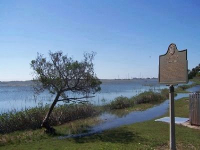
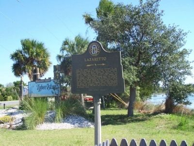
Location. 32° 0.907′ N, 80° 52.72′ W. Marker is on Tybee Island, Georgia, in Chatham County. Marker is at the intersection of US 80 and Olde Tybee Rd., on the right when traveling east on US 80. east of Lazaretto Creek, Tybee Island. Touch for map. Marker is in this post office area: Tybee Island GA 31328, United States of America. Touch for directions.
Other nearby markers. At least 8 other markers are within one mile of this marker, measured as the crow flies. Cockspur Island Lighthouse (approx. half a mile away); Long Range Artillery Duel (approx. half a mile away); A Turning Point In History (approx. half a mile away); Federal Batteries on Tybee Island (approx. half a mile away); 5,275 Shots & Shells in 30 Hours (approx. one mile away); The Breached Wall (approx. one mile away); A Devastating Bombardment (approx. one mile away); Federal Siege Batteries (approx. one mile away). Touch for a list and map of all markers in Tybee Island.
Regarding Lazaretto. A lazaretto or lazaret is a quarantine station for maritime travellers. Lazarets can be ships permanently at anchor, isolated islands, or mainland buildings. Until 1908, lazarets were also used for disinfecting postal items, usually by fumigation.
Related marker. Click here for another marker that is related to this marker. Lazaretto Quarantine Station - Essington, PA
Also see . . . Atlantic Slave Trade to Savannah. New Georgia Encyclopedia website entry:
The voyage across the Atlantic Ocean from West Africa to Savannah lasted between four and six months. The duration of the voyage combined with the prolonged confinement of slaves increased the occurrence of infectious diseases.
To prevent the spread of disease in Savannah, city officials in 1767 authorized the construction of a nine-story quarantine facility, a lazaretto (Italian for "pest house"), on the west end of Tybee Island. (Submitted on October 25, 2008, by Mike Stroud of Bluffton, South Carolina.)
Credits. This page was last revised on October 19, 2021. It was originally submitted on October 25, 2008, by Mike Stroud of Bluffton, South Carolina. This page has been viewed 1,937 times since then and 69 times this year. Photos: 1, 2, 3. submitted on October 25, 2008, by Mike Stroud of Bluffton, South Carolina. • Bill Pfingsten was the editor who published this page.


