Olentangy West in Columbus in Franklin County, Ohio — The American Midwest (Great Lakes)
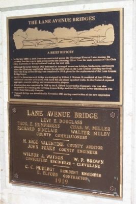
The Lane Avenue Bridges
A Brief History
• In the late 1800's a steel truss was constructed across the Olentangy River at Lane Avenue. Its primary function was to gain access across the Olentangy River from the main campus of The Ohio State University to the agricultural land on the west side.
• Although the great flood of 1913 destroyed or damaged numerous bridges, businesses, and houses along the Olentangy and Scioto Rivers, the old steel truss at the Lane Avenue crossing survived. After the King Avenue Bridge was completed in 1914, plans for the replacement of the Lane Avenue Bridge began.
• In 1917 a three-lane arch bridge was designed by Wilbur J. Watson. It consisted of four 97-foot reinforced concrete arch spans, with earth fill and closed spandrel walls. It also featured exposed aggregate concrete railings and commemorative plaques.
• Construction was completed in 1919 by the E. Elford Construction Company, who was also responsible for building the old King Avenue Bridge and the McCracken Power Building on The Ohio State University Campus.
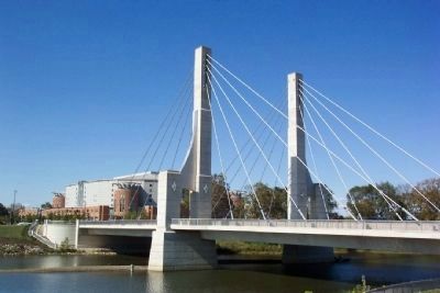
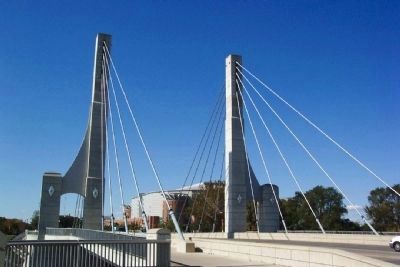
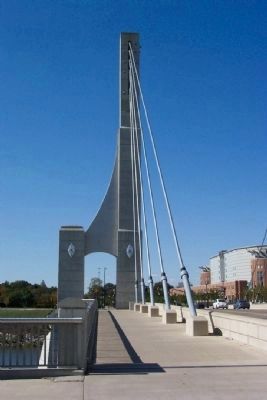
• The arch bridge was demolished in November 2002 during construction of the new suspension bridge.
Erected by Franklin County, Ohio.
Topics. This historical marker is listed in these topic lists: Bridges & Viaducts • Industry & Commerce • Roads & Vehicles. A significant historical month for this entry is November 2002.
Location. 40° 0.4′ N, 83° 1.28′ W. Marker is in Columbus, Ohio, in Franklin County. It is in Olentangy West. Marker is at the intersection of Lane Avenue and Olentangy River Road, on the right when traveling west on Lane Avenue. Touch for map. Marker is in this post office area: Columbus OH 43210, United States of America. Touch for directions.
Other nearby markers. At least 8 other markers are within walking distance of this marker. The Lane Avenue Bridge (within shouting distance of this marker); a different marker also named The Lane Avenue Bridge (about 400 feet away, measured in a direct line); a different marker also named The Lane Avenue Bridges (about 400 feet away); Richard & Annette Bloch Cancer Survivors Plaza (about 400 feet away); Uranus (approx. 0.2 miles away); Freedom Brutus (approx. ¼ mile away); General Curtis E. LeMay (approx. ¼ mile away); Jesse Cleveland (Jesse) Owens (approx. ¼ mile away). Touch for a list and map of all markers in Columbus.
Credits. This page was last revised on February 3, 2023. It was originally submitted on October 25, 2008, by William Fischer, Jr. of Scranton, Pennsylvania. This page has been viewed 1,315 times since then and 11 times this year. Photos: 1, 2, 3, 4. submitted on October 25, 2008, by William Fischer, Jr. of Scranton, Pennsylvania. • Kevin W. was the editor who published this page.


