Tavernier in Monroe County, Florida — The American South (South Atlantic)
Tavernier
Photographed by Marsha A. Matson, May 16, 2015
1. Tavernier Marker
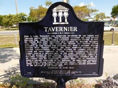
What is today Tavenier was originally inhabited by the Calusa and Tequesta Native Americans. The Tequesta occupied the area around Biscayne Bay, while the Calusa inhabited Southwest Florida. In 1513, the Florida Keys were discovered and mapped by Spanish explorer Juan Ponce de Leon who named the islands Los Martires (The Martyrs"), as they looked like suffering men from a distance. During Florida's First Spanish Period, the Keys remained isolated from imperial administration, as Spain focused its colonial efforts in Central and South America. In 1774, British cartographer Bernard Romans created a detailed map of the Keys, including Tavernier, which he mapped as Key Tabona. The Tavernier vicinity offered a favorable anchorage for Bahamian fisherman and wreckers due to its location near the hazardous Carysfort Reef. All of Tavernier's earliest settlers originated in the Bahamas. No settlement occurred in Tavernier during Florida's Territorial Period, although Key West began to grow as sponging, turtling, and wrecking became prominent in the economy of the Lower Keys.
this page online
Photographed by Marsha A. Matson, May 16, 2015
2. Tavernier Marker (reverse side)
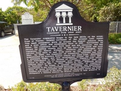
Erected 2013 by A Florida Heritage Site, Sponsored by the Historic Florida Keys Foundation, Inc. and the Florida Department of State. (Marker Number F-778.)
Topics and series. This historical marker is listed in these topic lists: Exploration • Indigenous Peoples and Communities • Settlements & Settlers. In addition, it is included in the Postal Mail and Philately series list. A significant historical year for this entry is 1513.
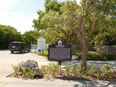
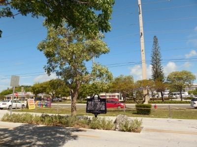
Location. 25° 0.57′ N, 80° 30.986′ W. Marker is in Tavernier, Florida, in Monroe County. It is at the intersection of Albury Boulevard and Overseases Highway (U.S. 1), in the median on Albury Boulevard. Located at the entrance to Old Settlers Park. Touch for map. Marker is in this post office area: Tavernier FL 33070, United States of America. Touch for directions.

Regionally, this marker is on the Florida Keys. It is also in the American South and on the Gulf Coast. Globally, it is in the North Atlantic Region, North America, a Gulf of Mexico state, the Western Hemisphere, the Western World, and the Anglosphere. Historically, it finds
Photographed by Marsha A. Matson, May 16, 2015
3. Tavernier Marker
Other nearby markers. At least 8 other markers are within 9 miles of this marker, measured as the crow flies: Plantation Key (approx. 4.8 miles away); Betsy the Lobster - History (approx. 4.9 miles away); Yateras (approx. 4.9 miles away); African Queen (approx. 7.7 miles away); Indian Wells (approx. 7.9 miles away); Yellow Submarine / Recompression Chamber (approx. 8½ miles away); British Cannon circa 1600's (approx. 8½ miles away); Site of Islamorada Railway Station (approx. 8.7 miles away).
Photographed by Marsha A. Matson, May 16, 2015
4. Tavernier Marker
Photographed by Marsha A. Matson, May 16, 2015
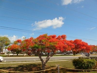
5. Blooming poinciana tree near marker
Credits. This page was last revised on February 5, 2019. It was originally submitted on May 21, 2015, by Marsha A. Matson of Palmetto Bay, Florida. This page has been viewed 1,404 times since then and 96 times this year. Last updated on February 5, 2019, by Douglass Halvorsen of Klamath Falls, Oregon. Photos: 1, 2, 3, 4, 5. submitted on May 21, 2015, by Marsha A. Matson of Palmetto Bay, Florida. • Andrew Ruppenstein was the editor who published this page.
