Near Soda Springs in Nevada County, California — The American West (Pacific Coastal)
Summit Valley Sheep Pens
Hwy 40 Scenic Bypass

Photographed By Barry Swackhamer, April 26, 2018
1. Summit Valley Sheep Pens Marker
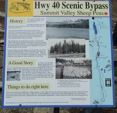
Captions: (bottom middle-right) Top: sheep grazing in Summit Valley (Mt. Judah in the distance)... Note the cattle to the left.; Center: Sheep grazing in the meadow 1928.; Bottom Bob Blackford's sheep corals at Soda Springs, 1942 ... Left: Milli and Skippy 1946 at Ice Lakes, courtesy of Milli Martin.
"The sound of the bells when it was quiet (no trains), was magical to hear."
The tinkle of bells on the lead sheep was once a common sound in Summit Valley late in the summer and fall.
Lake Van Norden filled with water with each winter's snowfall. As summer progressed P.G.&E. let water out to even out the flow to the Drum Forebay Power Plant down the Yuba River. As the water flowed out the grass grew. Just as the grass had grown the Basque sheepherders arrived with their flocks and set up camp.
The sheepherders had started their journey in the Central Valley in the spring and then worked their way up the canyons to the Sierra Summit meadows, including Summit Valley. Here the sheep fattened on the new grass in preparation for the rest of their journey on the railroad.
Summit Valley, and Soda Springs, was for decades one of the top sheep shipping centers in the United States and sheep continued to move to Summit pastures into the 1970's. When Interstate 80 was built it included an underpass for sheep so they could get to the meadow under and north of Castle Peak.
A Good Story
In 1946 8 year old Milli Martin opened the door of the Norden Store to see the most beautiful dog in the world. He'd been left behind by the sheepherders. Millie's aunt coached her to convince her father to keep the dog and so Skippy became part of the family for 12 years. He never lost his herding instinct. Once, early on during a family vacation, he spotted some cattle and raced away soon herding them into a tight circle. He was on a leash after that whenever there was livestock around.
Things to do right here
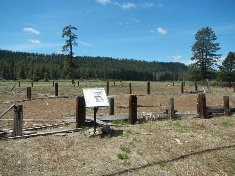
Take a walk among the wildflowers. Walk along the water's edge and see how many bird species you can spot. Follow the Yuba River to its source above Sugar Bowl. Walk over t the sheepherder's cabin and see what accommodations were like (directly across the meadow from here). Imagine the time when Basque sheepherders' wagons dotted the valley floor and sheep grazed the meadow.
Erected by Donner Summit Historical Society.
Topics and series. This historical marker is listed in these topic lists: Agriculture • Animals. In addition, it is included in the Donner Summit Historical Society series list.
Location. 39° 18.844′ N, 120° 21.277′ W. Marker is near Soda Springs, California, in Nevada County. Marker is on Old Donner Summit Road near Sugar Bowl Road, on the right when traveling east. Touch for map. Marker is in this post office area: Soda Springs CA 95728, United States of America. Touch for directions.
Other nearby markers. At least 8 other markers are within walking distance of this marker. Royal Gorge History (a few steps from this marker); Norden Station (approx. ¼ mile away); Hutchinson Lodge (approx. ¼ mile away); Summit Valley (approx. 0.3 miles away); Cal Lodge (approx. 0.3 miles away); Tri Lodges (approx. 0.3 miles away); Clair Tappaan Lodge (approx. 0.3 miles away); Dutch Flat Donner Lake Wagon Road (approx. 0.4 miles away). Touch for a list and map of all markers in Soda Springs.
Credits. This page was last revised on February 7, 2019. It was originally submitted on February 7, 2019, by Barry Swackhamer of Brentwood, California. This page has been viewed 178 times since then and 13 times this year. Photos: 1, 2. submitted on February 7, 2019, by Barry Swackhamer of Brentwood, California.
