Harpers Ferry in Jefferson County, West Virginia — The American South (Appalachia)
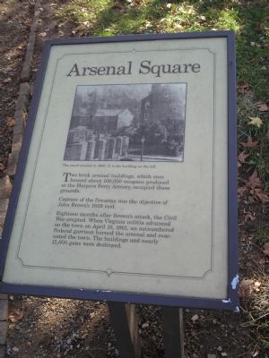
Arsenal Square
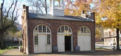
Capture of the firearms was the objective of John Brown’s 1859 raid.
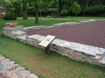
Eighteen months after Brown’s attack, the Civil War erupted. When Virginia militia advanced on the town on April 18, 1861, an outnumbered Federal garrison burned the arsenal and evacuated the town. The buildings and nearly 15,000 guns were destroyed.
Erected by National Park Service.
Topics. This historical marker is listed in these topic lists: Notable Places • War, US Civil. A significant historical month for this entry is April 1890.
Location. 39° 19.372′ N, 77° 43.803′ W. Marker is in Harpers Ferry, West Virginia, in Jefferson County. Marker is at the intersection of Shenandoah Street and Potomac Street, on the right when traveling north on Shenandoah Street. Marker is in the Lower Town at Harpers Ferry National Historical Park. Touch for map. Marker is in this post office area: Harpers Ferry WV 25425, United States of America. Touch for directions.
Other nearby markers. At least 8 other markers are within walking distance of this marker. "for the deposit of arms" (here, next to this marker); Burned, Flooded, and Leveled (a few steps from this marker); High Street in 1886 (a few steps from this marker); Large Arsenal Foundation (within shouting distance of this marker); Large Arsenal (within shouting distance of this marker); John Brown (within shouting distance of this marker); "The War That Ended Slavery" (within shouting distance of this marker); Harpers Ferry History (within shouting distance of this marker). Touch for a list and map of all markers in Harpers Ferry.
More about this marker. The top of the marker contains a photograph of “The small arsenal in 1860. It is the building on the left.”
Also see . . . Harpers Ferry National Historical Park. National Park Service. (Submitted on October 25, 2008, by Bill Coughlin of Woodland Park, New Jersey.)
Credits. This page was last revised on June 16, 2016. It was originally submitted on October 25, 2008, by Bill Coughlin of Woodland Park, New Jersey. This page has been viewed 1,451 times since then and 46 times this year. Photos: 1, 2. submitted on October 25, 2008, by Bill Coughlin of Woodland Park, New Jersey. 3. submitted on May 25, 2009, by Craig Swain of Leesburg, Virginia.


