Central Ward in Newark in Essex County, New Jersey — The American Northeast (Mid-Atlantic)
Trinity Church
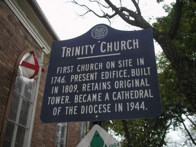
Photographed by Bill Coughlin, October 25, 2008
1. Trinity Church Marker
First church on site in 1746. Present edifice, built in 1809, retains original tower. Became a cathedral of the Diocese in 1944.
Erected 1964 by State of New Jersey.
Topics. This historical marker is listed in these topic lists: Architecture • Colonial Era • Religion & Religious Structures. A significant historical year for this entry is 1746.
Location. 40° 44.42′ N, 74° 10.158′ W. Marker is in Newark, New Jersey, in Essex County. It is in the Central Ward. It is at the intersection of Broad Street and Rector Street, on the left when traveling south on Broad Street. Touch for map. Marker is in this post office area: Newark NJ 07104, United States of America. Touch for directions.

Regionally, this marker is in North Jersey and in the New York City Metropolitan Area. It is also in the American Northeast, in the Mid-Atlantic, and on the Eastern Seaboard. Globally, it is in the North Atlantic Region, North America, the Western Hemisphere, the Western World, and the Anglosphere. Historically, it finds itself in what was once New Netherland and also one of the original Thirteen Colonies.
Other nearby markers. At
this page online

Photographed by Devry Becker Jones (CC0), January 2, 2026
2. Trinity Church Marker
The sign has weathered but remains legible.
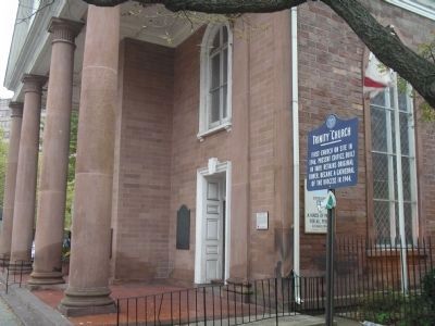
Photographed by Bill Coughlin, October 25, 2008
3. Marker on Broad Street
Church and marker are located on the north end of Military Park in Newark.
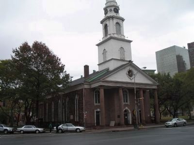
Photographed by Bill Coughlin, October 25, 2008
4. Trinity Church
During the Revolutionary War, this Loyalist church was occupied by both sides at different times. The original tower can be seen in this photo.
Credits. This page was last revised on January 3, 2026. It was originally submitted on October 25, 2008, by Bill Coughlin of Woodland Park, New Jersey. This page has been viewed 1,131 times since then and 41 times this year. Photos: 1. submitted on October 25, 2008, by Bill Coughlin of Woodland Park, New Jersey. 2. submitted on January 3, 2026, by Devry Becker Jones of Washington, District of Columbia. 3, 4. submitted on October 25, 2008, by Bill Coughlin of Woodland Park, New Jersey.
