New Market in Frederick County, Maryland — The American Northeast (Mid-Atlantic)
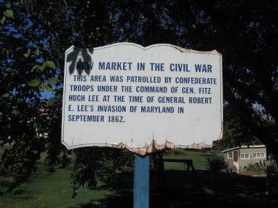
New Market in the Civil War
Inscription.
This area was patrolled by Confederate troops under the command of Gen. Fitz Hugh Lee at the time of General Robert E. Lee's invasion of Maryland in September 1862.
Topics. This historical marker is listed in this topic list: War, US Civil. A significant historical month for this entry is September 1862.
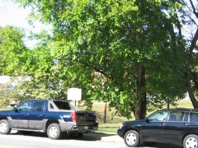
Location. Marker has been reported permanently removed. It was located near 39° 22.958′ N, 77° 16.512′ W. Marker was in New Market, Maryland, in Frederick County. Marker was at the intersection of Old National Road / West Main Street (State Highway 144) and Emory Alley, on the right when traveling west on Old National Road / West Main Street. This marker is near the entrance to New Market Elementary School. Touch for map. Marker was at or near this postal address: 87 Old National Road, New Market MD 21774, United States of America.
We have been informed that this sign or monument is no longer there and will not be replaced. This page is an archival view of what was.
Other nearby markers. At least 8 other markers are within walking distance of this location. The Town of New Market (approx. 0.2 miles away); New Market (approx. 0.2 miles away); 13 West Main Street (approx. ¼ mile away); a different marker also named New Market in the Civil War (approx. ¼ mile away); 9 West Main Street (approx. ¼ mile away); 5 West Main Street (approx. ¼ mile away); a different marker also named New Market (approx. ¼ mile away); 3 West Main Street (approx. 0.3 miles away). Touch for a list and map of all markers in New Market.
Regarding New Market in the Civil War. A partial duplicate of this marker is on the east side of New Market. That marker adds an additional paragraph to the text.
Additional commentary.
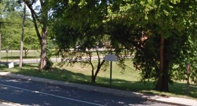
1. Marker appears to have been replaced.
A newer image of the marker (June 2012) appears to show that it has been replaced and additional text added.
— Submitted February 19, 2015, by J. Makali Bruton of Accra, Ghana.
Credits. This page was last revised on February 13, 2019. It was originally submitted on December 6, 2007, by Craig Swain of Leesburg, Virginia. This page has been viewed 1,349 times since then and 32 times this year. Last updated on February 9, 2019, by Devry Becker Jones of Washington, District of Columbia. Photos: 1, 2. submitted on December 6, 2007, by Craig Swain of Leesburg, Virginia. 3. submitted on February 19, 2015, by J. Makali Bruton of Accra, Ghana. • Bill Pfingsten was the editor who published this page.


