Centro histórico de Morelia , Michoacán, Mexico — The Pacific Coast (and Central Highlands)
General Santos Degollado
Photographed by J. Makali Bruton, January 27, 2019
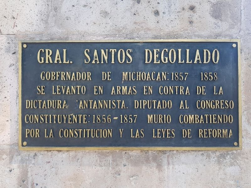
1. General Santos Degollado Marker

Gral. Santos Degollado
Gobernador de Michoacan: 1857 - 1858
Se levanto en armas en contra de la dictadura santannista. Diputado al Congreso Constituyente: 1856-1857 Murio combatiendo por la Constitucion y las Leyes de Reforma
General Santos Degollado
Governor of Michoacán from 1857 to 1858. He took up arms against the dictatorship of Santa Anna and was a deputy to the Constituent Congress from 1856 to 1857. He died while fighting for the Constitution and for the Reform Laws.
Erected 1961.
Topics. This memorial is listed in these topic lists: Government & Politics • Patriots & Patriotism • Wars, Non-US. A significant historical year for this entry is 1857.
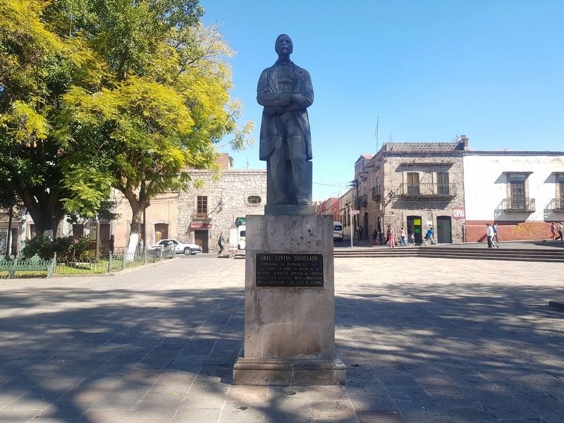
Location. 19° 42.324′ N, 101° 11.498′ W. Memorial is in Morelia, Michoacán. It is in Centro histórico de Morelia. It is on Calle de Eduardo Ruíz just west of Avenida Morelos Norte, on the left when traveling west. The marker is on the eastern side of the Plaza del Carmen. Touch for map. Memorial is in this post office area: Morelia MIC 58000, Mexico. Touch for directions.

Regionally, this memorial is in Western Mexico, in the Bajío,
this page online
Other nearby markers. At least 8 other markers are within walking distance of this marker: Del Carmen Square (a few steps from this marker); Plaza de la República (within shouting distance of this marker); Del Carmen Church (within shouting distance of this marker); Foundation of Morelia (about 120 meters away, measured in a direct line); General Mariano Matamoros (about 150 meters away); Temple of San José (approx. 0.3 kilometers away); The San José Garden (approx. 0.3 kilometers away); In Memory of the Victims of September 15, 2008 Attack (approx. 0.3 kilometers away). Touch for a list and map of all markers in Morelia.
Photographed by J. Makali Bruton, January 27, 2019
2. General Santos Degollado Marker
Photographed by J. Makali Bruton, January 27, 2019
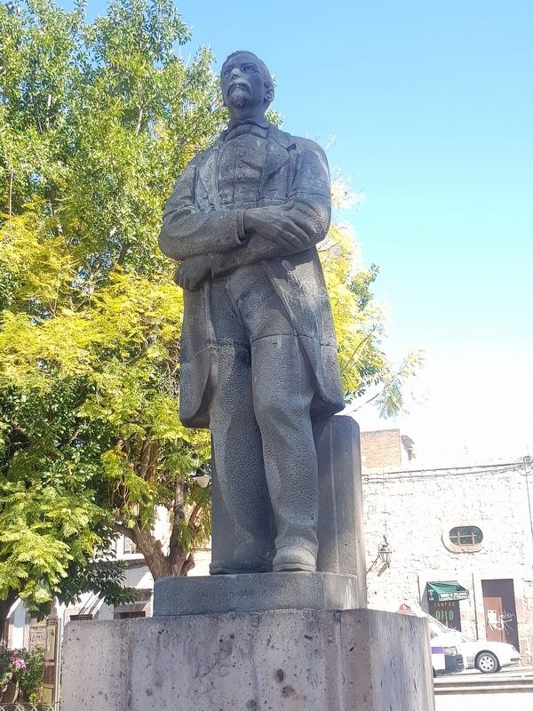
3. Statue of General Santos Degollado
The statue is inscribed with "F. Zuñiga 1961" on its reverse.
Credits. This page was last revised on April 4, 2025. It was originally submitted on February 10, 2019, by J. Makali Bruton of Washington, District of Columbia. This page has been viewed 330 times since then and 38 times this year. Photos: 1, 2, 3. submitted on February 10, 2019, by J. Makali Bruton of Washington, District of Columbia.
