Centro histórico de Morelia , Michoacán, Mexico — The Pacific Coast (and Central Highlands)
Del Carmen Square
Photographed by J. Makali Bruton, January 27, 2019
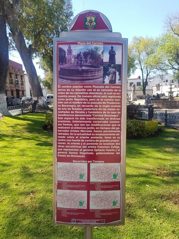
1. Plaza del Carmen Marker

La Plaza del Carmen
El nombre popular como Plazuela del Carmen, deriva de su relación con el ex convento de la orden de las carmelitas descalzas, al cual se encuentra anexa. De manera oficial está registrada como jardín República, pero se le conoce también con el nombre de la plazuela de Prudenciana Bocanegra, en recuerdo de la mujer oruinda de Ario de Rosales, protectora de las clases necesitadas de Morelia y fundadora de la casa de beneficencia denominada "Caridad Bocanegra".
Este espacio ha sido transformado en diversas ocasiones, Anteriormente conservaba numerosos fresnos, que son las modificaciones que se realizaron al entonces jardín, en tiempos del gobernador Aristeo Mercado, fueron parcialmente retirados. En la actualidad su emplazamiento alineado sobre el oriente poniente, tiene en su centro una fuente de cantera de grandes proporciones. Al oriente y al poniente se localizan dos obras escultóricas del artista Francisco Zuñiga, que representan al general Epitacio Huerta y al general Santos Degollado, gobernadores del Estado de Michoacán.
Del Carmen Square
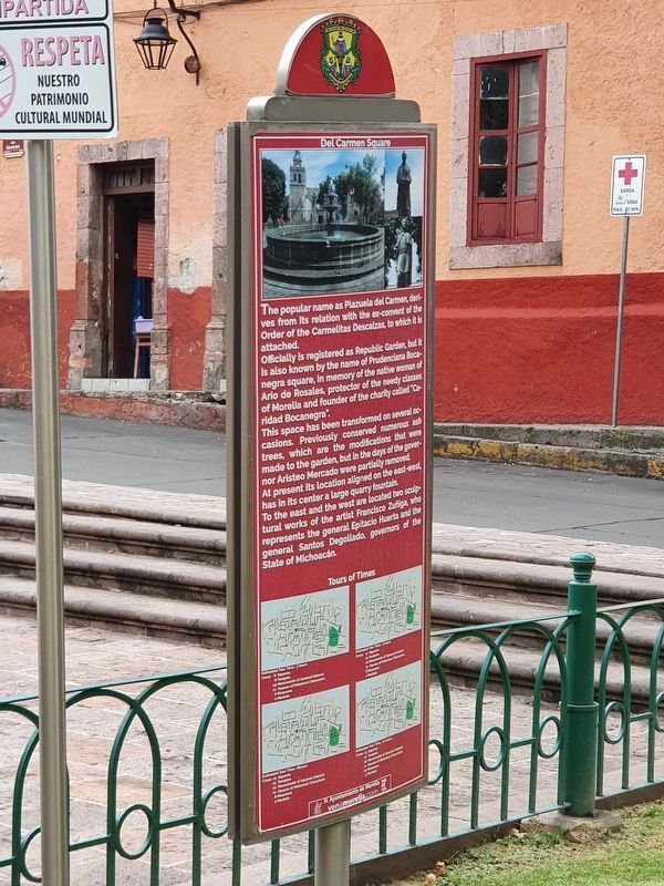
The popular name as Plazuela del
this page online
Officially is registered as Republic Garden, but it is also known by the name of Prudenciana Bocanegra square, in memory of the native woman of Ario de Rosales, protector of the needy classes of Morelia and founder of the charity called “Caridad Bocanegra”.
This space has been transformed on several occasions. Previously conserved numerous ash trees, which are the modifications that were made to the garden, but in the days of the governor Aristeo Mercado were partially removed.
At present its location aligned on the east-west, has in its center a large quarry fountain.
To the east and the west are located two sculptural works of the artist Francisco Zuñiga, who represents the general Epitacio Huerta and the general Santos Degollado, governors of the State of Michoacán.
Erected by Honorable Ayuntamiento de Morelia.
Topics. This historical marker is listed in these topic lists: Charity & Public Work • Parks & Recreational Areas.
Location. 19° 42.318′ N, 101° 11.496′ W.
Photographed by J. Makali Bruton, September 28, 2021
2. Del Carmen Square Marker English text

Regionally, this marker is in Western Mexico, in the Bajío, and on the Pacific Coast. Globally, it is in North America, specifically in Mesoamerica, on the Ring of Fire, on the Pacific Rim, and in the Western Hemisphere. Historically, it finds itself in what was once New Spain, a Spanish colony, and the Aztec Empire.
Other nearby markers. At least 8 other markers are within walking distance of this marker: General Santos Degollado (a few steps from this marker); Plaza de la República (within shouting distance of this marker); Del Carmen Church (within shouting distance of this marker); Foundation of Morelia (about 120 meters away, measured in a direct line); General Mariano Matamoros (about 150 meters away); Temple of San José (approx. 0.3 kilometers away); The San José Garden (approx. 0.3 kilometers away); In Memory of the Victims of September 15, 2008 Attack
Photographed by J. Makali Bruton, January 27, 2019
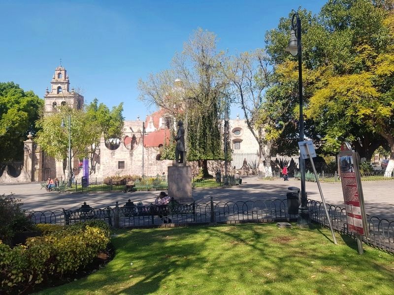
3. Del Carmen Square and Marker
The marker can be seen here to the right in this view towards the north, with the Rectoría de Nuestra Señora del Carmen (Rectory of Our Lady of Carmen) in the distance. The statue of General Santos Degollado can be seen roughly in the center of this view.
Photographed by J. Makali Bruton, January 27, 2019
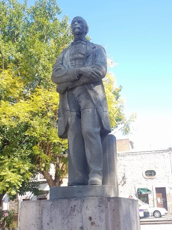
4. The statue of General Santos Degollado in Del Carmen Square
Photographed by J. Makali Bruton, January 27, 2019
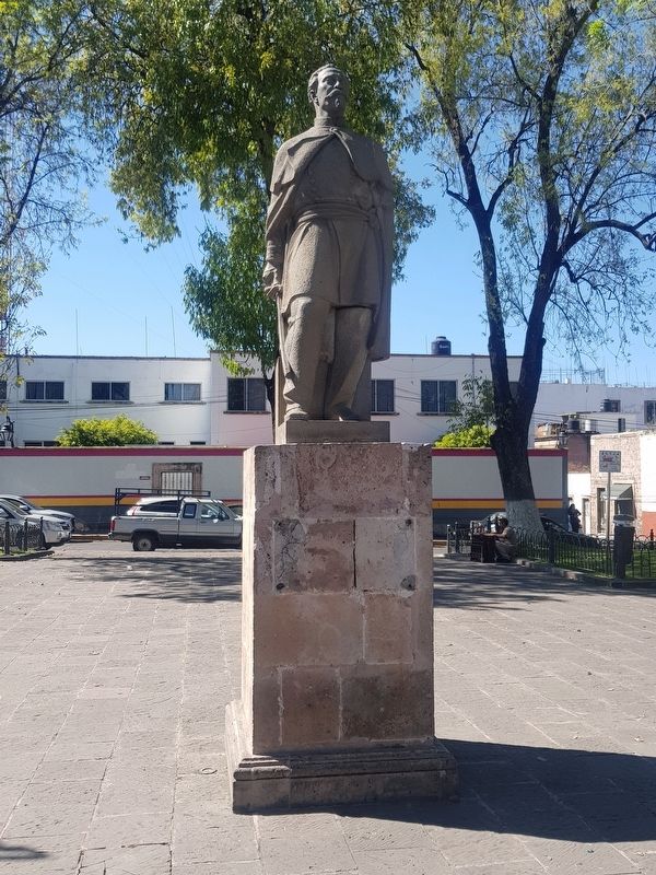
5. Statue of General Epitacio Huerta, also mentioned in the marker text
Unfortunately a marker for General Huerta has most likely been stolen.
Photographed by J. Makali Bruton, January 27, 2019
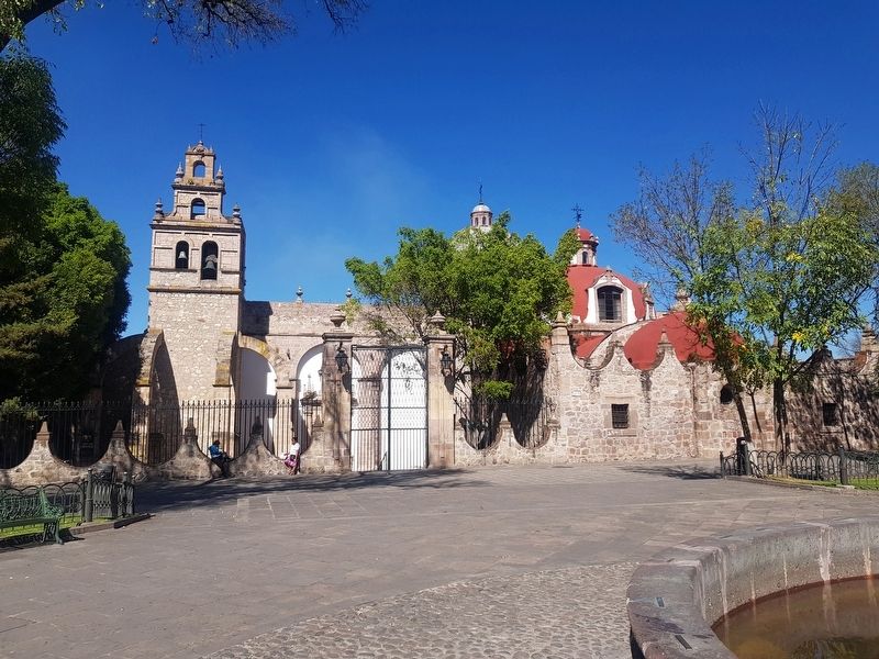
6. An additional view of the Rectoría de Nuestra Señora del Carmen (Rectory of Our Lady of Carmen)
Credits. This page was last revised on April 4, 2025. It was originally submitted on February 10, 2019, by J. Makali Bruton of Washington, District of Columbia. This page has been viewed 732 times since then and 76 times this year. Photos: 1. submitted on February 10, 2019, by J. Makali Bruton of Washington, District of Columbia. 2. submitted on October 23, 2021, by J. Makali Bruton of Washington, District of Columbia. 3, 4, 5, 6. submitted on February 10, 2019, by J. Makali Bruton of Washington, District of Columbia.
