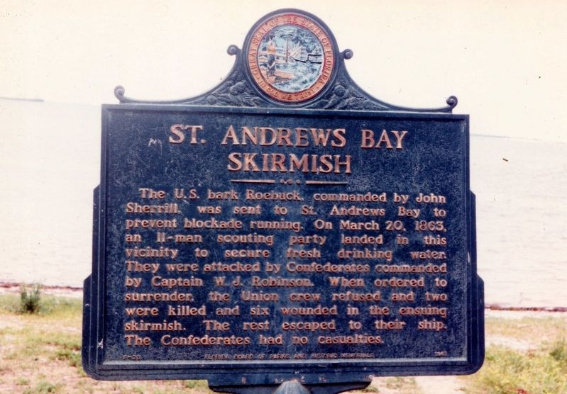
Panama City in Bay County, Florida — The American South (South Atlantic)
St. Andrews Bay Skirmish
Erected 1961 by Florida Board of Parks and Historic Memorials. (Marker Number F-23.)
Topics. This historical marker is listed in this topic list: War, US Civil. A significant historical date for this entry is March 20, 1863.
Location. This marker has been replaced by another marker nearby. It was located near 30° 9.853′ N, 85° 41.242′ W. Marker was in Panama City, Florida, in Bay County. Marker was on West Beach Drive (U.S. Bus 98) just west of Fairland Avenue, on the right when traveling east. Marker was located in a pull off along the bay. Touch for map. Marker was in this post office area: Panama City FL 32401, United States of America. Touch for directions.
Other nearby markers. At least 8 other markers are within walking distance of this location. The St. Andrew Bay Saltworks (approx. 0.3 miles away); Oakland Cemetery (approx. ¾ mile away); John Christo, Senior (approx. ¾ mile away); Buena Vista Point Archaeological Site (approx. 0.8 miles away); Lion Fountain (approx. 0.8 miles away); Historic St. Andrew Church (approx. 0.8 miles away); The Old Sentry (approx. 0.8 miles away); Salt Kettle (approx. 0.8 miles away). Touch for a list and map of all markers in Panama City.
Regarding St. Andrews Bay Skirmish. Marker was replaced with F-425 St. Andrew Skirmish in 2000.
Credits. This page was last revised on April 10, 2024. It was originally submitted on February 10, 2019, by Tim Fillmon of Webster, Florida. This page has been viewed 697 times since then and 57 times this year. Photo 1. submitted on February 10, 2019, by Tim Fillmon of Webster, Florida. • Andrew Ruppenstein was the editor who published this page.
