Angeles National Forest near Santa Clarita in Los Angeles County, California — The American West (Pacific Coastal)
Power Plant No. 1
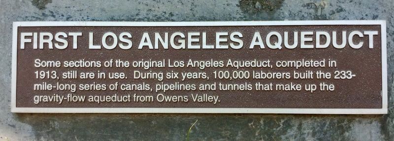
First Los Angeles Aqueduct
Photographed by Craig Baker, July 28, 2018
1. Power Plant 1, Aqueduct Marker
Some sections of the original Los Angeles Aqueduct, completed 1913, are still in use. During six years, 100,000 laborers built the 233-mile-long series of canals, pipelines and tunnels that make up the gravity-flow aqueduct from Owens Valley.
Erected by Los Angeles Dept of Water & Power.
Topics. This historical marker is listed in these topic lists: Industry & Commerce • Man-Made Features. A significant historical year for this entry is 1913.
Location. 34° 35.199′ N, 118° 27.25′ W. Marker is near Santa Clarita, California, in Los Angeles County. It is in Angeles National Forest. It can be reached from Pelton Street half a mile east of San Francisquito Canyon Road. Located in a small park near Power Plant 1. Touch for map. Marker is in this post office area: Santa Clarita CA 91390, United States of America. Touch for directions.

Regionally, this marker is in Greater Los Angeles and in the Transverse Ranges. It is also on the American Pacific Coast. Globally, it is in North America, on the Ring of Fire, on the Pacific Rim, in the Western Hemisphere, in the Western World, and in the Anglosphere. Historically,
this page online
Other nearby markers. At least 8 other markers are within 5 miles of this marker, measured as the crow flies: Tack Room (about 400 feet away, measured in a direct line); Before the Dam (approx. 4.4 miles away); Water Wars (approx. 4.4 miles away); Construction of the Dam (approx. 4.4 miles away); Night of the Disaster (approx. 4.4 miles away); William Mulholland (approx. 4.4 miles away); The Aftermath (approx. 4.4 miles away); The Lives That Were Lost (approx. 4.4 miles away). Touch for a list and map of all markers in Santa Clarita.
Regarding Power Plant No. 1. PP-1 began operation in 1917, providing more than 70 percent of Los Angeles’ electricity. 100 years later, PP-1 now supplies less than 1 percent of the city’s power, because of increased population and power needs.
Also see . . . Power Plant 1 history. Water and Power Associates website. (Submitted on February 10, 2019.)
Additional commentary.
1. L.A. Dept of Water & Power
My father, and later myself, had the honor of working at historic Power Plant 1 as electrical
Photographed by Craig Baker, July 28, 2018
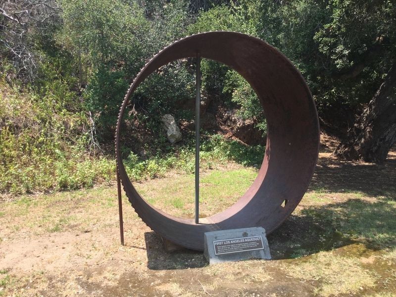
2. Aqueduct Display and Marker
— Submitted February 12, 2019, by Craig Baker of Sylmar, California.
Additional keywords. San Francisquito Power Plant 1, PP-1, DWP, LADWP, Los Angeles Department of Water and Power,
Photographed by Craig Baker, July 28, 2018
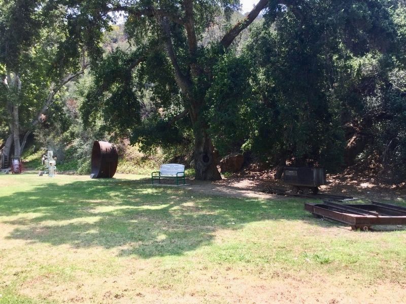
3. Historical Park
A collection of historical displays in the park near Power Plant 1.
Photographed by Craig Baker, July 28, 2018
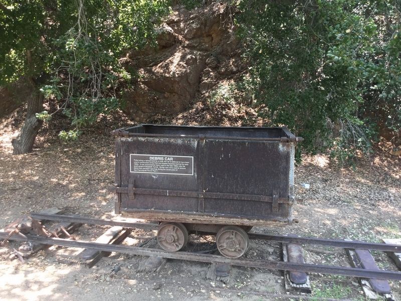
4. Debris Car
Pulled along a railroad track by a mule, this car is believed to have been used in construction of the First Los Angeles Aqueduct during the early 1900s. It was uncovered by heavy rains in the late 1960s near the south portal of Elizabeth Tunnel. Similar cars were used to remove debris from penstock openings during the construction of San Francisquito Power Plant 1.
Photographed by Craig Baker, July 28, 2018
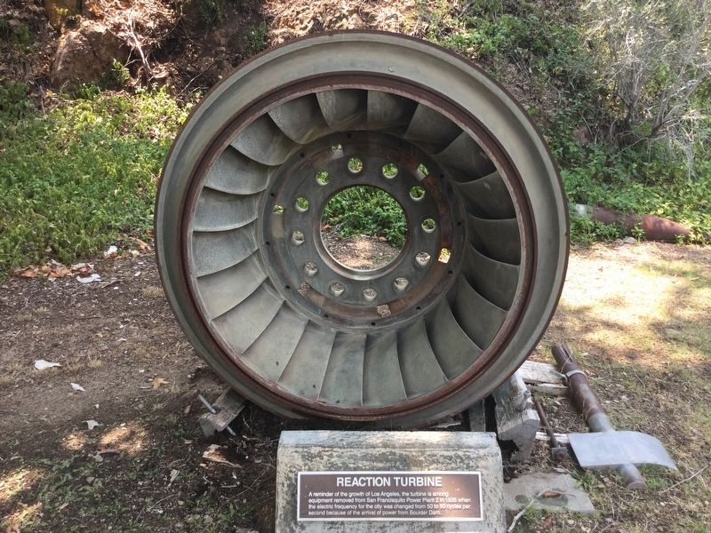
5. Reaction Turbine
A reminder of the growth of Los Angeles, the turbine is among equipment removed from San Francisquito Power Plant 2 in 1935 when the electric frequency for the city was changed from 50 to 60 cycles per second because of the arrival of power from Boulder Dam.
Photographed by Craig Baker, July 28, 2018
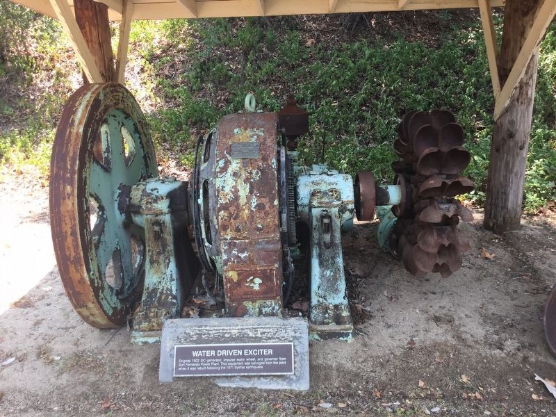
6. Water-Driven Exciter
Original 1922 DC generator, impulse water wheel, and governor from San Fernando Power Plant. This equipment was salvaged from the plant when it was rebuilt following the 1971 Sylmar earthquake.
Photographed by Craig Baker, July 28, 2018
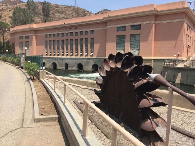
7. Pelton Water Wheel
Standing sentinel in front of San Francisquito Power Plant 1 is one of two Pelton wheels from unit five, which was the largest generator of its type in the country when it was installed in 1928. With a combined horsepower of 32,200, the twin water wheels powered the generator that produced 25 million watts of electricity. Unit five was removed from service in 1985.

Photographed by Craig Baker, July 28, 2018
8. Road Sign at Highway
San Francisquito Power Plant 1
Credits. This page was last revised on June 21, 2026. It was originally submitted on February 10, 2019, by Craig Baker of Sylmar, California. This page has been viewed 2,588 times since then and 104 times this year. Last updated on February 12, 2019, by Craig Baker of Sylmar, California. Photos: 1, 2, 3, 4, 5, 6. submitted on February 10, 2019, by Craig Baker of Sylmar, California. 7. submitted on February 11, 2019, by Craig Baker of Sylmar, California. 8. submitted on February 12, 2019, by Craig Baker of Sylmar, California. • Andrew Ruppenstein was the editor who published this page.
