Near Abingdon in Harford County, Maryland — The American Northeast (Mid-Atlantic)
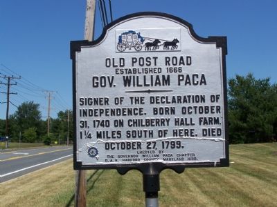
Gov. William Paca
Old Post Road
| — | Established 1666 | — |
Photographed by William Pfingsten, June 23, 2007
1. Gov. William Paca Marker
Erected 1930 by the Governor William Paca Chapter D.A.R. [Daughters of the American Revolution], Harford County, Md.
Topics and series. This historical marker is listed in these topic lists: Colonial Era • Government & Politics • Patriots & Patriotism • War, US Revolutionary. In addition, it is included in the Daughters of the American Revolution (DAR), and the Signers of the Declaration of Independence series lists. A significant historical date for this entry is October 31, 1740.
Location. 39° 26.97′ N, 76° 17.731′ W. Marker is near Abingdon, Maryland, in Harford County. It is on Philadelphia Road (Maryland Route 7) 0.4 miles north of Route 24, on the right when traveling north. Touch for map. Marker is in this post office area: Abingdon MD 21009, United States of America. Touch for directions.

Regionally, this marker is in the Baltimore Metro Region and in Central Maryland. It is also in the American Mid-Atlantic, in the Chesapeake Bay Region, and on the Eastern Seaboard.
this page online
Other nearby markers. At least 8 other markers are within 4 miles of this marker, measured as the crow flies: Captain John Smith (approx. 0.9 miles away); Site of “Old Baltimore” (approx. 0.9 miles away); a different marker also named Cokesbury College (approx. 1.3 miles away); “Constant Friendship” (approx. 1.6 miles away); Harford Town (approx. 2.2 miles away); This Tablet (approx. 2.3 miles away); "The Bush Declaration" (approx. 2.3 miles away); Sophia’s Dairy (approx. 3.7 miles away). Touch for a list and map of all markers in Abingdon.
Another marker is no longer nearby. Cokesbury College (was approx. 1.2 miles away but has been confirmed missing).
Also see . . . The Declaration of Independence. (Submitted on June 24, 2007.)
Additional commentary.
1. Chilberry Hall Farm
The property no longer exists. The land is now a restricted part of the Aberdeen Proving
Photographed by Allen C. Browne, September 5, 2015
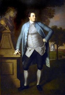
2. William Paca
1772 portrait by Charles Willson Peale in the Maryland Historical Society Museum in Baltimore, Maryland
— Submitted June 24, 2007, by Bill Pfingsten of Bel Air, Maryland.
Credits. This page was last revised on February 24, 2020. It was originally submitted on June 23, 2007, by Bill Pfingsten of Bel Air, Maryland. This page has been viewed 3,465 times since then and 84 times this year. Last updated on February 14, 2019, by Carl Gordon Moore Jr. of North East, Maryland. Photos: 1. submitted on June 23, 2007, by Bill Pfingsten of Bel Air, Maryland. 2. submitted on May 4, 2016, by Allen C. Browne of Silver Spring, Maryland.
