Shady Side in Anne Arundel County, Maryland — The American Northeast (Mid-Atlantic)
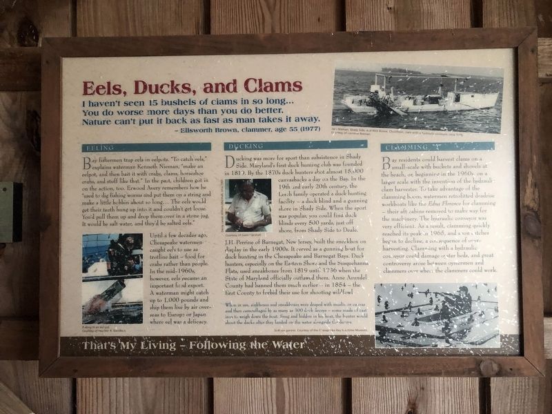
Eels, Ducks, and Clams
— Ellsworth Brown, clammer, age 55 (1977)
Eeling
Bay fishermen trap eels in eelpots. "To catch eels, explains waterman Kenneth Neman, "make an eelpot, and then bait it with crabs, clams, horseshoe crabs, and stuff like that." In the past, children got in on the action, too. Erwood Avery remembers how he "used to dig fishing worms and put them on a string and make a little bobbin about so long... The eels would get their teeth hung up into it and couldn't get loose. You'd pull them up and drop them over in a stone jug. It would be salt water, and they'd be salted eels."
Until a few decades ago, Chesapeake watermen caught eels to use as trotline bait — food for crabs rather than people. In the mid-1960s, however, eels became an important food export. A waterman might catch up to 1,000 pounds and ship them live by air overseas to Europe or Japan where eel was a delicacy.
Ducking
Ducking was more for sport than subsistence in Shady Side. Maryland's first duck hunting club was founded in 1819. By the 1870s duck hunters shot almost 15,000 canvasbacks a day on the Bay. In the 19th and early 20th century, the Lerch family operated a duck hunting facility — a duck blind and a gunning shore in Shady Side. When the sport was popular, you could find duck blinds every 500 yards, just off shore, from Shady Side to Deale.
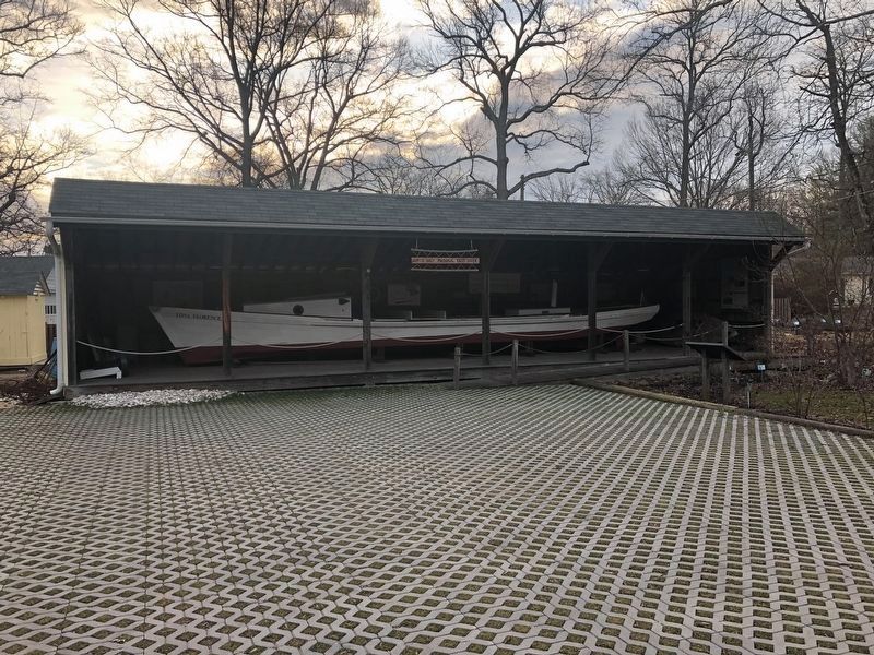
J.H. Perrine of Barnagat, New Jersey, built the sneakbox on display in the early 1900s. It served as a gunning boat for duck hunting in the Chesapeake and Barnegat Bays. Duck hunters, especially on the Eastern Shore and the Susquehanna Flats, used sneakboxes from 1819 until 1936 when the State of Maryland officially outlawed them. Anne Arundel County had banned them much earlier — in 1854 — the first County to forbid their use for shooting wildfowl.
When in use, sinkboxes and sneakboxes were drapped with muslin or canvas and then camouflaged by as many as 300 duck decoys — some made of cast iron to weigh down the boat. Snug and hidden in his boat, the hunter would shoot the ducks after they landed on the water alongside the decoys.
Clamming
Bay residents could harvest clams on a small-scale with buckets and shovels at the beach, or, beginning in the 1960s, on a larger scale with the invention of the hydraulic clam harvester. To take advantage of the clamming boom, watermen retrofitted deadrise workboats like the Edna Florence for clamming — their aft cabins

Photographed By Devry Becker Jones (CC0), February 16, 2019
2. The marker is part of this outdoor exhibit.
That's My Living — Following the Water
Erected by Chesapeake Bay Gateways Network.
Topics. This historical marker is listed in these topic lists: Animals • Environment • Industry & Commerce • Waterways & Vessels. A significant historical year for this entry is 1819.
Location. 38° 50.953′ N, 76° 30.708′ W. Marker is in Shady Side, Maryland, in Anne Arundel County. Marker is on East West Shady Side Road west of Bast Avenue when traveling north. Touch for map. Marker is at or near this postal address: 1418 East West Shady Side Road, Shady Side MD 20764, United States of America. Touch for directions.
Other nearby markers. At least 8 other markers are within walking distance of this marker. The Edna Florence (here, next to this marker); Seasons of the Waterman (here, next to this marker); Fishing (here, next to this marker); Crabbing (here, next to this marker); Oystering (a few steps from this marker); Transformation of the Avery House and over a Century of Expansion (a few steps from this marker); Going to Market (within shouting distance of this marker); Edna Florence (within shouting distance of this marker). Touch for a list and map of all markers in Shady Side.
Credits. This page was last revised on March 18, 2019. It was originally submitted on February 16, 2019, by Devry Becker Jones of Washington, District of Columbia. This page has been viewed 169 times since then and 12 times this year. Photos: 1, 2. submitted on February 16, 2019, by Devry Becker Jones of Washington, District of Columbia. • Bill Pfingsten was the editor who published this page.
