Highland Park in Los Angeles in Los Angeles County, California — The American West (Pacific Coastal)
Route 66 & Chicken Boy
America’s Mother Road
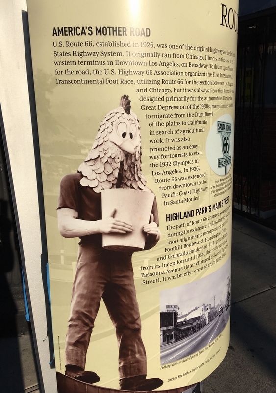
U.S. Route 66, established in 1926, was one of the original highways of the United States Highway System. It originally ran from Chicago, Illinois in the east to its western terminus in Downtown Los Angeles, on Broadway. To drum up publicity for the road, the U.S. Highway 66 Association organized the First International Transcontinental Foot Race, utilizing Route 66 for the section between Los Angeles and Chicago, but it was always clear that Route 66 was designed primarily for the automobile. During the Great Depression of the 1930s, many families used it to migrate from the Dust Bowl of the plains to California in search of agricultural work. It was also promoted as an easy way for tourists to visit the 1932 Olympics in Los Angeles. In 1936, Route 66 was extended from downtown to the Pacific Coast Highway in Santa Monica.
Highland Park’s Main Street
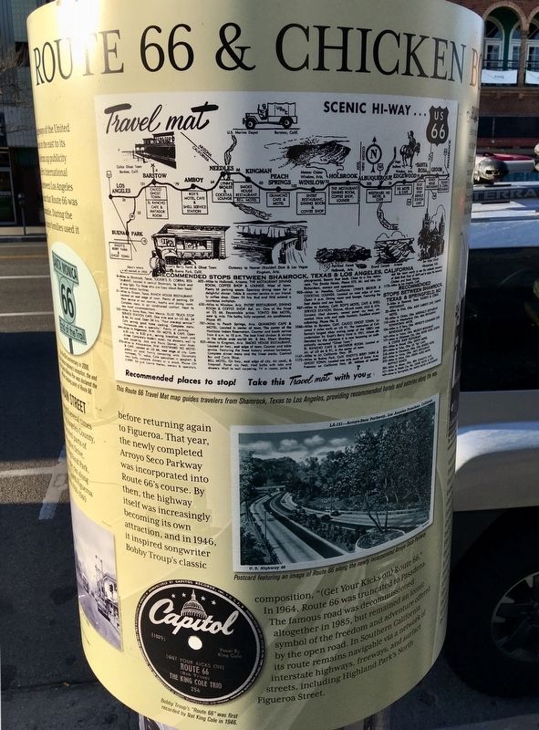
The path of Route 66 changed several times during its existence. In Los Angeles County, most alignments incorporated parts of Foothill Boulevard, Huntington Drive, and Colorado Boulevard. In Highland Park, from its inception until 1934, the route ran along Pasadena Avenue (later changed to North Figueroa Street). It was briefly rerouted from 1936-1940 before returning again to Figueroa. That year, the newly completed Arroyo Seco Parkway was incorporated into Route 66's course. By then, the highway itself was increasingly becoming its own attraction, and in 1946, it inspired songwriter Bobby Troup's classic composition, "(Get Your Kicks on) Route 66." In 1964, Route 66 was truncated to Pasadena. The famous road was decommissioned altogether in 1985, but remained an iconic symbol of the freedom and adventure offered by the open road. In Southern California its route remains navigable via a network of interstate highways, freeways, and surface streets, including Highland Park's North Figueroa Street.
Roadside Chicken Boy
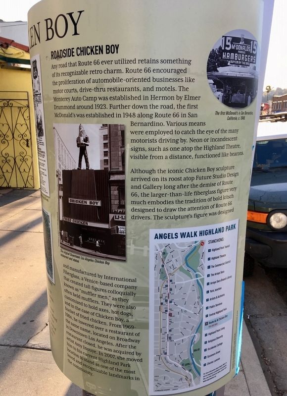
Any road that Route 66 ever utilized retains something of its recognizable retro charm. Route 66 encouraged the proliferation of automobile-oriented businesses like motor courts, drive-thru restaurants, and motels. The Monterey Auto Camp was established in Hermon by Elmer Drummond around 1923. Further down the road, the first McDonald's was established in 1948 along Route 66 in San Bernardino. Various means were employed to catch the eye of the many motorists driving by. Neon or incandescent signs, such as one atop the Highland Theatre, visible from a distance, functioned like beacons.
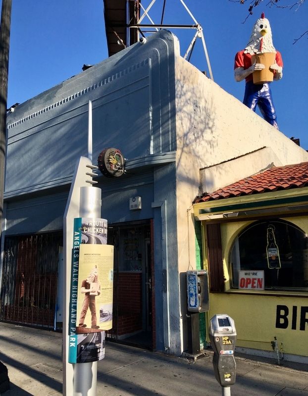
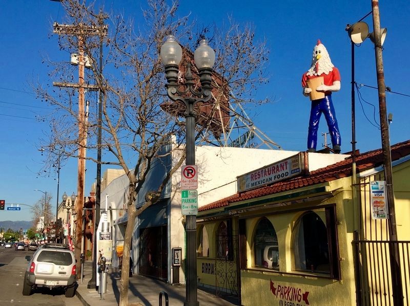
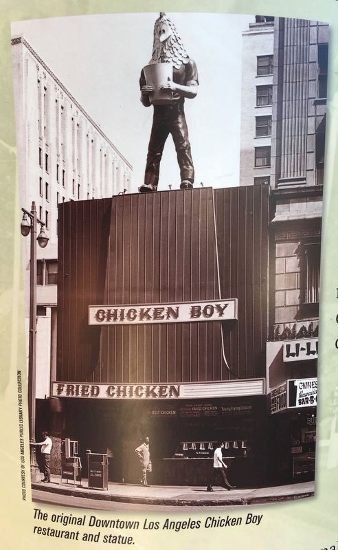
Although the iconic Chicken Boy sculpture arrived on its roost atop Future Studio Design and Gallery long after the demise of Route 66, the larger-than-life fiberglass figure very much embodies the tradition of bold kitsch designed to draw the attention of Route 66 drivers. The sculpture's figure was designed and manufactured by International Fiberglass, a Venice-based company that created tall figures colloquially known as "muffler men," as they often held mufflers. They were also customized to hold axes, hot dogs, and in the case of Chicken Boy, a bucket of fried chicken. From 1969-1984, he towered over a restaurant of the same name, located on Broadway in Downtown Los Angeles. After the restaurant closed, he was acquired by artist Amy Inouye. In 2007, she moved him to his current Highland Park location to stand as one of the most loved and recognizable landmarks in the community.
Erected 2017 by City of Los Angeles.
Topics and series. This historical marker is listed in these topic lists: Arts, Letters, Music • Industry & Commerce • Roads & Vehicles. In addition, it is included in the U.S. Route 66 series list.
Location. 34° 6.521′ N, 118° 11.668′ W. Marker is in Los Angeles, California, in Los Angeles County. It is in Highland Park. Marker is on Figueroa Street north of Avenue 55, on the right when traveling north. Touch for map. Marker is at or near this postal address: 5558 N Figueroa St, Los Angeles CA 90042, United States of America. Touch for directions.
Other nearby markers. At least 8 other markers are within walking distance of this marker. Highland Theatre (within shouting distance of this marker); Smith House (about 600 feet away, measured in a direct line); Highland Park Ebell Club (about 700 feet away); Central Highland Park (about 700 feet away); Highland Park Transit (approx. 0.2 miles away); The Commercial District (approx. 0.2 miles away); Highland Park Living (approx. 0.2 miles away); G.W.E. Griffith House (approx. ¼ mile away). Touch for a list and map of all markers in Los Angeles.
Also see . . . Angels Walk L.A. Self-guided walking tours of historic neighborhoods in Los Angeles. The Chicken Boy marker is part of the Highland Park walk. (Submitted on February 22, 2019.)
Credits. This page was last revised on August 12, 2023. It was originally submitted on February 22, 2019, by Craig Baker of Sylmar, California. This page has been viewed 560 times since then and 58 times this year. Photos: 1, 2, 3, 4, 5, 6. submitted on February 22, 2019, by Craig Baker of Sylmar, California. • Andrew Ruppenstein was the editor who published this page.
