Near Ely in White Pine County, Nevada — The American Mountains (Southwest)
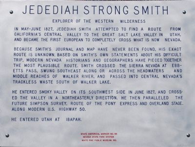
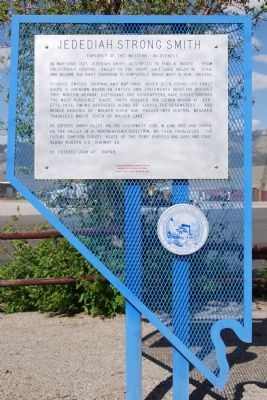
Jedediah Strong Smith
Explorer of the Western Wilderness
Because Smith’s journal and map have never been found, his exact route is unknown. Based on Smith’s own statements about his difficult trip, modern Nevada historians and geographers have pieced together the most plausible route. Smith crossed the Sierra Nevada at Ebbetts Pass, swung southeast along or across the headwaters and the middle reaches of Walker River, and passed into central Nevada’s trackless waste south of Walker Lake.
He entered Smoky Valley on its southwest side in June, 1827, and crossed the valley in a northeasterly direction. He then paralleled the future Simpson Survey, route of the Pony Express and Overland Stage, along modern U.S. Highway 50.
He entered Utah at Ibapah
Erected 1970 by Nevada State Park System, White Pine Public Museum. (Marker Number 84.)
Topics. This historical marker is listed in these topic lists: Exploration • Roads & Vehicles • Settlements & Settlers. A significant historical month for this entry is June 1827.
Location. 39° 17.487′ N, 114° 50.276′ W. Marker is near Ely, Nevada , in White Pine County. Marker is on U.S. 93, on the right when traveling north. Located at rest area, four miles north of Ely. Touch for map. Marker is in this post office area: Ely NV 89301, United States of America. Touch for directions.
Other nearby markers. At least 5 other markers are within 7 miles of this marker, measured as the crow flies. Nevada Northern Railway (approx. 3½ miles away); Ely - Forging the Link (approx. 4.1 miles away); U.S. Post Office Ely, Nevada - 1937 (approx. 4.2 miles away); The Liberty Pit (approx. 4.3 miles away); Copper Country (approx. 6.8 miles away). Touch for a list and map of all markers in Ely.
Also see . . . New Amended Text for Marker. The Nevada State Historic Preservation Office (SHPO) recently updated the text of the roughly 260 state historical markers in Nevada. The Nevada SHPO placed the amended text of each individual marker on its website and will change the actual markers in the field as funding allows. Minor changes have been made to the marker for grammar and readability. The link will take you to the Nevada SHPO page for the marker with the amended text. (Submitted on November 12, 2013, by Duane Hall of Abilene, Texas.)
Credits. This page was last revised on November 24, 2019. It was originally submitted on June 25, 2007, by Dawn Bowen of Fredericksburg, Virginia. This page has been viewed 1,862 times since then and 37 times this year. Photos: 1, 2. submitted on June 25, 2007, by Dawn Bowen of Fredericksburg, Virginia. • J. J. Prats was the editor who published this page.

