Near Cooke City in Park County, Montana — The American West (Mountains)
The Summer of 1877
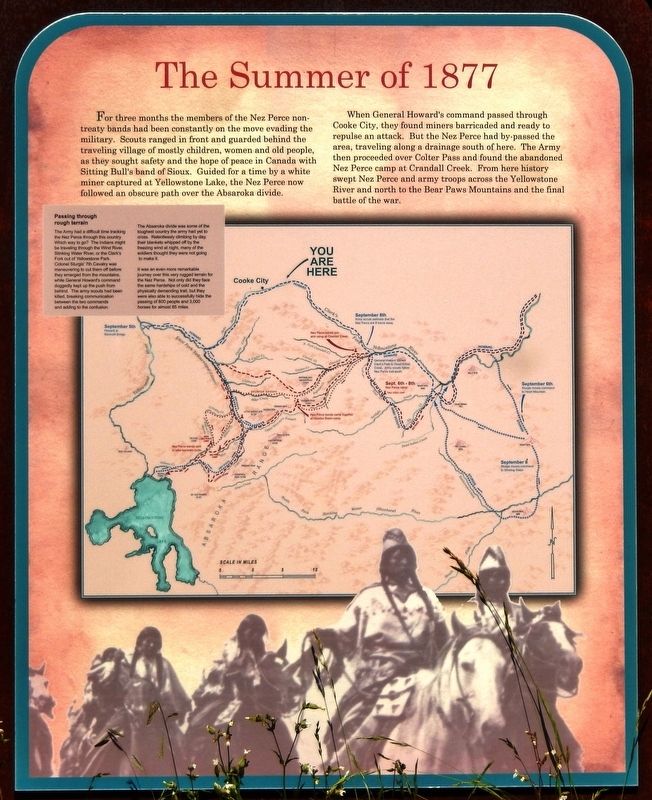
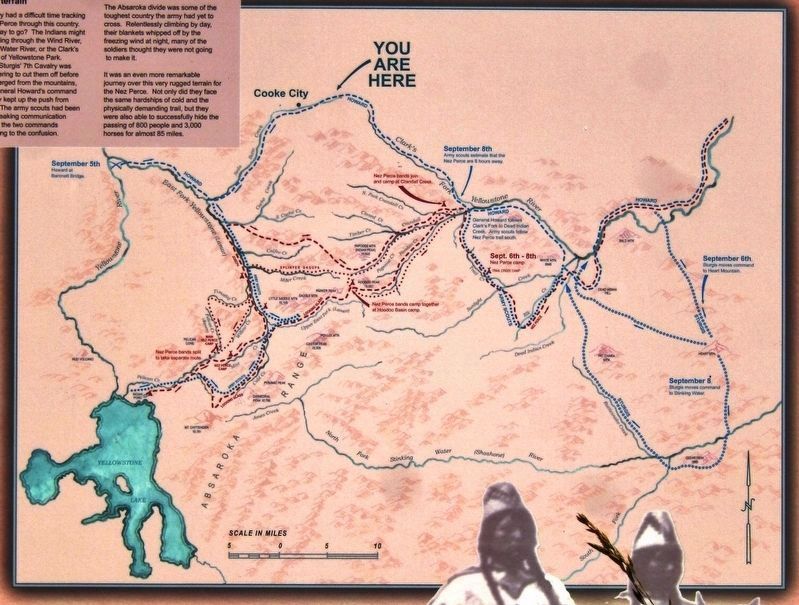
When General Howard's command passed through Cooke City, they found miners barricaded and ready to repulse an attack. But the Nez Perce had by-passed the area, traveling along a drainage south of here. The Army then proceeded over Colter Pass and found the abandoned Nez Perce camp at Crandall Creek. From here history swept Nez Perce and army troops across the Yellowstone River and north to the Bear Paws Mountains and the final battle of the war.
Passing through rough terrain
The Army had a difficult time tracking the Nez Perce through this country. Which way to go? The Indians might be traveling through the Wind River, Stinking Water River, or the Clark's Fork out of Yellowstone Park. Colonel Sturgis' 7th Cavalry was maneuvering to cut them off before they emerged from the mountains, while General Howard's command doggedly kept up the push from behind. The army scouts had been killed, breaking communication between the two commands and adding to the confusion.
The Absaroka divide was some of the toughest country the army had yet to cross. Relentlessly climbing by day, their blankets whipped off by the freezing wind at night, many of the soldiers thought they were not going to make it.
It was an even more remarkable journey over this very rugged terrain for the Nez Perce. Not only did they face the same hardships of cold and the physically demanding trail, but they were also able to successfully hide the passing of 800 people and 3,000 horses for almost 85 miles.
Topics. This historical marker is listed in these topic lists: Native Americans • Wars, US Indian. A significant historical year for this entry is 1877.
Location. 45° 1.196′ N, 109° 52.433′ W. Marker is near Cooke City, Montana, in Park County. Marker is on Beartooth Highway (U.S. 212) 0.2 miles east of Kersey Lake Road, on the left when traveling east. Marker is located in a large, paved pull-out on the north side of the highway. Touch for map. Marker is in this post office area: Cooke City MT 59020, United States of America. Touch for directions.
Other nearby markers. At least 3 other markers are within 4 miles of this marker, measured as the crow flies. You're Standing on the 45th Parallel (approx. 1˝ miles away in Wyoming); Cooke City General Store (approx. 3 miles away); The New World Mining District (approx. 3.4 miles away).
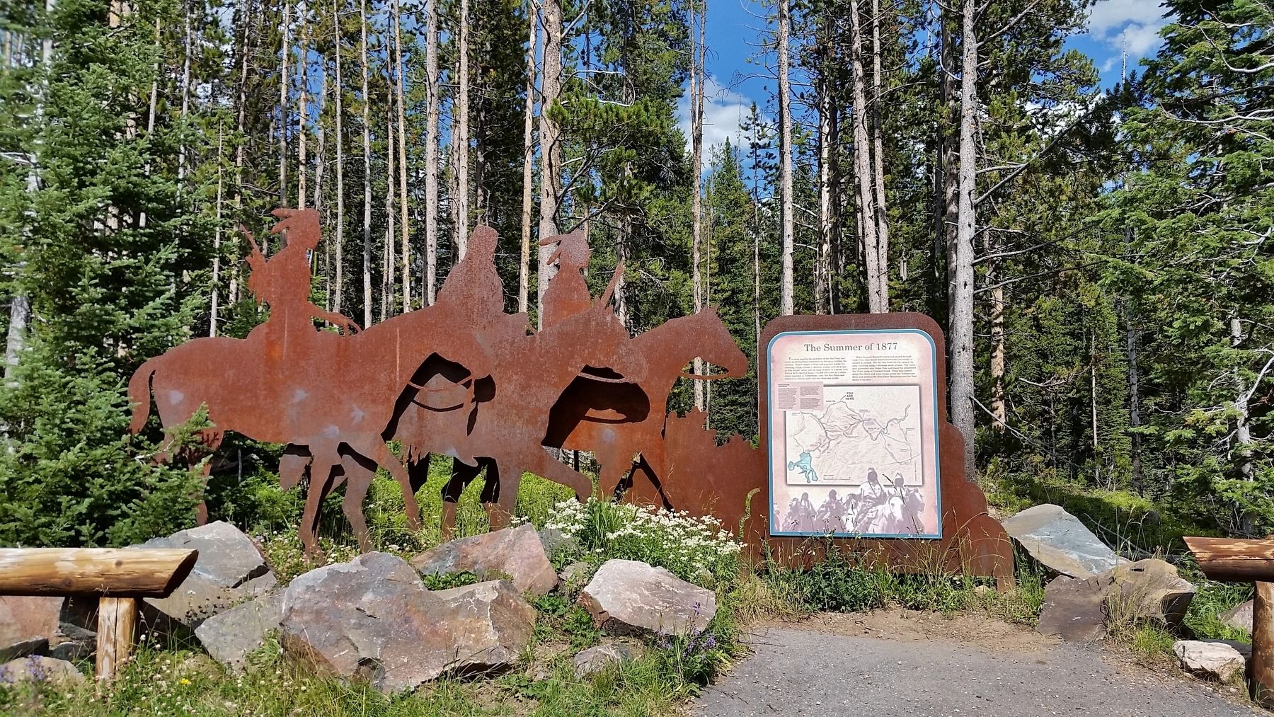
More about this marker. Marker is a large composite plaque, mounted vertically at eye-level on a rusted metal "cut-out" sculpture of Native Americans on horseback.
Also see . . . Flight of the Nez Perce. A band of 800 men, women, and children — plus almost 2,000 horses — left their homeland in what is now Oregon and Idaho pursued by the US Army. Settlers were moving into their homeland and the US Government was trying to force them onto a reservation. The Army stopped them near the Bear’s Paw Mountains, less than 40 miles from the Canadian border. This is where it is believed the flight ended and Chief Joseph said, “From where the sun now stands, I will fight no more forever.” Some Nez Perce escaped to Canada, but after fierce fighting and a siege, the rest of the band surrendered on October 5 and most of the survivors were sent to the Indian Territory in Oklahoma. (Submitted on February 24, 2019, by Cosmos Mariner of Cape Canaveral, Florida.)
Credits. This page was last revised on February 25, 2019. It was originally submitted on February 24, 2019, by Cosmos Mariner of Cape Canaveral, Florida. This page has been viewed 236 times since then and 24 times this year. Photos: 1, 2, 3. submitted on February 24, 2019, by Cosmos Mariner of Cape Canaveral, Florida. • Bill Pfingsten was the editor who published this page.


