Forest City in Rutherford County, North Carolina — The American South (South Atlantic)
North Carolina
⎯⎯⎯
South Carolina
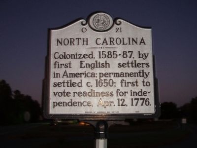
Photographed by Stanley and Terrie Howard, October 25, 2008
1. NORTH CAROLINA Marker
North Carolina. Colonized, 1585-87, by first English settlers in America; permanently settled c.1650; first to vote readiness for independence, Apr. 12, 1776.
South Carolina. Formed 1712, from part of Carolina, which was chartered in 1663, it was first settled by the English in 1670. One of the 13 original states.
Erected 1985 by Department of Archives and History. (Marker Number O-21.)
Topics and series. This historical marker is listed in these topic lists: Colonial Era • Political Subdivisions • Settlements & Settlers • War, US Revolutionary. In addition, it is included in the North Carolina Division of Archives and History series list. A significant historical date for this entry is April 12, 1950.
Location. 35° 10.885′ N, 81° 47.798′ W. Marker is in Forest City, North Carolina, in Rutherford County. It is on Cliffside Hwy (U.S. 221). Touch for map. Marker is in this post office area: Forest City NC 28043, United States of America. Touch for directions.

Regionally, this marker is in North Carolina’s Mountains. It is also in the American South, specifically in the Upper South, in Appalachia, and
this page online
Other nearby markers. At least 8 other markers are within 4 miles of this marker, measured as the crow flies: Welcome to Cowpens National Battlefield (approx. 3 miles away in South Carolina); Morgan's Flying Army (approx. 3.3 miles away in South Carolina); Spirit up the People (approx. 3.3 miles away in South Carolina); U.S. Memorial Monument (approx. 3.3 miles away in South Carolina); Battle of Cowpens Monument (approx. 3.3 miles away in South Carolina); January 17, 1781 (approx. 3.3 miles away in South Carolina); The Battle of Cowpens: Prelude to Victory (approx. 3.3 miles away in South Carolina); The Cavalry (Dragoons) at Cowpens (approx. 3.3 miles away in South Carolina).
Other markers no longer nearby. The Overmountain Victory National Historic Trail (was approx. 3.1 miles away in South
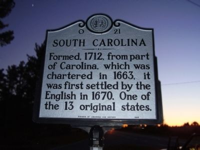
Photographed by Stanley and Terrie Howard, October 25, 2008
2. SOUTH CAROLINA Marker
Photographed by Stanley and Terrie Howard, October 25, 2008
3. North Carolina
Credits. This page was last revised on March 17, 2024. It was originally submitted on October 27, 2008, by Stanley and Terrie Howard of Greer, South Carolina. This page has been viewed 1,022 times since then and 26 times this year. Photos: 1, 2, 3. submitted on October 27, 2008, by Stanley and Terrie Howard of Greer, South Carolina. • Bill Pfingsten was the editor who published this page.
Editor’s want-list for this marker. Clear, daylight photos of the marker and its context. • Can you help?
