Compton Village in Wilmington in New Castle County, Delaware — The American Northeast (Mid-Atlantic)
Wilmington Historic Trail
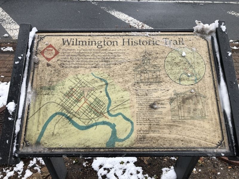
This Historic Trail links the historical, social, and cultural patterns of development in Wilmington. The commercial and residential structures along this trail recreate the vitality and historic importance of 17th and 18th-century Wilmington. The trail begins just east of 6th & Church Streets at Fort Christina State Park, and ends at the Friends Meeting House at 6th and West Streets.
The Wilmington Historic Trail
1. Fort Christina at the Rocks
2. St. Stanislas Kostka
3. Old Swedes Church
4. Christina Cultural Arts Center
5. Hendrickson House Museum
6. Mt. Enon Baptist Church
7. Scots African Methodist Episcopal (AME) Church
8. St. Mary's Roman Catholic Church
9. People's Settlement Association
10. Old Asbury Methodist Church
11. Old Customs House
12. St. Peters Cathedral and Rectory
13. The Friends Meeting House
14. West Presbyterian Church
15. Old Town Hall 1798-1800
City Historic Districts
A. Old Swedes
B. St. Mary's
C. Eastside
D. Market St. Mall
E. Quaker Hill
Topics and series. This historical marker is listed in these topic lists: Colonial Era • Forts and Castles • Religion & Religious Structures
this page online
Location. 39° 44.501′ N, 75° 32.829′ W. Marker is in Wilmington, Delaware, in New Castle County. It is in Compton Village. It is at the intersection of North Walnut Street (Business U.S. 13) and East 7th Street on North Walnut Street. Touch for map. Marker is at or near this postal address: 301 East 7th Street, Wilmington DE 19801, United States of America. Touch for directions.

Regionally, this marker is in Greater Philadelphia. It is also in the American Mid-Atlantic, on the Delmarva Peninsula, and on the Eastern Seaboard. Globally, it is in the North Atlantic Region, North America, the Western Hemisphere, the Western World, and the Anglosphere. Historically, it finds itself in what was once New Netherland and also one of the original Thirteen Colonies.
Other nearby markers. At least 8 other markers are within walking distance of this marker: St. Michael's Day Nursery (within shouting distance of this marker); Votes for Women (within shouting distance of this marker); Bethel A.M.E. Church (within shouting distance of this marker); Ezion-Mount Carmel United Methodist Church (about 400 feet away, measured in a direct line); Louis L. Redding City County Building (about 500 feet away); Holocaust (about 600 feet away); Spencer Plaza rain gardens are working to keep Wilmington's waterways clear! (about 600 feet away); a different marker also named Gravesite of Bishop Peter Spencer (1779-1843) and His Devoted Wife, Annes (about 600 feet away). Touch for a list and map of all markers in Wilmington.
Another marker is no longer nearby. Gravesite of Bishop Peter Spencer (1779-1843) and His Devoted Wife, Annes (was about 600 feet away but has been replaced with another marker now near it).
Credits. This page was last revised on July 11, 2023. It was originally submitted on March 1, 2019, by Devry Becker Jones of Washington, District of Columbia. This page has been viewed 526 times since then and 36 times this year. Photo 1. submitted on March 1, 2019, by Devry Becker Jones of Washington, District of Columbia. • Bill Pfingsten was the editor who published this page.
