Ellison Bay in Door County, Wisconsin — The American Midwest (Great Lakes)
Ellison Bay
Town of Liberty Grove
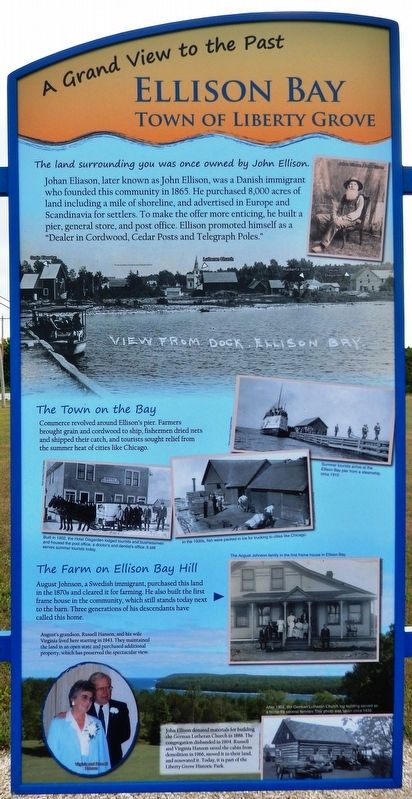
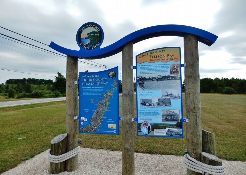
The land surrounding you was once owned by John Ellison.
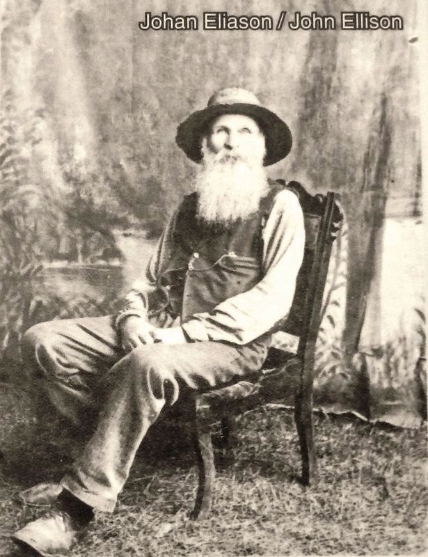
Johan Eliason, later known as John Ellison, was a Danish immigrant who founded this community in 1865. He purchased 8,000 acres of land including a mile of shoreline, and advertised in Europe and Scandinavia for settlers. To make the offer more enticing, he built a pier, general store, and post office. Ellison promoted himself as a "Dealer in Cordwood, Cedar Posts and Telegraph Poles."
The Town on the Bay
Commerce revolved around Ellison's pier. Farmers brought grain and cordwood to ship, fishermen dried nets and shipped their catch, and tourists sought relief from the summer heat of cities like Chicago.
The Farm on Ellison Bay Hill
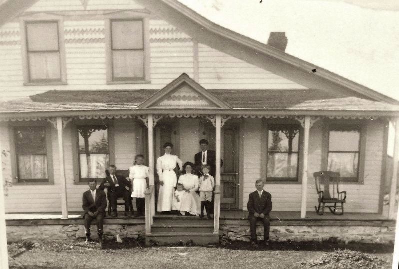
August Johnson, a Swedish immigrant, purchased this land in the 1870s and cleared it for farming. He also built the first frame house in the community, which still stands today next to the barn. Three generations of his descendants have called this home.
John Ellison donated materials for building the German Lutheran Church in 1888. The congregation disbanded in 1904. Russell and Virginia Hanson saved the cabin from demolition in 1966, moved it to their land, and renovated it. Today, it is part of the Liberty Grove Historic Park.
(photo captions)
• View from the Dock, Ellison Bay (Photo courtesy of Virginia and Russell Hanson)
• Summer tourists arrive at the Ellison Bay Pier from a steamship, circa 1915 (Photo courtesy of Augusta Erickson)
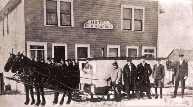
• Built in 1902, the Hotel Disgarden lodged tourists and businessmen and housed the post office, a doctor’s and dentist’s office. It still serves summer tourists today. (Photo courtesy of Dottie Sladky)
• In the 1930s, fish were packed in ice for trucking to cities like Chicago. (Photo courtesy of Len Apfelbach, M.D.)
• The August Johnson family in the first frame house in Ellison Bay
• August's grandson, Russell Hanson, and his wife Virginia lived here starting in 1943. They maintained the land in an open state and purchased additional property, which has preserved the spectacular view.
• After 1904, the German Lutheran Church log building served as a home for several families. This photo was taken circa 1935. (Photo courtesy of Virginia and Russell Hanson)
Erected by Door County Coastal Byway, Federal Highway Administration, and Wisconsin Department of Transportation.
Topics. This historical marker is listed in these topic lists: Communications • Industry & Commerce • Parks & Recreational Areas • Settlements & Settlers • Waterways & Vessels. A significant historical year for this entry is 1865.
Location. 45° 14.742′ N, 87° 5.156′ W. Marker is in Ellison Bay, Wisconsin, in Door County. Marker is on Sunnyside Lane (State Highway 42) 0.1 miles north of Porcupine Bay Road, on the left when traveling north. Marker is located on the west side of the highway, at the south entrance to Liberty Grove Historic Park and the Liberty Grove Historical Society complex. Touch for map. Marker is at or near this postal address: 11871 Wisconsin Highway 42, Ellison Bay WI 54210, United States of America. Touch for directions.
Other nearby markers. At least 8 other markers are within 5 miles of this marker, measured as the crow flies. Niagara Escarpment (here, next to this marker); The Clearing (approx. 1.3 miles away); Veterans Memorial (approx. 4.3 miles away); Nature of Sister Bay (approx. 4.3 miles away); Village of Sister Bay (approx. 4.3 miles away); a different marker also named Village of Sister Bay (approx. 4.3 miles away); The Hotz Estate (approx. 4.4 miles away); The Fishtug Skipper (approx. 4.4 miles away). Touch for a list and map of all markers in Ellison Bay.
More about this marker. This marker consists of two large, rectangular, composite plaques, mounted at eye-level, on the north-facing side of a heavy duty wooden-frame kiosk.
Related markers. Click here for a list of markers that are related to this marker. Door County Coastal Byway
Also see . . . How Ellison Bay Got Its Name
. Not much is known about the early, European part of Eliason’s life, before he immigrated to America at the age of 33, in June 1855, eventually arriving in Ephraim, where he bought a stony 40 acres of land. Four years later, in 1859, he paid $6.11 for three tax delinquent lots of land in what was to become known as Ellison Bay. By 1870, Eliason owned 588 acres, and eventually is said to have owned as much as 8,000 acres of land throughout the county, much of that bought through tax delinquencies. Eliason was unaware that the area was named for him until he spotted the misspelled name on a government map several years later. (Submitted on March 2, 2019, by Cosmos Mariner of Cape Canaveral, Florida.)
Photographed By Cosmos Mariner, July 20, 2018
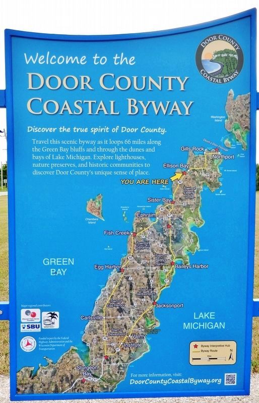
5. Door County Coastal Byway
(adjacent panel; to left of marker)
(adjacent panel; to left of marker)
Discover the true spirit of Door County. Travel this scenic byway as it loops 66 miles along the Green Bay bluffs and through the dunes and bays of Lake Michigan. Explore lighthouses, nature preserves, and historic communities to discover Door County's unique sense of place.
Credits. This page was last revised on December 28, 2019. It was originally submitted on March 2, 2019, by Cosmos Mariner of Cape Canaveral, Florida. This page has been viewed 287 times since then and 22 times this year. Photos: 1, 2, 3, 4, 5, 6. submitted on March 2, 2019, by Cosmos Mariner of Cape Canaveral, Florida. • Bill Pfingsten was the editor who published this page.
