Cumberland Township near Gettysburg in Adams County, Pennsylvania — The American Northeast (Mid-Atlantic)
Wofford's Brigade
McLaws' Division - Longstreet's Corps
— Army of Northern Virginia —
Inscription.
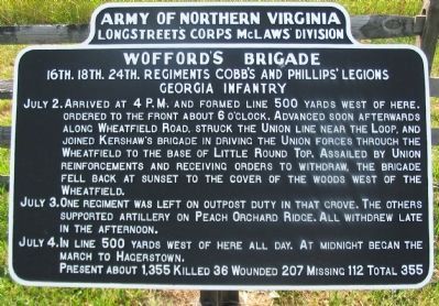
Longstreet's Corps McLaws' Division
Army of Northern Virginia
16th. 18th. 24th. Regiments Cobb's and Phillips' Legions
Georgia Infantry
July 2. Arrived at 4 p.m. and formed line 500 yards west of here. Ordered to the front about 6 o'clock. Advanced soon afterwards along Wheatfield Road, struck the Union line near the loop, and joined Kershaw's brigade in driving the Union forces through the Wheatfield to the base of Little Round Top. Assailed by Union reinforcements and receiving orders to withdraw, the brigade fell back at sunset to the cover of the woods west of the Wheatfield.
July 3. One regiment was left on outpost duty in that grove. The others supported artillery on Peach Orchard Ridge. All withdrew late in the afternoon.
July 4. In line 500 yards west of here all day. At midnight began the march to Hagerstown.
Present about 1,355. Killed 36. Wounded 207. Missing 112. Total 355.
Erected 1907 by Gettysburg National Military Park Commission.
Topics. This historical marker is listed in this topic list: War, US Civil. A significant historical date for this entry is July 2, 1863.
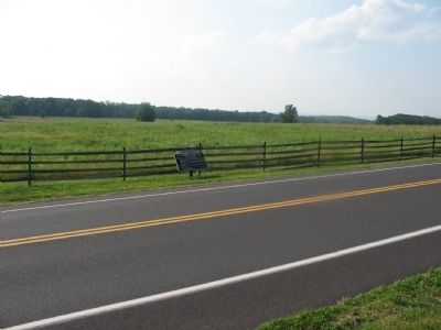
Location. 39° 48.039′ N, 77° 15.037′ W. Marker is near Gettysburg, Pennsylvania, in Adams County. It is in Cumberland Township. Marker is at the intersection of Emmitsburg Road (Business U.S. 15) and Peach Orchard Road, on the right when traveling south on Emmitsburg Road. Located near stop 10, the Peach Orchard, on the driving tour of Gettysburg National Military Park. Touch for map. Marker is in this post office area: Gettysburg PA 17325, United States of America. Touch for directions.
Other nearby markers. At least 8 other markers are within walking distance of this marker. 68th Pennsylvania Infantry (a few steps from this marker); 2d New Hampshire Volunteer Infantry (within shouting distance of this marker); 3rd Maine Infantry (within shouting distance of this marker); Battery G, 1st N.Y. Light Artillery (about 300 feet away, measured in a direct line); Barksdale's Brigade (about 300 feet away); First Division (about 300 feet away); Third Corps (about 300 feet away); Second Division (about 400 feet away). Touch for a list and map of all markers in Gettysburg.

Photographed By Craig Swain
3. Wofford's Brigade in the Wheatfield
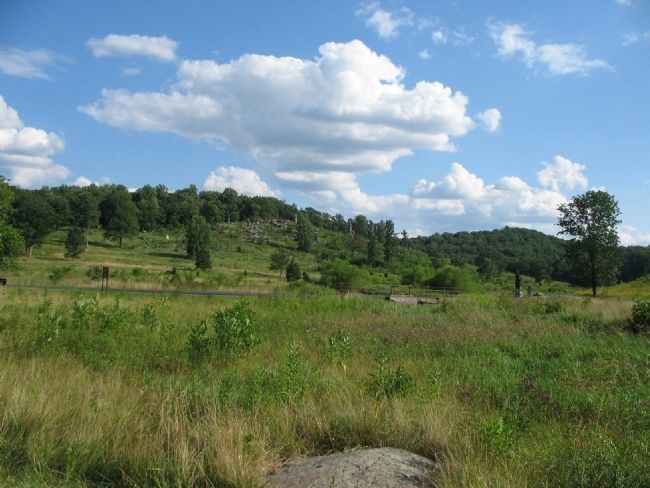
Wofford's Brigade advanced through the Peach Orchard on July 2 and cleared the woods to the east, landing on the flank of three different Federal Brigades. From there, Wofford's men entered the Wheatfield. There they met counterattacks from several Federal Brigades sent to shore up the weakened sector. This view looks from the northern edge of the Wheatfield across to Little Round Top. Crawford Avenue is seen crossing Plum Run in the foreground.
Credits. This page was last revised on February 7, 2023. It was originally submitted on October 27, 2008, by Craig Swain of Leesburg, Virginia. This page has been viewed 1,203 times since then and 15 times this year. Photos: 1, 2. submitted on October 27, 2008, by Craig Swain of Leesburg, Virginia. 3. submitted on October 7, 2008, by Craig Swain of Leesburg, Virginia.

