
Capitol Hill in Northeast Washington in Washington, District of Columbia — The American Northeast (Mid-Atlantic)
Swampoodle
Hub, Home, Heart
| — | Greater H Street NE Heritage Trail | — |
Photographed by Craig Swain, September 29, 2012
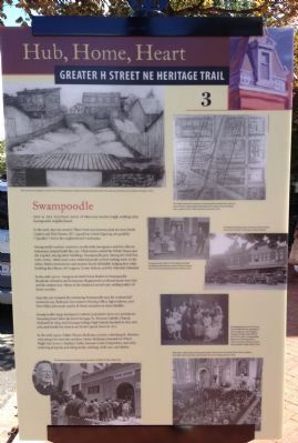
1. Swampoodle Marker
This is the western edge of what once was the rough, working-class Swampoodle neighborhood.
In the early days the marshy Tiber Creek ran between what are now North Capitol and First Streets, NE. Legend has it that lingering rain puddles ("poodles") led to the neighborhood's nickname.
Swampoodle's earliest residents, mostly Irish immigrants and free African Americans, helped build this city. Their hands crafted the White House and the Capitol, among other buildings. Swampoodle grew during the Civil War (1861-1865), when more once-enslaved people arrived seeking work. In the 1880s Italian stonecarvers and masons found affordable lodging here while building the Library of Congress, Union Station, and the National Cathedral.
In the early 1900s, Congress located Union Station in Swampoodle. Hundreds of homes and businesses disappeared as railroad tracks were laid and the station rose. Many of the displaced moved east, settling today's H Street corridor.
Soon the city rezoned the remaining Swampoodle area for commercial/industrial use. Railroad, Government Printing Office, light industry, and Post Office jobs made nearby H Street attractive to more families.
Swampoodle's large immigrant Catholic population drew two institutions honoring Jesuit Saint Aloysius Gonzaga: St. Aloysius Catholic Church, dedicated in 1859, and Gonzaga College High School, founded in 1821 and relocated beside the church on North Capitol Street in 1871.
In the early 1950s, Father Horace McKenna revived a shrinking St. Aloysius, refocusing it to serve the neediest. Father McKenna founded So Others Might Eat (some), Martha's Table, Sursum Corda Cooperative, and other enduring programs providing meals, clothing, child care, and shelter.
Erected 2012 by Cultural Tourism DC. (Marker Number 3.)
Topics and series.
this page online
Location. 38° 53.836′ N, 77° 0.2′ W. Marker is in Northeast Washington in Washington, District of Columbia. It is in Capitol Hill. It is at the intersection of F Street Northeast and 2nd Street Northeast, on the right when traveling east on F Street Northeast. Touch for map. Marker is at or near this postal address: 201 F Street Northeast, Washington DC 20002, United States of America. Touch for directions.

Regionally, this marker is in the Washington Metropolitan Area. It is also in the American Northeast, in the Upper South, in the Mid-Atlantic, in the Tidewater, and in the Chesapeake Bay Region. Globally, it is in North America, the Western Hemisphere, the Western World, and the Anglosphere.
Other nearby markers. At least 8 other markers are within walking distance of this marker: Roll Out the Barrel (about 300 feet away, measured
Photographed by Craig Swain, September 29, 2012
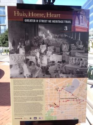
2. Back of Marker
Another marker is no longer nearby. All Aboard! (was approx. ¼ mile away but has been confirmed missing).
Photographed by Craig Swain, September 29, 2012
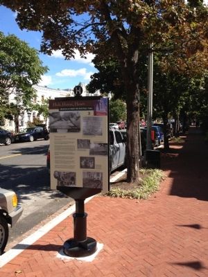
3. Swampoodle Marker
Photographed by Craig Swain, September 29, 2012
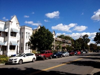
4. The Neighborhood Today
Credits. This page was last revised on January 15, 2024. It was originally submitted on September 30, 2012, by Craig Swain of Leesburg, Virginia. This page has been viewed 1,603 times since then and 56 times this year. Last updated on March 3, 2019, by Bruce Guthrie of Silver Spring, Maryland. Photos: 1, 2, 3, 4. submitted on September 30, 2012, by Craig Swain of Leesburg, Virginia. • Andrew Ruppenstein was the editor who published this page.
