Adams Morgan in Northwest Washington in Washington, District of Columbia — The American Northeast (Mid-Atlantic)
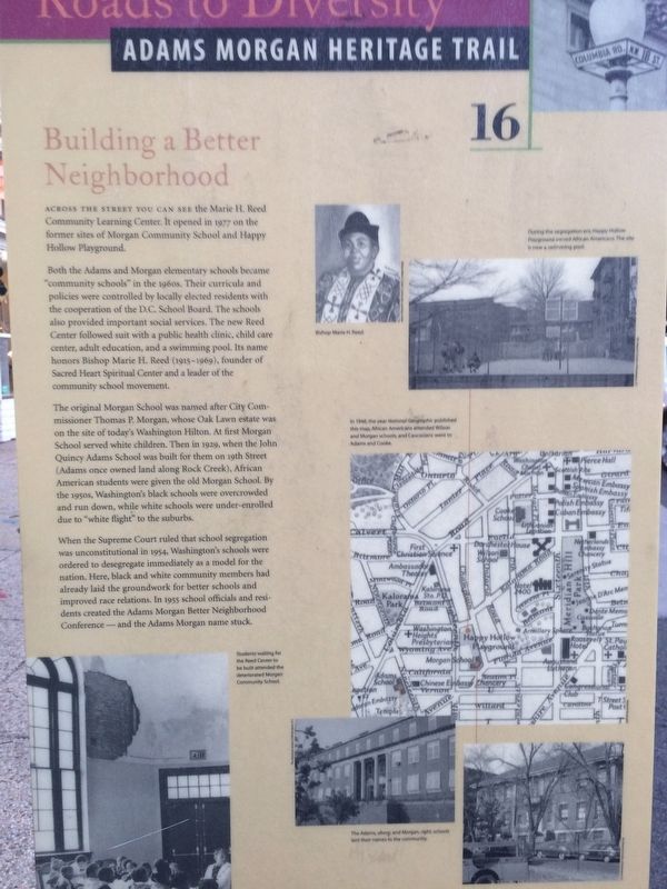
Building a Better Neighborhood
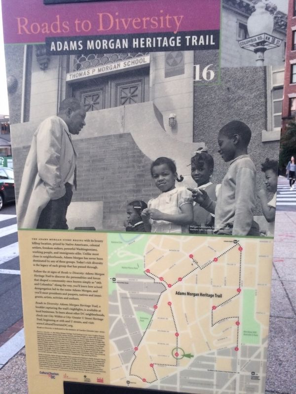
Roads to Diversity
— Adams Morgan Heritage Trail —
Both the Adams and Morgan elementary schools became "community schools" in the 1960s. Their curricula and policies were controlled by locally elected residents with the cooperation of the D.C. School Board. The schools also provided important social services. The new Reed Center followed suit with a public health clinic, child care center, adult education, and swimming pool. Its name honors Bishop Marie H. Reed (1915-1969), founder of Sacred Heart Spiritual Center and leader of the community school movement.
The original Morgan School was named after City Commissioner Thomas P. Morgan, whose Oak Lawn estate was on the site of today's Washington Hilton. At first Morgan School served white children. Then in 1929, when the John Quincy Adams School was built for them on 19th Street (Adams once owned land along Rock Creek), African American students were given the old Morgan School. By the 1950s, Washington's black schools were overcrowded and run down, while white schools were under-enrolled due to "white flight" to the suburbs.
When the Supreme Court ruled that school segregation was unconstitutional in 1954, Washington's schools were ordered to desegregate immediately as a model for the nation. Here, black and white community members had already laid the groundwork for better schools and improved race relations. In 1955 school officials and residents created the Adams Morgan Better Neighborhood Conference—and the Adams Morgan name stuck.
Erected 2005 by Cultural Tourism DC. (Marker Number 16.)
Topics and series. This historical marker is listed in these topic lists: African Americans • Civil Rights • Education. In addition, it is included in the Adams Morgan Heritage Trail, and the Former U.S. Presidents: #06 John Quincy Adams series lists. A significant historical year for this entry is 1929.
Location. 38° 55.076′ N, 77° 2.505′ W. Marker is in Northwest Washington in Washington, District of Columbia. It is in Adams Morgan. Marker is at the intersection of 18th Street Northwest and California Street Northwest, on the right when traveling south on 18th Street Northwest. Touch for map. Marker is at or near this postal address: 2100 18th Street Northwest, Washington DC 20009, United States of America. Touch for directions.
Other nearby markers. At least 8 other markers are within walking distance of this marker. Urban Renewal Era (about 600 feet away, measured in a direct line); The Changing Faces of Adams Morgan (about 700 feet away); Calvin T.S. Brent Residence (approx. 0.2 miles away); Strivers' Section
Also see . . . Roads to Diversity Pamphlet. (Submitted on October 21, 2017, by Devry Becker Jones of Washington, District of Columbia.)
Credits. This page was last revised on February 21, 2023. It was originally submitted on October 21, 2017, by Devry Becker Jones of Washington, District of Columbia. This page has been viewed 345 times since then and 21 times this year. Last updated on March 7, 2019, by Devry Becker Jones of Washington, District of Columbia. Photos: 1, 2. submitted on October 21, 2017, by Devry Becker Jones of Washington, District of Columbia. • Bill Pfingsten was the editor who published this page.
Editor’s want-list for this marker. A wide shot of the marker in context. • A better close-up photo of the marker. • Can you help?

