Mount Pleasant in Northwest Washington in Washington, District of Columbia — The American Northeast (Mid-Atlantic)
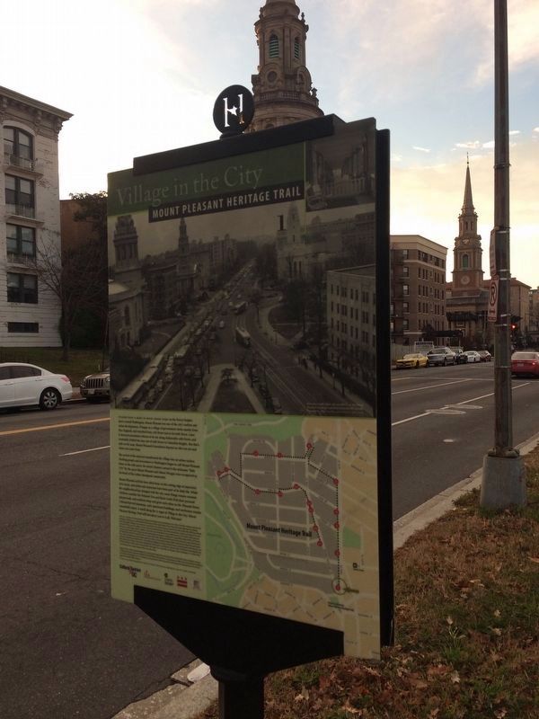
Fashionable 16th Street
Village in the City
— Mount Pleasant Heritage Trail —
Today's 16th Street from the White House to Silver Spring, Maryland is one of the city's key gateways. But through the 1890s it jogged left where Mt. Pleasant Street runs today and then dead-ended at the edge of today's Rock Creek Park.
After decades on the city's wish list, in 1903, 16th Street was straightened and extended to Spring Road, several blocks north of here. This improvement, coupled with the arrival of the electric streetcar, made airy Mount Pleasant an attractive location for residential building. Suddenly, it was easy to commute downtown and back.
Two decades earlier, Mary Foote Hamilton, socialite developer and wife of Senator John Henderson, had begun working to make 16th Street the city's most fashionable. The couple lived in Henderson Castle (now demolished) at 16th and Florida Avenue. She lured embassies from France, Spain, Mexico Cuba, Lithuania, Italy, and Poland to 16th Street. Henderson also had the street re-named Avenue of the Presidents, but that lasted only one year.
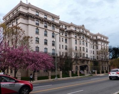
When the Kenesaw Apartment House across the park opened in 1906, it led a wave of luxury apartment building here. The Kenesaw housed members of Congress and other prominent Washingtonians. Washington Senators pitcher Walter Johnson and his family lived there in 1915 while their house at 1843 Irving Street was under construction.
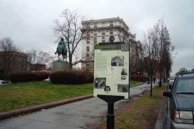
In 1913 the Kenesaw owners donated today's park land to the city. President Coolidge dedicated this sculpture of Francis Asbury, the first bishop in America in 1924.
Erected 2006 by Cultural Tourism DC. (Marker Number 1.)
Topics and series. This historical marker is listed in these topic lists: Arts, Letters, Music • Churches & Religion • Hispanic Americans • Railroads & Streetcars. In addition, it is included in the Former U.S. Presidents: #30 Calvin Coolidge, the Francis Asbury, Traveling Methodist Preacher, and the Mount Pleasant Heritage Trail series lists. A significant historical year for this entry is 1903.
Location. 38° 55.651′ N, 77° 2.195′ W. Marker is in Northwest Washington in Washington, District of Columbia. It is in Mount Pleasant. Marker is on 16th Street Northwest just north of Harvard Street Northwest, on the left when traveling north. Touch for map. Marker is at or near this postal address: 3025 Mt Pleasant St NW, Washington DC 20009, United States of America. Touch for directions.
Other nearby markers. At least 8 other markers are within walking distance of this marker. Francis Asbury (a few steps from this marker); The Trolley Arrives in Mount Pleasant (within shouting distance of this marker); Everyday People (about 300 feet away, measured in a direct line); Turbulence and Change
Photographed By Devry Becker Jones (CC0), December 24, 2017
2. Back of Fashionable 16th Street Marker
More about this marker. Picture captions:
[Pictures in upper right of marker]:
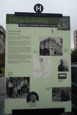
The luxurious Kenesaw Apartment House, left, designed by architect George M. Stone, below, contained a pharmacy, visible on left, and a café.
[Map in center of marker]:
The site plan for the Kenesaw shows old 16th St., now Mt. Pleasant St., and Kenesaw Ave., now Irving St.
[Two pictures in lower left of marker]:
From left, Carolyn Ann, Hazel, Robert, Edwin and Walter Jr., the family of famed Senators pitcher, Walter "Big Train" Johnson, below right, on their Irving St. porch.
[Picture in lower right of marker]:
Mount Pleasant residents Christina and Barbara Leckie, dressed up for Easter pose next to the statue in Asbury Park in 1954.
[Pictures of street sign in lower right of marker]:
This
sample sign was designed for the renaming of 16th St. as Avenue of the Presidents in 1913.
Additional keywords. Adams Morgan, Columbia Heights
Credits. This page was last revised on March 31, 2024. It was originally submitted on March 17, 2009, by Richard E. Miller of Oxon Hill, Maryland. This page has been viewed 1,819 times since then and 17 times this year. Last updated on March 8, 2019, by Devry Becker Jones of Washington, District of Columbia. Photos: 1. submitted on March 17, 2009, by Richard E. Miller of Oxon Hill, Maryland. 2. submitted on December 24, 2017, by Devry Becker Jones of Washington, District of Columbia. 3. submitted on March 17, 2009, by Richard E. Miller of Oxon Hill, Maryland. 4. submitted on May 13, 2015, by Allen C. Browne of Silver Spring, Maryland. 5. submitted on March 17, 2009, by Richard E. Miller of Oxon Hill, Maryland. • Bill Pfingsten was the editor who published this page.
