Mount Pleasant in Northwest Washington in Washington, District of Columbia — The American Northeast (Mid-Atlantic)
War and Peace
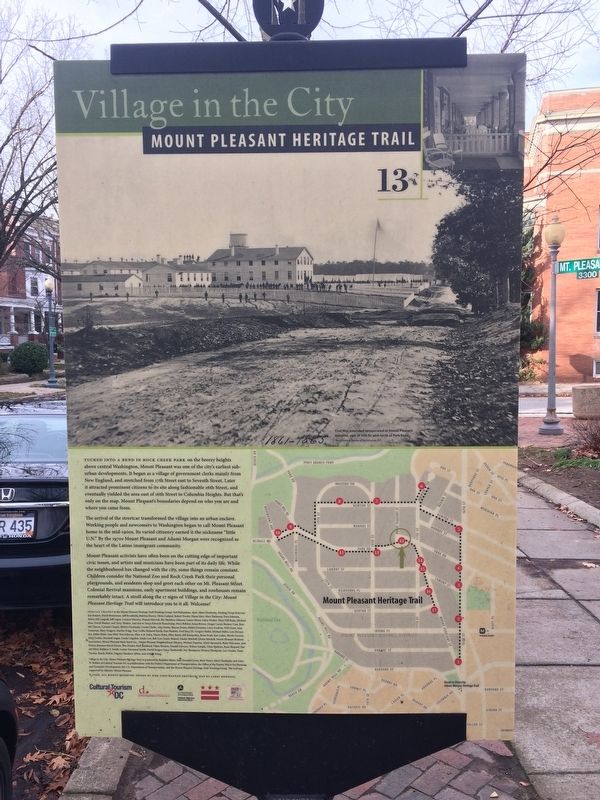
Village in the City
— Mount Pleasant Heritage Trail —
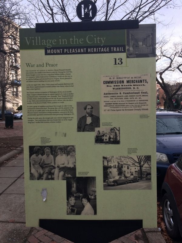
The mansion of Samuel P. Brown, Mount Pleasant's founder once stood in the middle of the block to your left. During the Civil War, Brown bought 73 acres here for a song from William Selden, a former U.S. treasurer. Selden believed the Confederacy would win the war, so he sold his holdings and retreated home to Virginia. Brown planned to sell Selden's land as building lots once peace arrived.
As the war raged (1861-1865), Union camps and hospitals filled these hilltops. Brown regularly hosted wounded soldiers from Maine, where he had been a state legislator.
The Union's wartime occupation of Washington left the city in terrible shape. Congress debated moving the nation's capital to St. Louis or another heartland location. Fortunately, after Alexander "Boss" Shepherd's Board of Public Works rebuilt and improved the city, the government decided to stay. Well-connected land speculators such as Brown, who was also a member of the Board of Public Works, profited as a result.
In 1906 a group of neighbors purchased this triangle in order to stop commercial construction here. The group then sold the property to the city for use as a public park. In the process they also revived the Mount Pleasant Citizens Association to bring community concerns to the three presidentially appointed commissioners then governing Washington, DC.
During the early 1960s, the triangle park was a favorite hangout for area teenagers. "You could always find your friends there or at the Argyle drug store," recalled Bob Sciandra, a former resident.
Erected 2006 by Cultural Tourism DC. (Marker Number 13.)
Topics and series. This historical marker is listed in these topic lists: Settlements & Settlers • War, US Civil. In addition, it is included in the Mount Pleasant Heritage Trail series list. A significant historical year for this entry is 1906.
Location. 38° 55.956′ N, 77° 2.38′ W. Marker is in Northwest Washington in Washington, District of Columbia. It is in Mount Pleasant. Marker is at the intersection of Park Road Northwest and Mount Pleasant Street Northwest, on the right when traveling east on Park Road Northwest. On the grounds of Park Road Triangle Park. Touch for map. Marker is in this post office area: Washington DC 20010, United States of America. Touch for directions.
Other nearby markers. At least 8 other markers are within walking distance of this marker. Casualties Arriving at Mount Pleasant General Hospital, May 1864 (about 300 feet away, measured in a direct line); Changing Fashions (about 400 feet away); Main Street (about 400 feet away); Streetcar Suburb (about 600 feet away); Nacotchtank Family at the Piney Branch Quarry, ca. 1600 (about 700
Credits. This page was last revised on January 30, 2023. It was originally submitted on December 25, 2017, by Devry Becker Jones of Washington, District of Columbia. This page has been viewed 290 times since then and 36 times this year. Last updated on March 8, 2019, by Devry Becker Jones of Washington, District of Columbia. Photos: 1, 2. submitted on December 25, 2017, by Devry Becker Jones of Washington, District of Columbia. • Bernard Fisher was the editor who published this page.
Editor’s want-list for this marker. A wide shot of the marker in context. • Can you help?

