Financial District in Manhattan in New York County, New York — The American Northeast (Mid-Atlantic)
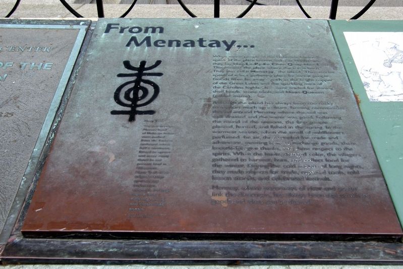
From Menatay…
Photographed by Larry Gertner, December 1, 2018
1. From Menatay... Marker
When native people of the Delaware nation speak of the place known today as Manhattan, they say Hay-La-Py-Ee-Chen Quay-Hee-OLass. This means “the place where the sun is born.” They also call it Menatay, “the island”. Their stories speak of it as a gathering place for native people. Goods from far away, such as the bright copper of the Great lakes and the sparkling mica of the Carolina highlands were traded for shining bead shells, stone tools and Hans-Queem (Golden Maize).
Although the island has always been too rocky to support much agriculture, farming communities thrived around Menatay where the soil was well drained and the water was good. Following the round of the seasons, the first people planted, hunted and fished in the spring. In the warmest season, when the smell of wildflowers perfumed the air, they traveled for trade and adventure, meeting here to exchange goods, share knowledge, give thanks, and show respect to the spirits. When the leaves changed color, the villagers gathered to harvest, hunt and collect food for the winter. During the cold moons of long nights, they made objects for trade, repaired tools, told lesson stories, and celebrated festivals.
Menatay, where waterways of river and ocean link the directions, has always been a place where goods and ideas can be shared.
Topics. This historical marker is listed
this page online
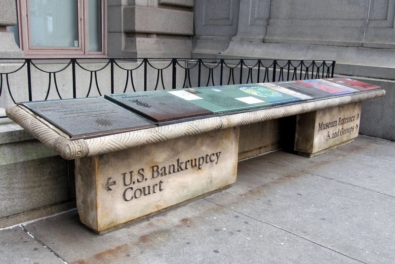
Location. 40° 42.266′ N, 74° 0.814′ W. Marker is in Manhattan, New York, in New York County. It is in the Financial District. It is on Whitehall Street near Bowling Green, on the right when traveling south. The marker is one of several in a bank to the left of the main entrance to the National Museum of the American Indian. Touch for map. Marker is in this post office area: New York NY 10004, United States of America. Touch for directions.

Regionally, this marker is in New York City. It is also in the American Northeast, in the Mid-Atlantic, and on the Eastern Seaboard. Globally, it is in the North Atlantic Region, North America, the Western Hemisphere, the Western World, and the Anglosphere. Historically, it finds itself in what was once New Netherland and also one of the original Thirteen Colonies.
Other nearby markers. At least 8 other markers are within walking distance of this marker: A Place Of Many Names (here, next to this marker); …to Manhattan (here, next to this marker); Menatay, An Island Crossroads (here, next to this marker); Lower Manhattan Today (here, next to this marker); Drawn To The City (here, next to this marker); The Marketplace (a few steps from this marker); “North America” sculpted by Daniel Chester French (a few
Photographed by Larry Gertner, February 5, 2019
2. Inset
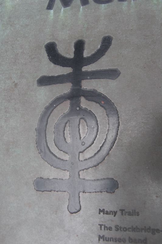
Inset – Many trails
The Stockbridge-Munsee band of Mohican Indians were pushed from the Eastern seaboard across half a continent, force to uproot and move many time to our present land in Wisconsin.
Many Trails is an original design symbolizing endurance, strength, and hope from a long suffering, proud, and determined people.
Symbol designed by Edwin Martin (Stockbridge-Munsee)
The Stockbridge-Munsee band of Mohican Indians were pushed from the Eastern seaboard across half a continent, force to uproot and move many time to our present land in Wisconsin.
Many Trails is an original design symbolizing endurance, strength, and hope from a long suffering, proud, and determined people.
Symbol designed by Edwin Martin (Stockbridge-Munsee)
Photographed by Larry Gertner, December 1, 2018
3. From Menatay... marker site
The bank of markers left of the main entrance.
Photographed by Larry Gertner, December 1, 2018
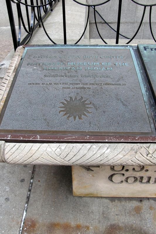
4. Museum information
Photographed by Larry Gertner, 1999
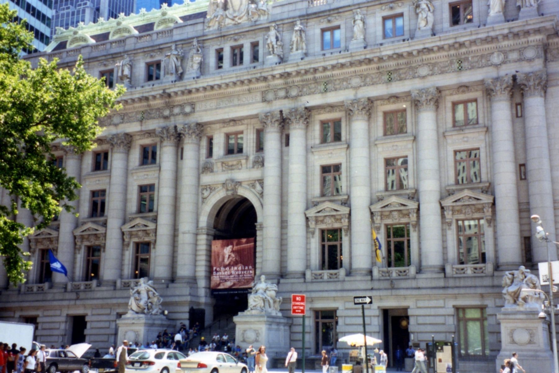
5. The National Museum of the American Indian (and Federal Bankruptcy Court)
Formerly the Alexander Hamilton Custom House. The marker bank is to the left of the entrance.
Credits. This page was last revised on January 31, 2023. It was originally submitted on March 4, 2019, by Larry Gertner of New York, New York. This page has been viewed 553 times since then and 19 times this year. Last updated on March 9, 2019, by Larry Gertner of New York, New York. Photos: 1, 2, 3, 4, 5. submitted on March 4, 2019, by Larry Gertner of New York, New York. • Andrew Ruppenstein was the editor who published this page.
