Canajoharie in Montgomery County, New York — The American Northeast (Mid-Atlantic)
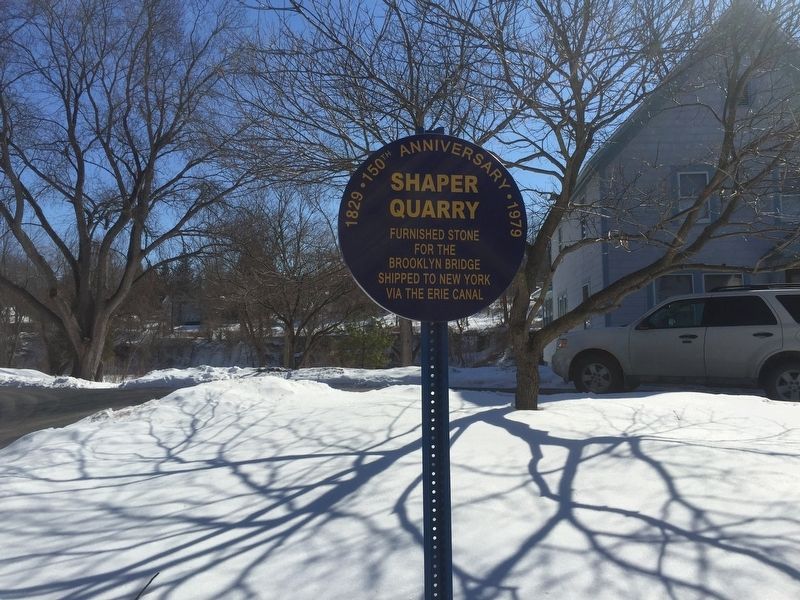
Shaper Quarry
1829 - 150th Anniversary - 1979
Topics. This historical marker is listed in these topic lists: Bridges & Viaducts • Industry & Commerce • Waterways & Vessels.
Location. 42° 54.251′ N, 74° 34.737′ W. Marker is in Canajoharie, New York, in Montgomery County. Marker is at the intersection of Cliff Street and Shaper Avenue, on the left when traveling west on Cliff Street. Touch for map. Marker is in this post office area: Canajoharie NY 13317, United States of America. Touch for directions.
Other nearby markers. At least 8 other markers are within walking distance of this marker. Chester B. Hoke (approx. 0.2 miles away); Sullivan-Clinton Campaign (approx. ¼ mile away); Canajoharie Academy (approx. 0.3 miles away); The Canalway Trail: Canajoharie/ To Market, to Market (approx. 0.3 miles away); Site of Johannes Reuff's Tavern (approx. 0.3 miles away); Northeastern Terminal (approx. 0.3 miles away); Routes of the Armies (approx. 0.4 miles away); Canajoharie/Canalway Trail/Pathway Through Mountains (approx. 0.4 miles away). Touch for a list and map of all markers in Canajoharie.
Regarding Shaper Quarry. The two towers were constructed by sinking cassions into the riverbed. Stone was placed atop two cassion (inverted boxes) which sank the cassions into the riverbed. Workers then dug out the earth beneath the cassion until bedrock was struck.
Also see . . . Canajoharie Geology. (Submitted on March 10, 2019, by Steve Stoessel of Niskayuna, New York.)
Credits. This page was last revised on March 11, 2019. It was originally submitted on March 9, 2019, by Steve Stoessel of Niskayuna, New York. This page has been viewed 471 times since then and 38 times this year. Photo 1. submitted on March 9, 2019, by Steve Stoessel of Niskayuna, New York. • Bill Pfingsten was the editor who published this page.
