Ellicott City in Howard County, Maryland — The American Northeast (Mid-Atlantic)
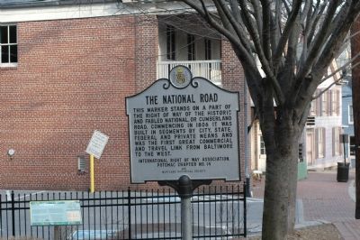
The National Road
Inscription.
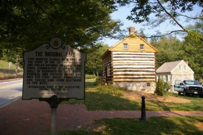
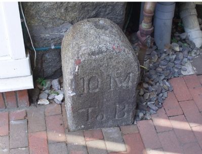
This marker stands on a part of the right of way of the historic and fabled National, or Cumberland Road. Commencing in 1806 it was built in segments by city, state, federal, and private means and was the first great commercial and travel link from Baltimore to the west.
Erected by International Right of Way Association, Potomac Chapter No. 14 and the Maryland Historical Society.
Topics and series. This historical marker is listed in this topic list: Roads & Vehicles. In addition, it is included in the The Historic National Road series list. A significant historical year for this entry is 1806.
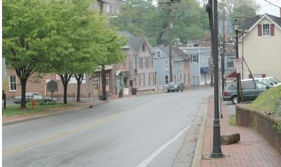
Location. 39° 16.125′ N, 76° 48.062′ W. Marker is in Ellicott City, Maryland, in Howard County. Marker is at the intersection of Main Street (Maryland Route 144) and Ellicott Mills Drive, on the right when traveling west on Main Street. West of this marker Route 144 is called Frederick Road. Touch for map. Marker is in this post office area: Ellicott City MD 21042, United States of America. Touch for directions.
Other nearby markers. At least 5 other markers are within walking distance of this marker. MaryLandscapes (here, next to this marker); Ellicott’s Mills (here, next to this marker); Fire House Annex (within shouting distance of this marker); Fells Lane Community (within shouting distance of this marker); New Fire Station & Transit Terminal (within shouting distance of this marker). Touch for a list and map of all markers in Ellicott City.
Regarding The National Road. The National Road became U.S. Route 40 in the 20th century, stretching from Baltimore to San Francisco. With the advent of the Interstate Highway system and the creation bypasses around towns the original route has been chopped up. For example, at this marker the roadway is now State route 144 while the current U.S. 40 bypasses the town and further west in Maryland U.S. 40 shares the roadway with Interstates 70 and 68.
Also see . . .
1. U.S. Route 40, America's Golden Highway. (Submitted on March 3, 2006.)
2. The Road that Built the Nation. from Pennsylvania's point of view. (Submitted on March 3, 2006.)
3. The International Right Of Way Association. (Submitted on March 3, 2006.)
4. The National Road (The Road and American Culture). Search inside this book by Karl B. Raitz at Amazon.com. (Submitted on April 24, 2006.)
Additional commentary.
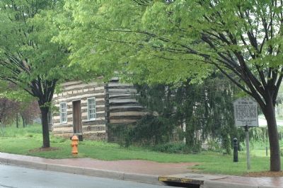
1. The log house
The log cabin in the photographs was originally on Merryman Road. It was dismantled in 1980, and assembled on the current location in 1988. According to the Historic American Buildings Survey, "the Merryman Road Log House is one of the oldest buildings in the area of Ellicott City, Maryland. It has played a prominent role in the history of area blacks; unfortunately, most of this heritage has not been recorded. The house is believed to have been built in the last decade of the eighteenth century, which would be contemporary with the settling of Ellicott City. In 1877, St. Luke's AME Church, late of Oella, Maryland, held services in the Merryman Road Log House until construction of its new Ellicott City church building could be completed."
— Submitted May 15, 2008, by Christopher Busta-Peck of Shaker Heights, Ohio.
Credits. This page was last revised on July 14, 2019. It was originally submitted on March 3, 2006, by Tom Fuchs of Greenbelt, Maryland. This page has been viewed 2,642 times since then and 40 times this year. Photos: 1. submitted on March 3, 2006, by Tom Fuchs of Greenbelt, Maryland. 2, 3. submitted on April 24, 2006, by Tom Fuchs of Greenbelt, Maryland. 4. submitted on February 12, 2008, by Christopher Busta-Peck of Shaker Heights, Ohio. 5. submitted on October 2, 2006, by Tom Fuchs of Greenbelt, Maryland. • J. J. Prats was the editor who published this page.
