Near Wheeless in Cimarron County, Oklahoma — The American South (West South Central)
Santa Fe Trail
Photographed by Cosmos Mariner, June 13, 2011
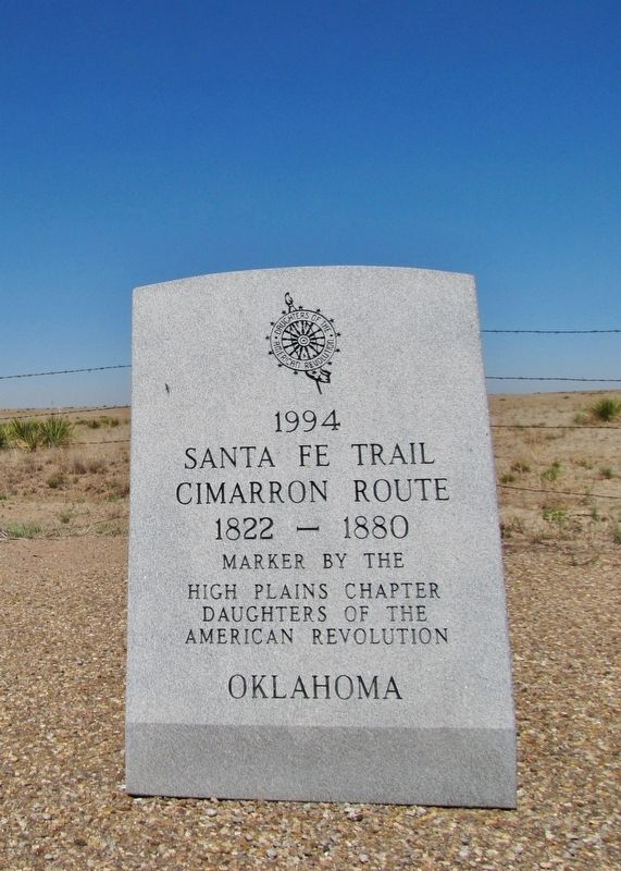
1. Santa Fe Trail Marker
Santa Fe Trail
Cimarron Route
1822-1880
Marker by the
High Plains Chapter
Daughters of the
American Revolution
Oklahoma
Erected 1994 by High Plains Chapter, Daughters of the American Revolution.
Topics and series. This historical marker is listed in these topic lists: Roads & Vehicles • Settlements & Settlers. In addition, it is included in the Daughters of the American Revolution (DAR), and the Santa Fe Trail series lists. A significant historical year for this entry is 1822.
Location. 36° 47.199′ N, 102° 48.318′ W. Marker is near Wheeless, Oklahoma, in Cimarron County. It is on State Highway 325 3.6 miles north of E0190 Road, on the left when traveling north. Marker is located in a pull-out on the west side of the highway, at the point where the Santa Fe Trail crossed here from east to west. Touch for map. Marker is in this post office area: Boise City OK 73933, United States of America. Touch for directions.

Regionally, this marker is in the Oklahoma Panhandle. It is also in the American South, specifically on the prairies, on the Southern Plains, on the High Plains, and on the Santa Fe Trail Corridor.
this page online
Other nearby markers. At least 6 other markers are within 16 miles of this marker, measured as the crow flies: A different marker also named The Santa Fe Trail (a few steps from this marker); Fort Nichols (a few steps from this marker); Highest Point in Oklahoma (approx. 14.6 miles away); Black Mesa Nature Preserve (approx. 14.7 miles away); Cimarron County (approx. 14.7 miles away); Rocks Reveal Jurassic Life (approx. 15.1 miles away).
Regarding Santa Fe Trail. Google Maps aerial view clearly shows the Santa Fe Trail wagon ruts running east/west through this location.
Also see . . .
1. Santa Fe Trail. Wikipedia entry (Submitted on March 8, 2021, by Larry Gertner of New York, New York.)
2. The Great Prairie Highway: Santa Fe National Historic Trail. National Park Service entry:
The Santa Fe Trail
Photographed by Cosmos Mariner, June 13, 2011
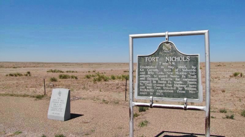
2. Santa Fe Trail Marker (wide view; showing adjacent Fort Nichols marker on right)
Established in May 1865, by Kit Carson, hero of Valverde and Brig. Gen., New Mexico Volunteers, to guard Santa Fe Trail and furnish escorts for caravans engaged in Santa Fe trade. Santa Fe Trail crossed this highway here and was first traveled by William Becknell's expedition from Missouri in 1823.
via Wikipedia, unknown
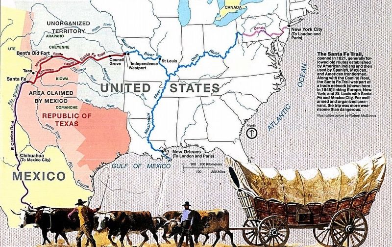
3. Santa Fe Trail map
Photographed by Cosmos Mariner, June 13, 2011
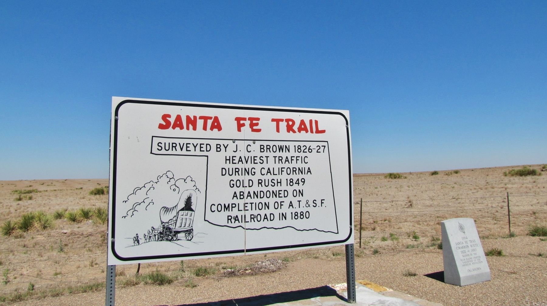
4. Santa Fe Trail Marker (wide view; showing adjacent Santa Fe Trail sign on left)
Surveyed by J. C. Brown 1826-27
Heaviest traffic during California Gold Rush 1849
Abandoned on completion of A.T. & S.F. Railroad in 1880
Credits. This page was last revised on March 8, 2021. It was originally submitted on March 22, 2019, by Cosmos Mariner of Cape Canaveral, Florida. This page has been viewed 710 times since then and 44 times this year. Photos: 1, 2. submitted on March 22, 2019, by Cosmos Mariner of Cape Canaveral, Florida. 3. submitted on March 8, 2021, by Larry Gertner of New York, New York. 4. submitted on March 22, 2019, by Cosmos Mariner of Cape Canaveral, Florida.
