Linthicum Heights in Anne Arundel County, Maryland — The American Northeast (Mid-Atlantic)
XAF Radar Antenna
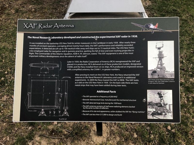
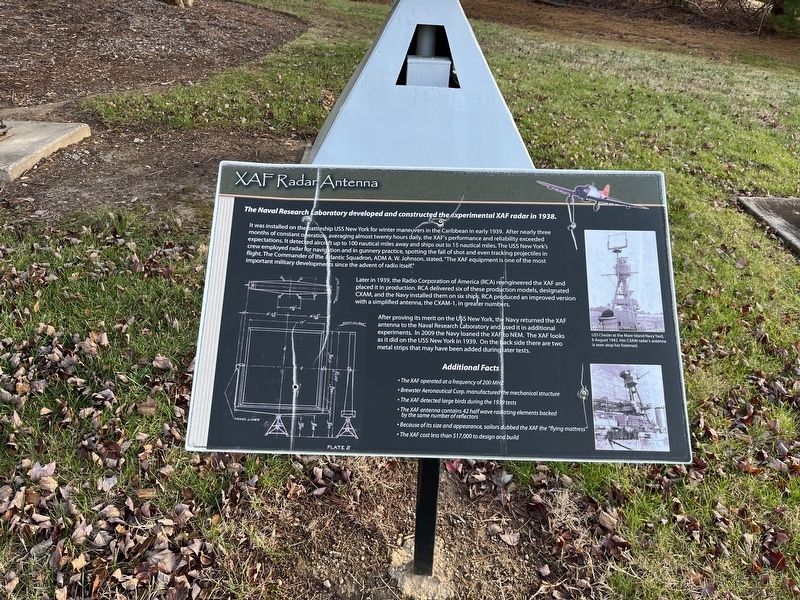
The Naval Research Laboratory developed and constructed the experimental XAF radar in 1938.
It was installed on the battleship USS New York for winter maneuvers in the Caribbean in early 1939. After nearly three months of constant operation, averaging almost twenty hours daily, the XAF's performance and reliability exceeded expectations. It detected aircraft up to 100 nautical miles away from ships out to 15 nautical miles. The USS New York's crew employed radar for navigation and in gunnery practice, spotting the fall of shot and even tracking projectiles in flight. The Commander of the Atlantic Squadron, ADM A.W. Johnson, stated, "The XAF equipment is one of the most important military developments since the advent of radio itself."
Later in 1939, the Radio Corporation of America (RCA) reengineered the XAF and placed it in production. RCA delivered six of these production models, designated CXAM, and the Navy installed them on six ships. RCA produced an improved version with a simplified antenna, the CXAM-1, in greater numbers.
After proving its merit on the USS New York, the Navy returned the XAF antenna to
this page online
Additional Facts
• The XAF operated at a frequency of 200 MHZ
• Brewster Aeronautical Corp. manufactured the mechanical structure
• The XAF detected large birds during the 1939 test
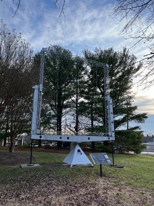
• The XAF antenna contains 42 half wave radiating elements backed by the same number of reflectors
• Because of its size and appearance, sailors dubbed the XAF the "flying mattress"
• The XAF cost less than $17,000 to design and build
Erected by National Electronics Museum.
Topics. This historical marker is listed in these topic lists: Air & Space • Communications • Military • Waterways & Vessels. A significant historical year for this entry is 1938.
Location. Marker has been permanently removed. It was located near 39° 11.72′ N, 76° 41.087′ W. Marker was in Linthicum Heights, Maryland, in Anne Arundel County. It was on West Nursery Road south of Elm Road, on the right when
Photographed by Adam Margolis, December 19, 2022
2. XAF Radar Antenna Marker
We have been informed that this marker is no longer there and will not be replaced. This page is an archival view of what was.
Regionally, this marker was in the Baltimore Metro Region. It was also in the American Mid-Atlantic and on the Eastern Seaboard. Globally, it was in the North Atlantic Region, North America, the Western Hemisphere, the Western World, and the Anglosphere. Historically, it found itself in what was once one of the original Thirteen Colonies and also the Antebellum South.

Other nearby markers. At least 8 other markers are within 2 miles of this location, measured as the crow flies: Stoney Run Train Station (approx. 0.8 miles away); Elkridge Furnace Inn (approx. 1.6 miles away); Elkridge Landing (approx. 1.8 miles away); a different marker also named Elkridge Landing (approx. 1.8 miles away); Herman F. Prehn (approx. 1.8 miles away); Linthicum Heights (approx. 1.8 miles away); In Honor of Those Who Served (approx. 1.8 miles away); Elk Ridge Landing (approx.
Photographed by Adam Margolis, December 19, 2022
3. XAF Radar Antenna Marker
Other markers no longer nearby. SCR-270 Radar Antenna (was within shouting distance of this marker but has been permanently removed); AN/SPG-55B Radar (was about 300 feet away, measured in a direct line but has been permanently removed); TPS-43 (was about 300 feet away but has been permanently removed); Nike Ajax (was about 300 feet away but has been permanently removed); a different marker also named Elkridge Furnace Inn (was approx. 1.7 miles away but has been replaced with another marker now near it); Benson-Hammond House • Annapolis and Baltimore Short Line / Linthicum Heights • Holly Run Church (was approx. 1.9 miles away but has been confirmed missing).
Credits. This page was last revised on July 18, 2026. It was originally submitted on March 31, 2019, by Devry Becker Jones of Washington, District of Columbia. This page has been viewed 818 times since then and 63 times this year. Photos: 1. submitted on March 31, 2019, by Devry Becker Jones of Washington, District of Columbia. 2, 3. submitted on March 21, 2023, by Adam Margolis of Mission Viejo, California.
