
Baton Rouge in East Baton Rouge Parish, Louisiana — The American South (West South Central)
Baton Rouge National Cemetery
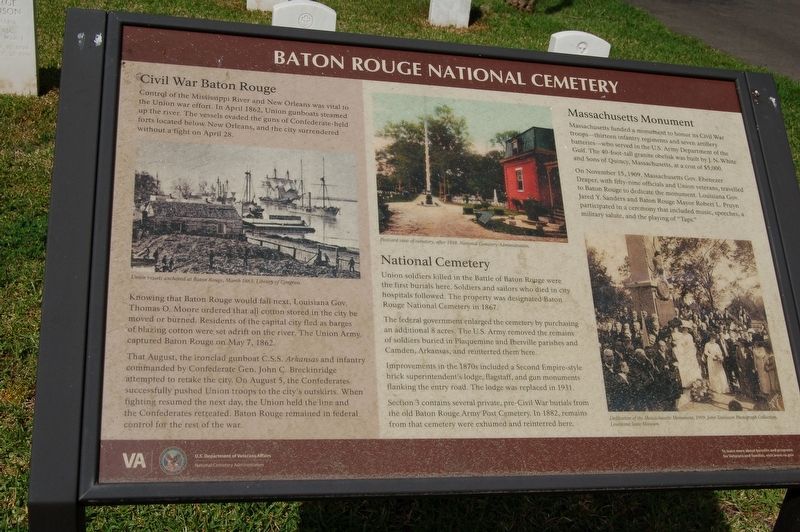
Photographed by Cajun Scrambler, March 30, 2019
1. Baton Rouge National Cemetery Marker
Knowing that Baton Rouge would fall next, Louisiana Gov. Thomas O. Moore ordered that all cotton stored in the city be moved or burned. Residents of the capital city fled as barges of blazing cotton were, set adrift on the river. The Union Army. captured Baton Rouge on May 7, 1862.
That August, the ironclad gunboat C.S.S. Arkansas and infantry commanded by Confederate Gen. John C. Breckinridge attempted to retake the city. On August 5, the Confederates successfully pushed Union troops to the city's outskirts. When fighting resumed the next day, the Union held the line and the Confederates retreated. Baton Rouge remained in federal control for the rest of the war.
this page online
The federal government enlarged the cemetery by purchasing an additional 8 acres. The U.S. Army removed the remains of soldiers buried in Plaquemine and lberville parishes and Camden, Arkansas, and reinterred them here.
Improvements in the 1870s included a Second Empire-style brick superintendent's lodge, flagstaff, and gun monuments flanking the entry road. The lodge was replaced in 1931.
Section 3 contains several private, pre-Civil War burials from the old Baton Rouge Army Post Cemetery. In 1882, remains from that cemetery were exhumed and reinterred here.
On November 15, 1909, Massachusetts Gov. Ebenezer Draper, with fifty-nine officials and Union veterans, travelled to Baton Rouge to dedicate the monument. Louisiana Gov. Jared Y. Sanders
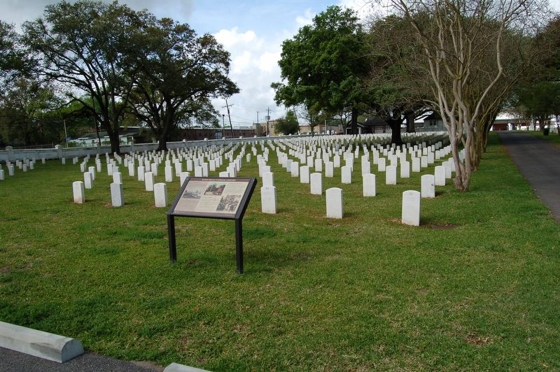
Photographed by Cajun Scrambler, March 30, 2019
2. Baton Rouge National Cemetery Marker
Erected by U.S.Department of Veteran Affairs.
Topics and series. This historical marker is listed in these topic lists: Cemeteries & Burial Sites • War, US Civil. In addition, it is included in the National Cemeteries series list.
Location. 30° 26.96′ N, 91° 10.054′ W. Marker is in Baton Rouge, Louisiana, in East Baton Rouge Parish. It can be reached from North 19th Street. Touch for map. Marker is at or near this postal address: 220 North 19th Street, Baton Rouge LA 70806, United States of America. Touch for directions.

Regionally, this marker is in Louisiana’s Florida Parishes. It is also in the American South, specifically in the Deep South, and in the Great River Road Region. Globally, it is in North America, a Gulf of Mexico state, the Western Hemisphere, the Western World, and the Anglosphere. Historically, it finds itself in what was once New Spain, the territory of the Mississippian Culture, the Louisiana
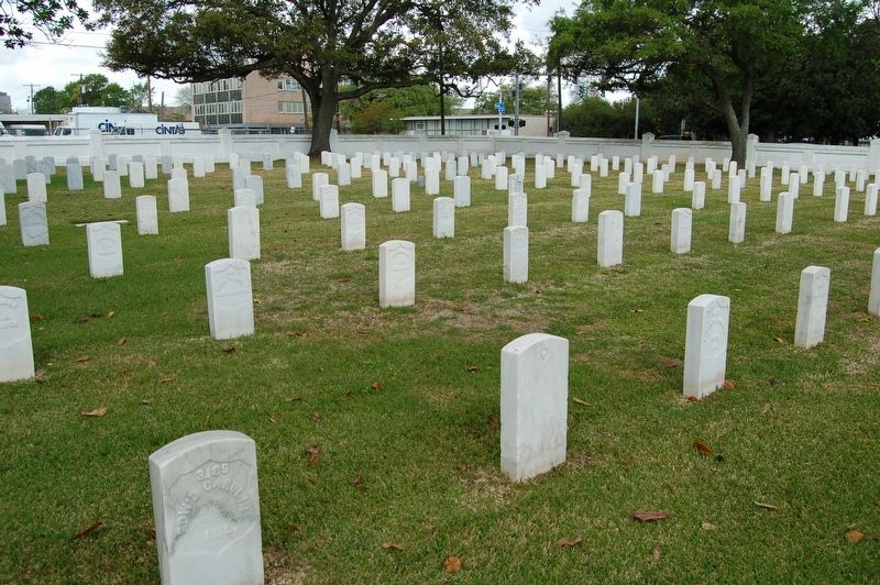
March 29, 2019
3. Baton Rouge National Cemetery Marker
Other nearby markers. At least 8 other markers are within walking distance of this marker: Yellow Fever Memorial (about 300 feet away, measured in a direct line); Massachusetts Memorial (about 400 feet away); Genl. Philemon Thomas (about 400 feet away); A National Cemetery System (about 500 feet away); National Cemetery (about 500 feet away); Magnolia Cemetery (about 800 feet away); Civil War Battle of Baton Rouge (approx. ¼ mile away); St. Joseph Catholic Cemetery (approx. 0.4 miles away). Touch for a list and map of all markers in Baton Rouge.
More about this marker. Located inside the Baton Rouge National Cemetery, open sun up to sun down.
Credits. This page was last revised on June 23, 2023. It was originally submitted on March 31, 2019, by Cajun Scrambler of Assumption, Louisiana. This page has been viewed 748 times since then and 45 times this year. Photos: 1, 2, 3. submitted on March 31, 2019.
