La Plata in Charles County, Maryland — The American Northeast (Mid-Atlantic)
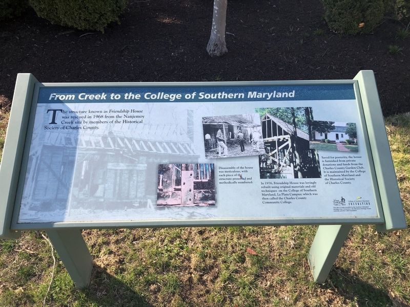
From Creek to the College of Southern Maryland
Photographed by Devry Becker Jones (CC0), March 31, 2019
1. From Creek to the College of Southern Maryland Marker
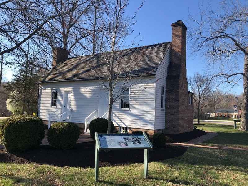
The structure known as Friendship House was rescued in 1968 from the Nanjemoy Creek site by members of the Historical Society of Charles County.
[Captions:]
Disassembly of the house was meticulous, with each piece of the structure preserved and methodically numbered.
In 1976, Friendship House was lovingly rebuilt using original materials and old techniques on the College of Southern Maryland, La Plata Campus; which was then called the Charles County Community College.
Saved for posterity, the house is furnished from private donations and funds from the Charles County Garden Club. It is maintained by the College of Southern Maryland and the Historical Society of Charles County.
Erected by The Southern Maryland Heritage Area Consortium, the Maryland Heritage Areas Authority and the College of Southern Maryland Foundation.
Topics. This historical marker is listed in these topic lists: Education • Notable Buildings • Waterways & Vessels. A significant historical year for this entry is 1968.
Location. 38° 33.589′ N, 77° 0.597′ W. Marker is in La Plata, Maryland, in Charles County. It can be reached
this page online

Regionally, this marker is in the Washington Metropolitan Area and in Southern Maryland. It is also in the American South, specifically in the Upper South, in the Mid-Atlantic, in the Tidewater, and on the Eastern Seaboard. Globally, it is in the North Atlantic Region, North America, the Western Hemisphere, the Western World, and the Anglosphere. Historically, it finds itself in what was once one of the original Thirteen Colonies and also the Antebellum South.
Other nearby markers. At least 8 other markers are within 2 miles of this marker, measured as the crow flies: Friendship House....one of Charles County's Oldest (a few steps from this marker); “The Monastery” (approx. 0.3 miles away); Thomas Stone (approx. 1.7 miles away); Church of St. Joseph (approx. 1.9 miles away); World War I Enlisted Military Memorial (approx. 2.1 miles away); Honor Roll (approx. 2.1 miles away); Vietnam Conflict Memorial
Photographed by Devry Becker Jones (CC0), March 31, 2019
2. From Creek to the College of Southern Maryland Marker
Credits. This page was last revised on June 6, 2022. It was originally submitted on March 31, 2019, by Devry Becker Jones of Washington, District of Columbia. This page has been viewed 412 times since then and 24 times this year. Photos: 1, 2. submitted on March 31, 2019, by Devry Becker Jones of Washington, District of Columbia.
