Buckner in Jackson County, Missouri — The American Midwest (Upper Plains)
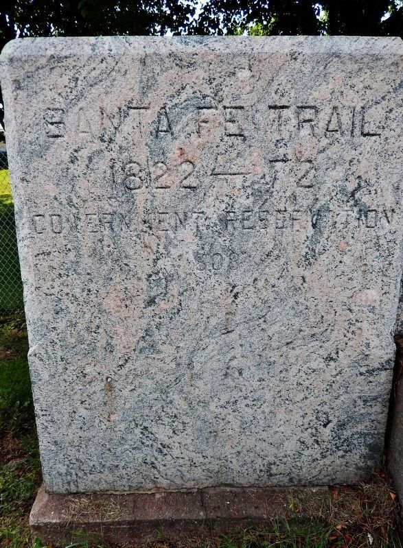
Santa Fe Trail
1822 - 72
Inscription.
1808
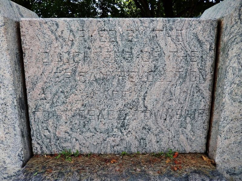
Marked by the
Daughters of the
American Revolution
of
Fort Osage Township
1918
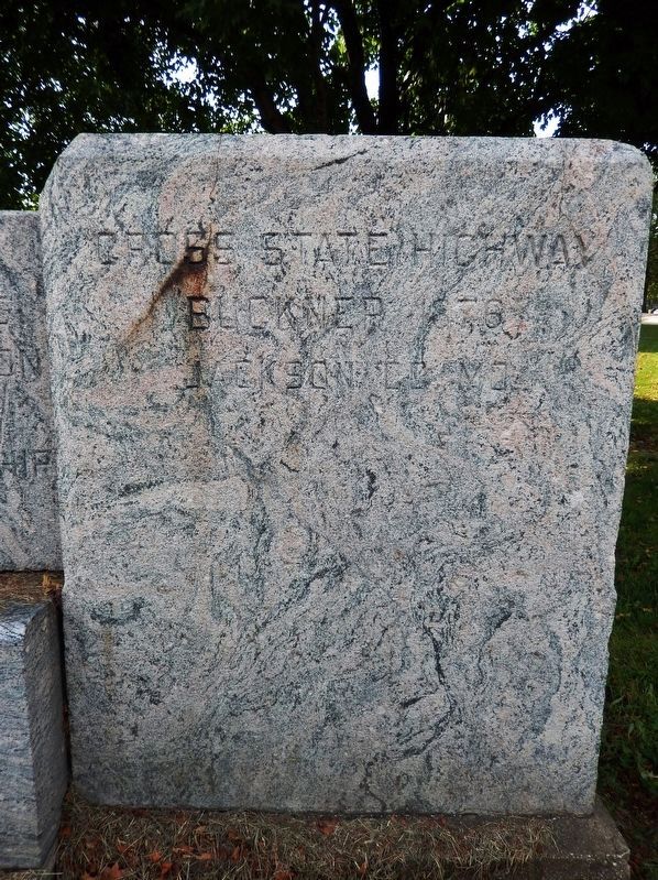
Cross State Highway
Buckner 1876
Jackson Co. Mo.
Erected 1918 by Daughters of the American Revolution of Fort Osage Township.
Topics and series. This historical marker is listed in these topic lists: Roads & Vehicles • Settlements & Settlers. In addition, it is included in the Daughters of the American Revolution, and the Santa Fe Trail series lists.
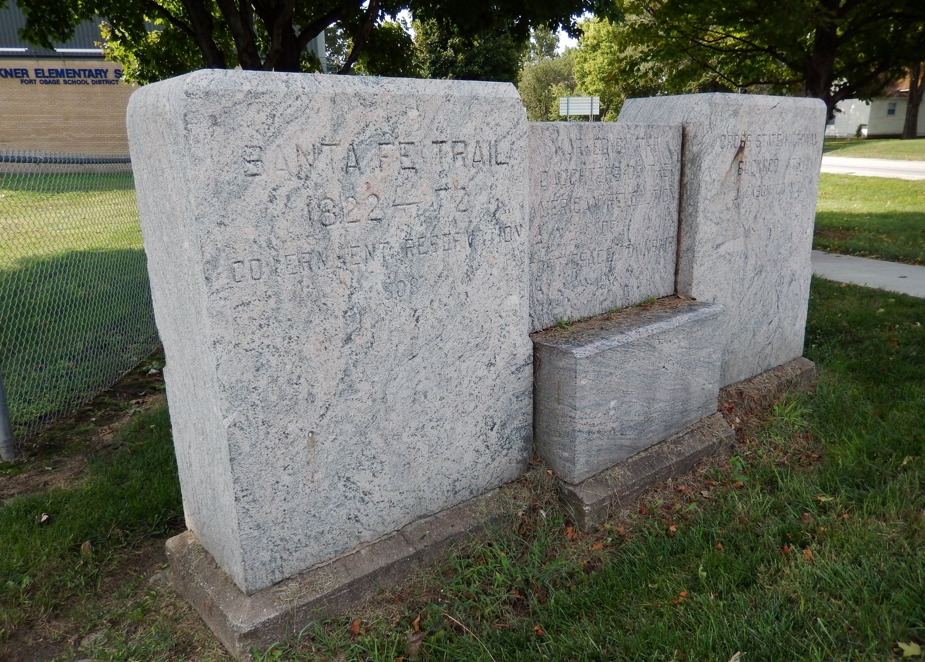
Location. 39° 8.267′ N, 94° 11.812′ W. Marker is in Buckner, Missouri, in Jackson County. Marker is at the intersection of East Monroe Street (U.S. 24) and North Buckner Tarsney Road (South Sibley Street), on the right when traveling east on East Monroe Street. Marker is located beside the sidewalk at the southeast corner of the intersection. Touch for map. Marker is at or near this postal address: 13 South Sibley Street, Buckner MO 64016, United States of America. Touch for directions.
Other nearby markers. At least 8 other markers are within 7 miles of this marker, measured as the crow flies. Fort Osage (approx. 0.4 miles away); a different marker also named Fort Osage (approx. 3.3 miles away); Events at Fort Osage (approx. 3.4 miles away); Restoration of Fort Osage (approx. 3½ miles away); a different marker also named Santa Fe Trail (approx. 5.1 miles away); Trail of Death (approx. 6 miles away); Engagement at the Little Blue (approx. 6.2 miles away); Potawatomi Trail of Death March (approx. 6.7 miles away).
Also see . . .
1. Jackson County Missouri History (Wikipedia). Explorers Merriwether Lewis and William Clark passed through Jackson County on their famous Lewis and Clark expedition in 1804. Among other items, their report indicated a "high, commanding position" along the river within the current boundaries of Jackson County that in 1808 became Fort Osage. (Submitted on April 11, 2019, by Cosmos Mariner of Cape Canaveral, Florida.)
2. The Missouri Cross-State Highway.
from American Monthly, October 1911
The Central or Old Trails Route was adopted as the cross-State highway; it will be the Missouri link in the “ocean to ocean” highway now under consideration by Congress. The work of the Missouri, Kansas, Colorado and New Mexico Chapters in marking the Santa Fé Trail from beginning to end is now about finished; in addition the Missouri Daughters of the American Revolution has been a factor in preserving two historic roads by joining the Good Roads
movement for a cross-State highway. (Submitted on April 11, 2019, by Cosmos Mariner of Cape Canaveral, Florida.)
Credits. This page was last revised on April 14, 2023. It was originally submitted on April 10, 2019, by Cosmos Mariner of Cape Canaveral, Florida. This page has been viewed 342 times since then and 27 times this year. Photos: 1, 2, 3, 4. submitted on April 11, 2019, by Cosmos Mariner of Cape Canaveral, Florida.


