San Luis Potosí, Mexico — The Northeast (and Central Highlands)
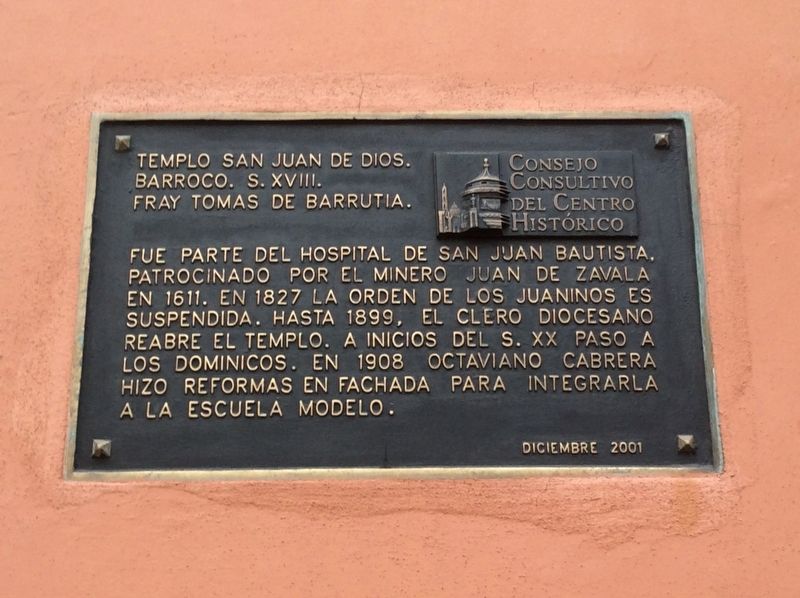
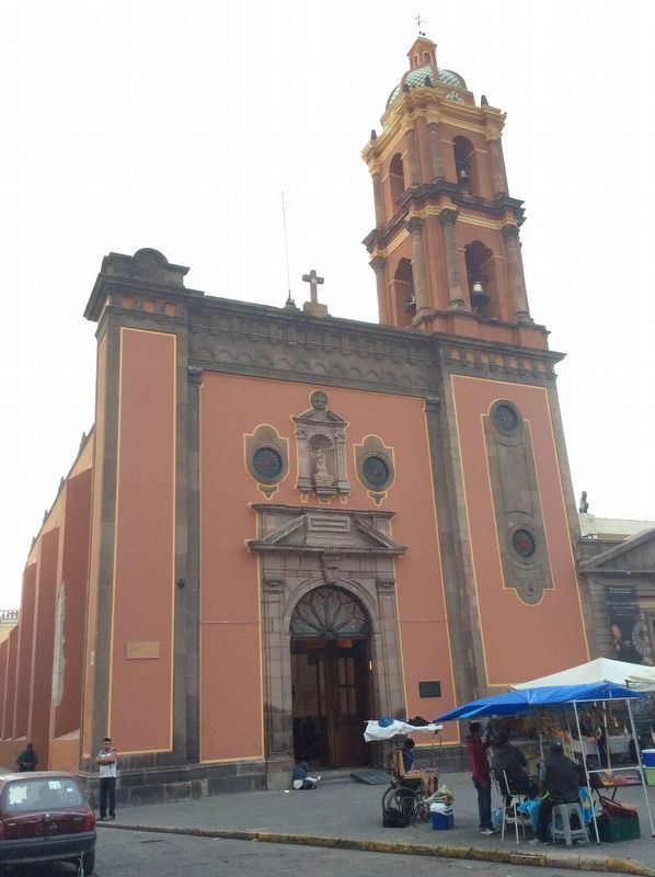
Temple of San Juan de Dios
Barroco. S. XVIII.
Fray Tomas de Barrutia.
Fue parte del Hospital de San Juan Bautista, patrocinado por el minero Juan de Zavala en 1611. En 1827 la Orden de los Juaninos es suspendida. Hasta 1899, el clero diocesano reabre el templo. A inicios del s. XX paso a los dominicos. En 1908 Octaviano Cabrera hizo reformas en fachada para integrarla a la Escuela Modelo.
Diciembre 2001
Temple of San Juan de Dios.
Baroque. 18th century. Friar Tomás de Barrutia.
It was originally part of the Hospital of San Juan Bautista, sponsored by the miner Juan de Zavala in 1611. In 1827 the Order of the Juaninos is suspended. The diocesan clergy reopened the temple in 189. At the beginning of the 20th century the temple was turned over to the Dominicans. In 1908 Octaviano Cabrera made renovations to the façade to integrate it into the Model School style.
December 2001
Erected 2001 by Consejo Consultivo del Centro Histórico.
Topics. This historical marker is listed in these topic lists: Architecture • Churches & Religion • Colonial Era • Man-Made Features. A significant historical month for this entry is December 2001.
Location. 22° 9.177′ N, 100° 58.483′ W. Marker is in San Luis Potosí. Marker is at the intersection of Mariano Escobedo and Álvaro Obregón, on the right when traveling north on Mariano Escobedo. Touch for map. Marker is in this post office area: San Luis Potosí 78000, Mexico. Touch for directions.
Other nearby markers. At least 8 other markers are within walking distance of this marker. Temple of San Juan de Dios / Former Model School (a few steps from this marker); Tribute to the Heroes of Mexican Independence (within shouting distance of this marker); Miguel Hidalgo Street / Crystal Palace (about 150 meters away, measured in a direct line); Municipal Palace (about 180 meters away); The Crystal Palace (about 180 meters away); Española Bookstore (about 180 meters away); Temple of Carmen and Ex-Convent of the Barefoot Carmelite Religious Order (about 180 meters away); Former House of the Vicereine (about 180 meters away). Touch for a list and map of all markers in San Luis Potosí.
Credits. This page was last revised on April 10, 2019. It was originally submitted on April 10, 2019, by J. Makali Bruton of Accra, Ghana. This page has been viewed 119 times since then and 11 times this year. Photos: 1, 2. submitted on April 10, 2019, by J. Makali Bruton of Accra, Ghana.

