Near Gamaliel in Monroe County, Kentucky — The American South (East South Central)
Free-Town Church
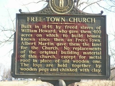
Photographed by Chad Comer, 2010
1. Free-Town Church Marker
Erected 1970 by Kentucky Historical Society - Kentucky Department of Highways. (Marker Number 1347.)
Topics and series. This historical marker is listed in these topic lists: African Americans • Cemeteries & Burial Sites • Religion & Religious Structures. In addition, it is included in the African Methodist Episcopal (AME) Church, and the Kentucky Historical Society series lists. A significant historical year for this entry is 1846.
Location. 36° 40.488′ N, 85° 47.946′ W. Marker is near Gamaliel, Kentucky, in Monroe County. It is on Fountain Run Road (State Highway 100), on the left when traveling north. Touch for map. Marker is in this post office area: Gamaliel KY 42140, United States of America. Touch for directions.

Regionally, this marker is in Kentucky’s
this page online
Other nearby markers. At least 8 other markers are within 5 miles of this marker, measured as the crow flies: Gamaliel Cemetery (approx. 2.3 miles away); Gamaliel (approx. 2.3 miles away); Camp Anderson (approx. 3.9 miles away); James Chism (approx. 4 miles away); Back in the Woods (approx. 5.1 miles away); Truth Will Prevail (approx. 5.1 miles away); African Americans and Mill Creek, Baptist (approx. 5.1 miles away); The Meetinghouse (approx. 5.1 miles away). Touch for a list and map of all markers in Gamaliel.
Regarding Free-Town Church. The Free-Town Church, also known as Mt. Vernon Church, was an African Methodist Episcopal church. Located on the church grounds is the Free-Town Church Cemetery, or Mount Vernon Cemetery, containing many of its congregation.
Also see . . . Freetown Church Cemetery (Find-a-Grave).
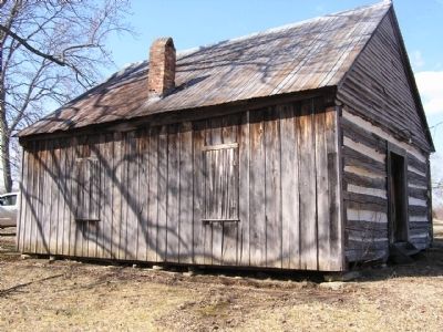
Photographed by Chad Comer, 2010
2. Free-Town Church
Additional keywords. Mt. Vernon Cemetery, African Methodist Emancipated, African Methodist Episcopal
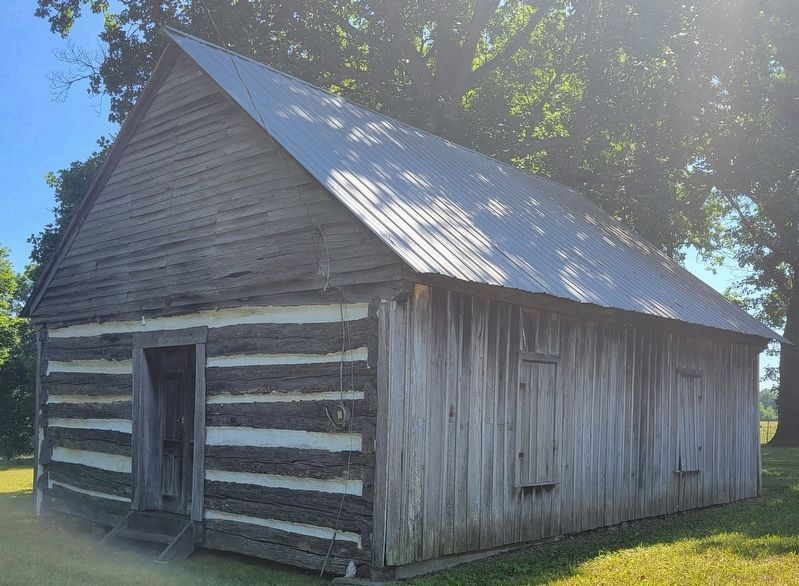
Photographed by Jan Lindall, June 11, 2024
3. Free-Town Church Marker
Credits. This page was last revised on June 15, 2024. It was originally submitted on January 1, 2011, by Chad Comer of Gamaliel, Kentucky. This page has been viewed 1,200 times since then and 37 times this year. Last updated on April 16, 2019, by C. R. Arterburn of Lexington, Kentucky. Photos: 1, 2. submitted on January 1, 2011, by Chad Comer of Gamaliel, Kentucky. 3. submitted on June 14, 2024, by Jan Lindall of Douglasville, Georgia. • Andrew Ruppenstein was the editor who published this page.
