San Luis Potosí, Mexico — The Northeast (and Central Highlands)
Capitán Miguel Caldera
Photographed by J. Makali Bruton, March 17, 2019
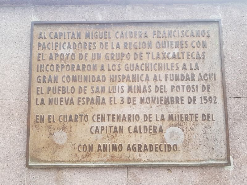
1. Capitán Miguel Caldera Marker

En el cuarto centenario de la muerte del Capitan Caldera.
Con animo agradecido.
To Captain Miguel Caldera and the Franciscan peacemakers of the region who, with the support of a group of Tlaxcalans, incorporated the Guachichiles into the great Hispanic community by founding here the town of San Luis Minas del Potosí of New Spain on November 3, 1592.
On the 400th anniversary of the death of Captain Caldera.
With grateful encouragement.
Erected 1997.
Topics. This historical marker is listed in these topic lists: Indigenous Peoples and Communities • Settlements & Settlers. A significant historical date for this entry is November 3, 1592.
Location. 22° 9.132′ N, 100° 58.67′ W. Marker is in San Luis Potosí. It is on Álvaro Obregón just west of Ignacio Allende, on the left when traveling west. Touch for map. Marker is in this post
this page online

Regionally, this marker is in Northern Mexico, in the Bajío, and in the Sierra Madre. Globally, it is in North America and the Western Hemisphere. Historically, it finds itself in what was once New Spain and also a Spanish colony.
Other nearby markers. At least 8 other markers are within walking distance of this marker: Founders Square (a few steps from this marker); Loreto Chapel / Jesuit Temple / Former Jesuit Convent and School (within shouting distance of this marker); Former Othón Theater (within shouting distance of this marker); Nineteenth Century Building (about 120 meters away, measured in a direct line); Royal Treasury (about 120 meters away); Government Palace (about 120 meters away); Government Palace / Vicereine’s House (about 120 meters away); The Plan of San Luis (about 120 meters away). Touch for a list and map of all markers in San Luis Potosí.
More about this marker. Miguel Caldera was an important figure in the pacification and colonization of Mexico's northern frontier immediately following the Spanish conquest of the Aztec Empire. He
Photographed by J. Makali Bruton, March 17, 2019
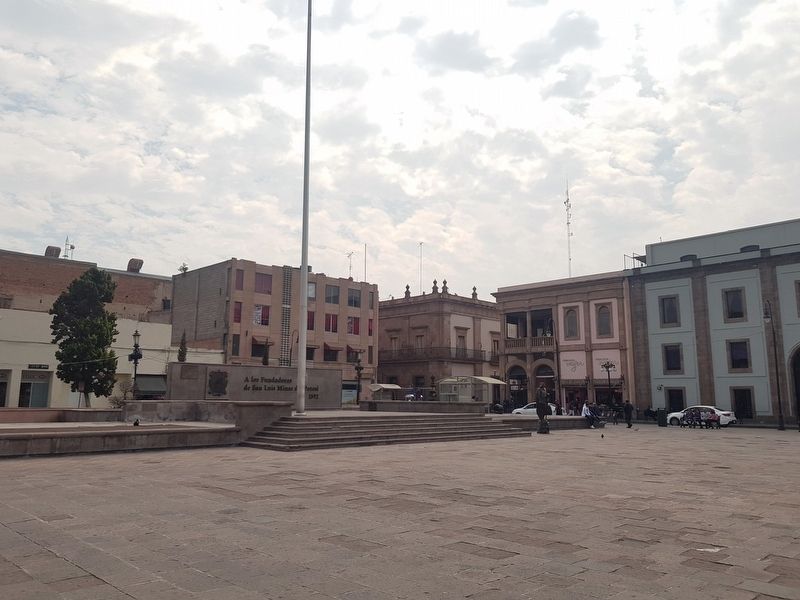
2. Capitán Miguel Caldera Marker
The marker can be seen on the leftmost side of this stage and flagpole on the eastern side of the plaza. To the right of the marker is written "A los Fundadores de San Luis Minas de Potosí 1592" (To the Founders of San Luis Minas de Potosí 1592).
Photographed by J. Makali Bruton, March 17, 2019
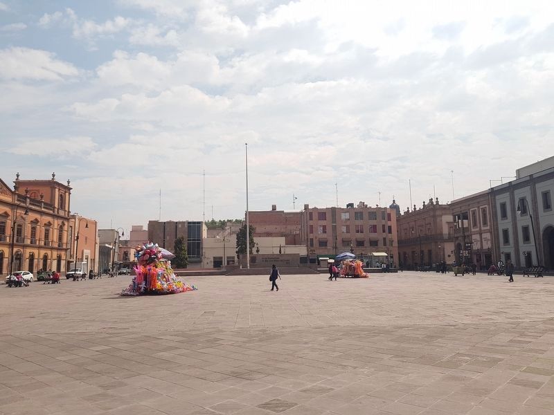
3. An additional view of the Capitán Miguel Caldera Marker and Founders Square
Photographed by J. Makali Bruton, March 17, 2019
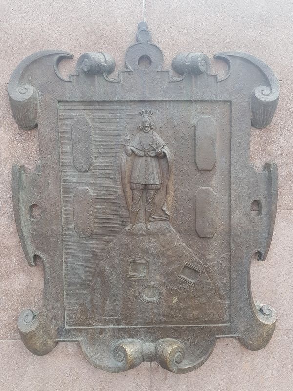
4. A nearby bronze seal of the City of San Luis Potosí
Photographed by J. Makali Bruton, March 17, 2019
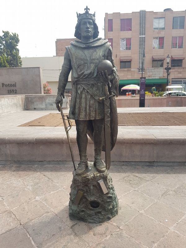
5. A nearby statue of San Luis (Saint Louis IX of France), namesake of the city
The statue is shown replicating the seal of the city of San Luis Potosí, where Saint Louis is shown standing on a mound, representing a mine. A gold and a silver bar are also included in the imagery, near the entrance to the mine.
Credits. This page was last revised on April 16, 2019. It was originally submitted on April 16, 2019, by J. Makali Bruton of Washington, District of Columbia. This page has been viewed 1,003 times since then and 65 times this year. Photos: 1, 2, 3, 4, 5. submitted on April 16, 2019, by J. Makali Bruton of Washington, District of Columbia.
