Hagerstown in Washington County, Maryland — The American Northeast (Mid-Atlantic)
Band Shell
Photographed by Allen C. Browne, April 7, 2019
1. Band Shell Marker
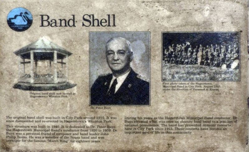
The original band shell was built in City Park around 1915. It was since dismantled and re-erected in Hagerstown’s Wheaton Park.
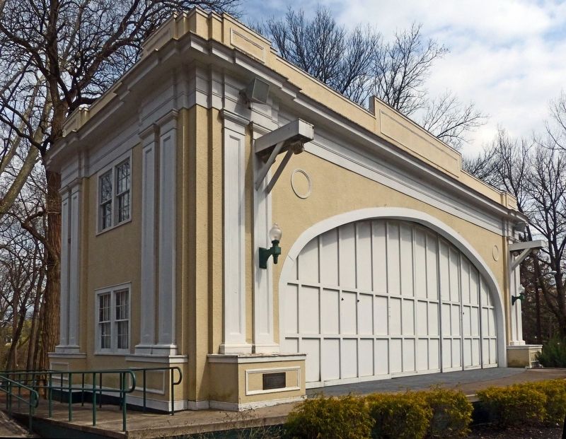
This structure was built in 1940. It is dedicated to Dr. Peter Buys, the Hagerstown Municipal Band’s conductor from 1920 to 1959. Dr. Buys was a personal friend of composer and band leader John Philip Sousa. He was a member of the Sousa band and arranger for the famous “March King” for eighteen years.
During his years as the Hagerstown Municipal Band conductor, Dr. Buys elevated what was once an obscure band to a position of national prominence. The band has presented summer concerts here in City Park since 1915. These concerts have become an important part of life in this community.
Topics. This historical marker is listed in these topic lists: Arts, Letters, Music • Entertainment • Parks & Recreational Areas.
Location. 39° 38.138′ N, 77° 43.934′ W. Marker is in Hagerstown, Maryland, in Washington County. It can be reached from Virginia Avenue. This marker is in Hagerstown's City Park. Touch for map. Marker is at
this page online

Regionally, this marker is in Western Maryland. It is also in the American Mid-Atlantic, in Appalachia, and specifically in Northern Appalachia. Globally, it is in North America, the Western Hemisphere, the Western World, and the Anglosphere. Historically, it finds itself in what was once one of the original Thirteen Colonies.
Other nearby markers. At least 8 other markers are within walking distance of this marker: City Park (about 300 feet away, measured in a direct line); Steam Engine 202 (about 700 feet away); Great Indian Warrior/Trading Path (about 800 feet away); The Clara Barton Memorial (approx. ¼ mile away); Trial and Error at Mount Aetna Furnace (approx. 0.3 miles away); Mary Titcomb (approx. 0.3 miles away); The Springs at Hager's Fancy (approx. 0.3 miles away); Jonathan Hager House Museum (approx. 0.3 miles away). Touch for a list and map of all markers in Hagerstown.
Another marker is no longer nearby. Hager House and Museum (was approx. 0.3 miles away but has been replaced with another

Photographed by Allen C. Browne, April 7, 2019
2. Band Shell Marker

Photographed by Allen C. Browne, August 22, 2017
3. Old Band Shell in Wheaton Park
Photographed by Allen C. Browne, April 7, 2019
4. 1965
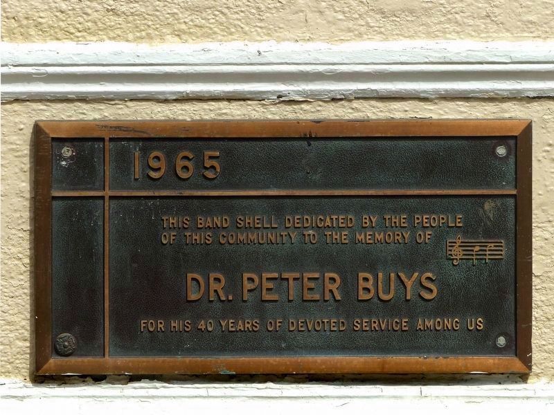
This Band Shell dedicated by the people of this community to the memory of
Dr. Peter Buys
for his 40 years of devoted service among us.
Dr. Peter Buys
for his 40 years of devoted service among us.
1915
5. Hagerstown Municipal Band
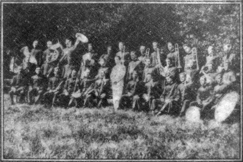
First photo taken of the Hagerstown Municipal Band in City Park, August 1915, under the direction of Vermond A. Knaus.
Photographed by Allen C. Browne, April 7, 2019
6. Modern Bandshell

Photographed by Allen C. Browne, April 7, 2019
7. Band Shell
City Park
City Park
A central feature of City Park, the Peter Buys Band Shell hosts summer concerts by the Hagerstown Municipal Band and other entertainment. Scan this QR code with your smart phone for a short video about events and the history of this jewel of our community.
Vimeo video (1m 23s)
Click for more information.
Click for more information.

April 7, 2019
8. Band Shell
Original band shell now located in Hagerstown’s Wheaton Park. Close-up of photo on marker

9. Dr. Peter Buys
Credits. This page was last revised on January 11, 2026. It was originally submitted on April 17, 2019, by Allen C. Browne of Silver Spring, Maryland. This page has been viewed 605 times since then and 62 times this year. Photos: 1, 2. submitted on April 17, 2019, by Allen C. Browne of Silver Spring, Maryland. 3, 4. submitted on April 19, 2019, by Allen C. Browne of Silver Spring, Maryland. 5, 6. submitted on April 17, 2019, by Allen C. Browne of Silver Spring, Maryland. 7. submitted on April 19, 2019, by Allen C. Browne of Silver Spring, Maryland. 8, 9. submitted on April 17, 2019, by Allen C. Browne of Silver Spring, Maryland. • Andrew Ruppenstein was the editor who published this page.
