Hodgenville in Larue County, Kentucky — The American South (East South Central)
The Memorial Building
Photographed by Beverly Pfingsten, June 11, 2005
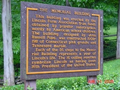
1. The Memorial Building Marker
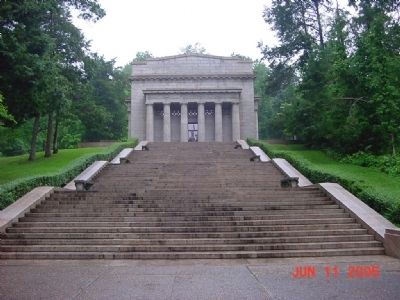
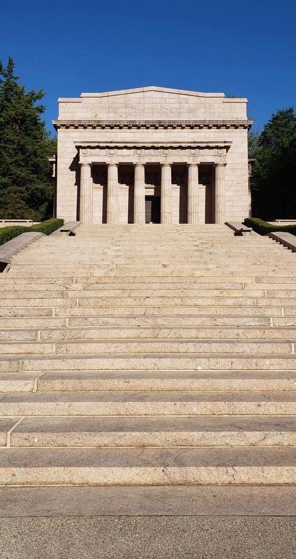
This building was erected by the Lincoln Farm Association from funds obtained by popular subscription, mostly by American school children. The building, designed by John Russell Pope, was constructed 1909-1911 of Connecticut pink granite and Tennessee marble.
Each of the 56 steps to the Memorial Building represents a year of Lincoln's life. The 16 ceiling rosettes symbolize Lincoln as having been 16th President of the United States.
Topics. This historical marker is listed in these topic lists: Agriculture • Education.
Location. 37° 31.847′ N, 85° 44.234′ W. Marker is in Hodgenville, Kentucky, in Larue County. It can be reached from Lincoln Farm Road (Kentucky Route 31E). Marker is on the grounds of The Lincoln Birthplace National Park. Touch for map. Marker is in this post office area: Hodgenville KY 42748, United States of America. Touch for directions.

Regionally, this marker is in the American South and specifically in the Upper South. Globally, it is in North America, the Western Hemisphere, the Western World, and the Anglosphere. Historically, it finds
this page online
Other nearby markers. At least 8 other markers are within 2 miles of this marker, measured as the crow flies: The Sinking Spring (a few steps from this marker); a different marker also named Sinking Spring (a few steps from this marker); An Enduring Symbol (within shouting distance of this marker); An Idyllic Frontier Scene (within shouting distance of this marker); Nancy Lincoln Inn (within shouting distance of this marker); a different marker also named Boundary Oak (about 300 feet away, measured in a direct line); Abraham Lincoln Birthplace (about 400 feet away); Grave of Frontiersman / South Fork Baptist Church (approx. 1.9 miles away). Touch for a list and map of all markers in Hodgenville.
Another marker is no longer nearby. The Boundary Oak (was within shouting distance of this marker but has been permanently removed).
Also see . . .
1. Abraham Lincoln Birthplace National Historic Park. National Park Service website entry (Submitted on November 2, 2008, by Bill Pfingsten of Bel Air, Maryland.)
2. Abraham Lincoln Birthplace National Historic Site - Sinking Spring Farm.
Photographed by Beverly Pfingsten, June 11, 2005
2. The Memorial Building
Photographed by Beverly Pfingsten, June 11, 2005
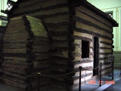
3. Model of Lincoln's Birthplace
Log cabin is located in the Memorial Building.
Photographed by Bradley Owen, October 13, 2019
4. The Memorial Building
Credits. This page was last revised on January 2, 2022. It was originally submitted on November 2, 2008, by Bill Pfingsten of Bel Air, Maryland. This page has been viewed 1,378 times since then and 17 times this year. Photos: 1, 2, 3. submitted on November 2, 2008, by Bill Pfingsten of Bel Air, Maryland. 4. submitted on January 19, 2021, by Bradley Owen of Morgantown, West Virginia.
