Near Belmont in Belmont County, Ohio — The American Midwest (Great Lakes)
Welcome to the National Road
The Historic National Road in Ohio
Photographed by Craig Doda, April 26, 2025
1. Welcome to the National Road Marker
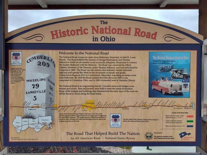
The National Road crosses six states from Baltimore, Maryland, to East St. Louis, Illinois. The road fulfilled the dreams of George Washington and Thomas Jefferson to build an all-weather route across the Allegheny Mountains to connect the Eastern Seaboard with the Midwest. The Road was conceived by Albert Gallatin, Secretary of the Treasury under Thomas Jefferson, and was authorized by Congress in 1806. The Road was the nation's first federally funded interstate highway and opened the West for movement of people and goods. Construction began in 1811 in Cumberland, Maryland, extending an earlier route from Baltimore. By 1818 the Road reached the Ohio River, by 1833 it was completed to Columbus, Ohio, and in 1850 it extended west to Vandalia, Illinois.
The National Road is an engineering marvel. Graceful stone arch bridges cross streams and rivers. Inns and taverns were built to meet the needs of travelers. Many of the bridges and buildings that characterized the early days of the road can still be found in towns along the Road today.
Much of the historic National Road is still part of U.S. Route 40. Several segments of the original Road are no longer used as highways but can still be explored. The longest section of the National Road is still found in Ohio, covering 237 miles from Bridgeport on the east to the Indiana state line on the west.
Topics and series.
this page online
Location. 40° 3.883′ N, 81° 0.699′ W. Marker is near Belmont, Ohio, in Belmont County. It can be reached from Interstate 70 west of Plainfield Road (Ohio Route 78), on the right when traveling west. Touch for map. Marker is in this post office area: Belmont OH 43718, United States of America. Touch for directions.

Regionally, this marker is in Ohio’s High Valley. It is also in the American Midwest, in Appalachia, and specifically in Northern Appalachia. Globally, it is in North America, the Western Hemisphere, the Western World, and the Anglosphere. Historically, it finds itself in what was once the Haudenosaunee (Iroquois) Confederacy, the territory of the Mississippian Culture, and the Northwest Territory.
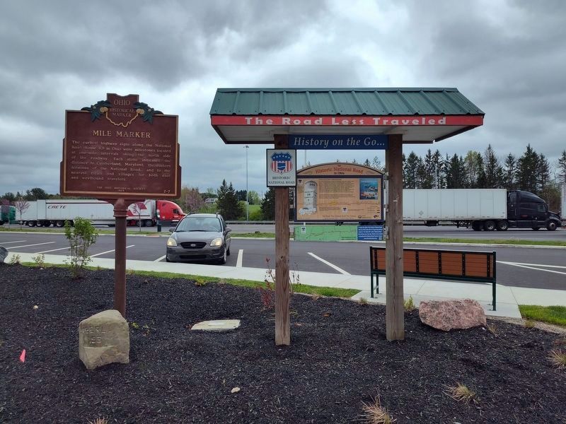
Other nearby markers. At least 8 other markers are within walking distance of this marker: Mile Marker (here, next to this marker); Ohio Native Plants (here, next to
Photographed by Craig Doda, April 26, 2025
2. Welcome to the National Road Marker
Another marker is no longer nearby. The Dwight D. Eisenhower Highway (was here, next to this marker but has been permanently removed).
Also see . . .
1. National Road. Ohio History Central website entry (Submitted on August 30, 2021, by William Fischer, Jr. of Reynoldsburg, Ohio.)
2. National Road & Zane Grey Museum. Ohio History Connection website entry (Submitted on August 30, 2021, by William Fischer, Jr. of Reynoldsburg, Ohio.)
Credits. This page was last revised on March 27, 2026. It was originally submitted on April 25, 2019, by Devry Becker Jones of Washington, District of Columbia. This page has been viewed 697 times since then and 42 times this year. Photos: 1, 2. submitted on April 29, 2025, by Craig Doda of Napoleon, Ohio. 3. submitted on April 25, 2019, by Devry Becker Jones of Washington, District of Columbia.
