Cumberland Township near Gettysburg in Adams County, Pennsylvania — The American Northeast (Mid-Atlantic)
Smith's New York Battery
— July 2 1863 - Second Day —
Capt. James E. Smith, U.S.A.
Commander, 4th New York Battery
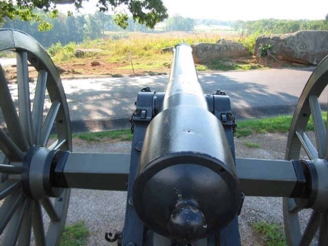
On July 2, Capt. James E. Smith hauled four of the six cannon of his 4th New York Battery onto this craggy ridge, positioning them along the crest behind you. The cannon were 10-pounder Parrotts - rifled guns with a three-inch bore and a range of up to 2 miles.
At about 3:30 p.m., Confederate cannon about a mile in front of you began pounding this position, and Smith's guns thundered in reply. Within an hour, long lines of Confederate infantry began advancing in this direction, and Smith tried to cripple them with rounds of case shot and shell. So destructive was the fire that advancing Confederates believed they were facing twice the number of cannon. But the men in gray could not be stopped.
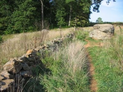
When the Confederates came within 300 yards, Smith ordered the ammunition changed to canister. However, the Confederates found cover behind a stone wall at the base of the field below you where their deadly rifle fire threatened the gun crews. Smith pleaded with the supporting infantry to save his guns, but after a long struggle the Confederates captured three of them when they seized the ridge.
Artillery Projectiles
Solid Shot
Solid iron. Used at longer ranges against massed troops, fortifications, and other batteries. Also to fell timber on enemy soldiers in the woods.
Case Shot
Iron shell filled with musket balls sealed in rosin or molten sulphur. Powder charge in core ignited by fuse. Designed to explode before impact. Also called "shrapnel."
Shell
Cast-iron shell filled with black powder. Time fuse ignited by cannon's discharge. Shell exploded into fragments that could kill or maim.
Canister
Tin can filled with iron balls packed in sawdust. Used at close range - 400 yards or less - against infantry. Double or triple canister could be used in a crisis.
Erected by Gettysburg National Military Park.
Topics. This historical marker is listed in this topic list: War, US Civil. A significant historical month for this entry is July 1851.
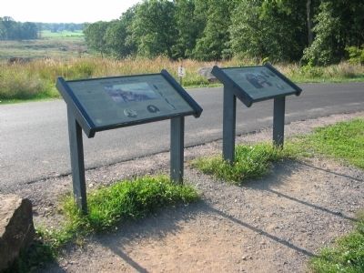
Location. This marker has been replaced by another marker nearby. It was located near 39° 47.535′ N, 77° 14.556′ W. Marker was near Gettysburg, Pennsylvania, in Adams County. It was in Cumberland Township. Marker was on Sickles Avenue, on the right when traveling north. Located in the Devils Den section of Gettysburg National Military Park. Touch for map. Marker was in this post office area: Gettysburg PA 17325, United States of America. Touch for directions.
Other nearby markers. At least 8 other markers are within walking distance of this location. Holding Houck's Ridge (a few steps from this marker); Robertson's Brigade (a few steps from this marker); 4th New York Independent Battery (a few steps from this marker); Buying Time (within shouting distance of this marker); 99th Pennsylvania Infantry (within shouting distance of this marker); The Attack on Devil's Den (within shouting distance of this marker); 124th New York Infantry (within shouting distance of this marker); Civil War Photography (within shouting distance of this marker). Touch for a list and map of all markers in Gettysburg.
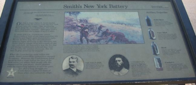
More about this marker. In the upper center is a painting of the battery in action. Cannoneers of the 4th New York Independent Battery desperately fire rounds of canister, "without sponging" between shots, to slow the approaching Texas battle line. Eventually the gunners could not aim their cannon low enough to hit the surging lines of Southern troops on the slopes just below here.
A portrait of Capt. James E. Smith, who commanded the 4th New York Battery. In the action here Smith lost 12 men, 11 horses, and 3 cannon.
A portrait of General Hood is captioned, A shell fragment that ripped
into the arm of Confederate Maj. Gen. John B. Hood may have come from Smith's guns. Hood was forced to give up command, but his regiments drove forward to this ridge where they captured Devil's Den along with three of Smith's guns.
Drawings of the projectiles illustrate the sidebar.
Related markers. Click here for a list of markers that are related to this marker. Smith's Battery Markers and Monuments

Photographed By Craig Swain, September 17, 2008
4. Gunner's View
Looking down the barrel of a Parrott Rifle toward Triangle Field. The guns' location is not accurate, as Smith's Battery was placed several dozen yards further up the crest of the ridge (to the north). However, the current location does give some appreciation for the gunner's view. The ground just past the road begins to drop off. At the stone wall, that slope is more pronounced. As seen from this view, while the position offered a great line of site to Warfield Ridge where the Confederates started their attack, the guns could not fire at the enemy in the foreground due to the slope.
Credits. This page was last revised on February 7, 2023. It was originally submitted on November 4, 2008, by Craig Swain of Leesburg, Virginia. This page has been viewed 1,384 times since then and 28 times this year. Photos: 1, 2, 3. submitted on November 4, 2008, by Craig Swain of Leesburg, Virginia. 4. submitted on November 5, 2008, by Craig Swain of Leesburg, Virginia.


