Near Longwood in Clarke County, Virginia — The American South (Mid-Atlantic)
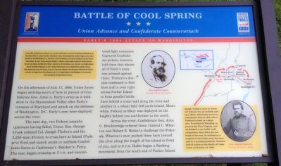
Battle of Cool Spring
Union Advance and Confederate Counterattack
— Early's 1864 Attack on Washington —
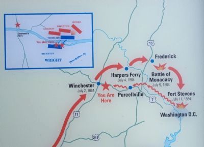
(Preface): In June 1864, Confederate Gen. Robert E. Lee sent Gen. Jubal A. Early's corps from the Richmond battlefields to the Shenandoah Valley to counter Union Gen. David Hunter's army. After driving Hunter into West Virginia, Early invaded Maryland to attack Washington, D.C., draw Union troops from Richmond, and release Confederate prisoners held at Point Lookout. On July 9, Early ordered Gen. Bradley T. Johnson's cavalry brigade eastward to free the prisoners. The next day, Johnson sent Maj. Harry Gilmer's regiment to raid the Baltimore area. Union Gen. Lew Wallace delayed Early at the Battle of Monocacy on July 9. Federal reinforcements soon strengthened the capital's defenses. Early attacked there near Fort Stevens on July 11-12 and then withdrew to the Shenandoah Valley with the Federals in pursuit. He stopped them at Cool Springs on July 17-18. Despite failing to take Washington or free prisoners, Early succeeded in diverting Federal resources.
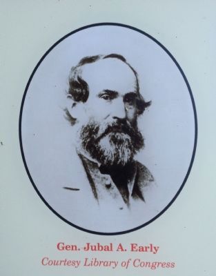
On the afternoon of July 17, 1864, Union forces began arriving south of here in pursuit of Confederate Gen. Jubal A. Early's army as it withdrew to the Shenandoah Valley after Early's invasion of Maryland and attack on the defenses of Washington, D.C. Early's men were deployed across the river.
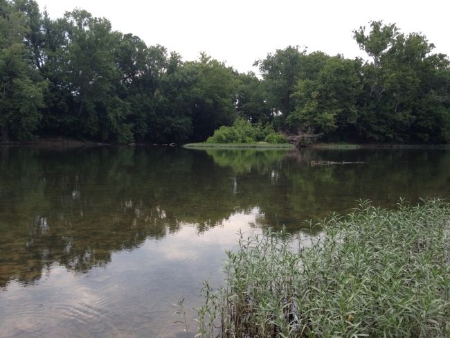
The next day, two Federal assaults upstream having failed, Union Gen. George Crook ordered Col. Joseph Thoburn and his 3,250-man division to cross here at Island (Parker's) Ford and march south to outflank Confederate forces at Castleman's (Snicker's) Ferry. The men began crossing at 3 p.m. and encountered light resistance. Captured Confederate pickets, however, told them that almost all of Early's army was arrayed against them. Thoburn's division continued to ford here and to your right across Parker Island to form parallel battle lines behind a stone wall along the river and another in a wheat field 100 yards inland. Meanwhile, Federal artillery was deployed on the heights behind you and farther to the north.
Across the river, Confederate Gen. John C. Breckinridge ordered Gens. Gabriel C. Wharton and Robert E. Rodes to challenge the Federals. Wharton's men pushed them back toward the river along the length of the island in front of you, and at 6 p.m. Rodes began a flanking movement from the south end of Parker Island.
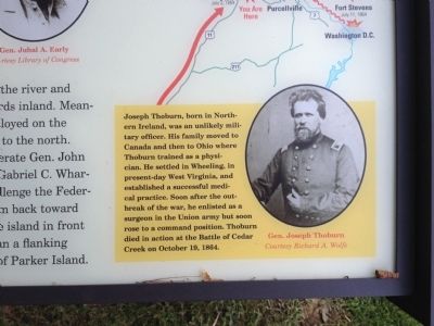
(Sidebar): Joseph Thoburn, born in Northern Ireland, was an unlikely military officer. His family moved to Canada and then to Ohio where Thoburn trained as a physician. He settled in Wheeling, in present-day West Virginia, and established a successful medical practice. Soon after the outbreak of the war, he enlisted as a surgeon in the Union army but soon rose to a command position. Thoburn died in action at the Battle of Cedar Creek on October 19, 1864.
Erected 2013 by Virginia Civil War Trails.
Topics and series. This historical marker is listed in this topic list: War, US Civil. In addition, it is included in the Virginia Civil War Trails series list. A significant historical month for this entry is June 1864.
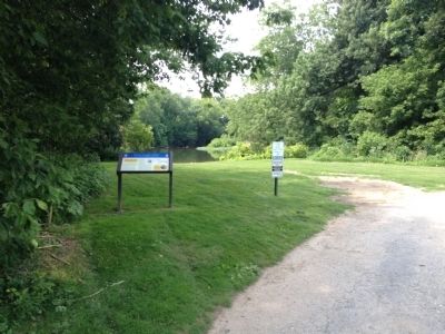
Location. Marker has been reported missing. It was located near 39° 8.251′ N, 77° 52.241′ W. Marker was near Longwood, Virginia, in Clarke County. Marker could be reached from Parker Lane, on the left when traveling north. Located on the Shenandoah University, Shenandoah River Campus at Cool Spring Battlefield. The marker along the walking trail of the battlefield. Touch for map. Marker was at or near this postal address: 1400 Parker Lane, Bluemont VA 20135, United States of America. Touch for directions.
Other nearby markers. At least 8 other markers are within 2 miles of this location, measured as the crow flies. Col. George D. Wells Leads the Way (a few steps from this marker); Confederate Counterattack and Union Retreat (about 400 feet away, measured in a direct line); a different marker also named Battle of Cool Spring (about 500 feet away); Judge Parker's “Retreat” & the Battle of Cool Spring (about 600 feet away); Thoburn’s Rescue (approx. one mile away); The Retreat (approx. 1.4 miles away); a different marker also named Battle of Cool Spring (approx. 1.4 miles away); a different marker also named Battle of Cool Spring (approx. 1˝ miles away). Touch for a list and map of all markers in Longwood.
Related marker. Click here for another marker that is related to this marker. A Virtual Tour by HMDb markers
Also see . . .
1. The Battle of Cool Spring. American Battlefield Trust website entry (Submitted on August 30, 2014, by Craig Swain of Leesburg, Virginia.)
2. The Battle of Cool Spring. Shenandoah at War website entry (Submitted on August 30, 2014, by Craig Swain of Leesburg, Virginia.)
Credits. This page was last revised on August 3, 2022. It was originally submitted on August 28, 2014, by Craig Swain of Leesburg, Virginia. This page has been viewed 975 times since then and 33 times this year. Last updated on May 1, 2019, by Allen C. Browne of Silver Spring, Maryland. Photos: 1. submitted on August 28, 2014, by Craig Swain of Leesburg, Virginia. 2, 3, 4. submitted on August 30, 2014, by Craig Swain of Leesburg, Virginia. 5. submitted on August 28, 2014, by Craig Swain of Leesburg, Virginia. 6. submitted on August 30, 2014, by Craig Swain of Leesburg, Virginia. • Bernard Fisher was the editor who published this page.
