St. Charles in St. Charles County, Missouri — The American Midwest (Upper Plains)
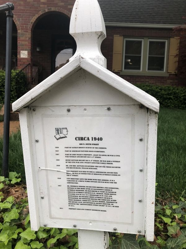
Circa 1940
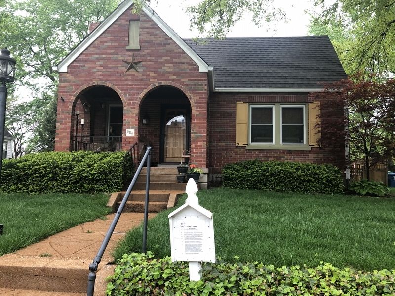
609 N. Sixth Street
1830: Part of Nathan Boone's survey of the Commons.
1857: Part of Jeremiah Fletcher Riggs Subdivision.
1867: Part of John Wilke's property. (Alley to Lewis) He was a Civil War veteran and bought 603 N. 6th Street.
1902: Henry Kettler bought 603 N. 6th Street. He was also a veteran of the Civil War and a Wilke's longtime family friend.
1930: Mr. and Mrs. Kettler sub-divided this lot for their daughter and her husband, William Schnarre.
1932: This property was sold to Emil H. Lehenbauer and his wife Helen. He was an instructor at Immanuel Lutheran School on the 6th Street.
1940: City directory lists the home with this address. It is a variation of a brick Tudor cottage and was built for the Lehenbauers.
1957: Dr. Frederick Neidner and his wife Dorthea (nee Schroeter), retired to this home after an illustrious career in Lutheran ministries. He had served 32 years as pastor of Immanuel Lutheran Church in St. Charles. Prior services included 1910 to 1912 as a missionary in St. Paul and Minneapolis. He founded Christ Lutheran Church in Minneapolis. He continued serving the community as Red Cross chairman, community council member, president of the Rotary Club, and historical society director. He received the "Distinguished Citizen Award" in 1971. He died in 1974.
2011: Property sold and current residents reside.
Erected by Saint Charles Commons Neighborhood Association.
Topics. This historical marker is listed in these topic lists: Architecture • Charity & Public Work • Churches & Religion • War, US Civil. A significant historical year for this entry is 1830.
Location. 38° 47.306′ N, 90° 29.152′ W. Marker is in St. Charles, Missouri, in St. Charles County. Marker is on North 6th Street north of Lewis Street, on the right when traveling north. Touch for map. Marker is at or near this postal address: 609 North 6th Street, Saint Charles MO 63301, United States of America. Touch for directions.
Other nearby markers. At least 8 other markers are within walking distance of this marker. 1889 (a few steps from this marker); 612 North Sixth Street (a few steps from this marker); Circa 1899 (within shouting distance of this marker); Circa 1894 (about 400 feet away, measured in a direct line); Circa 1904 (about 400 feet away); 1900 (about 600 feet away); Circa 1939 (about 600 feet away); 1902 (about 600 feet away). Touch for a list and map of all markers in St. Charles.
Credits. This page was last revised on September 1, 2021. It was originally submitted on May 1, 2019, by Devry Becker Jones of Washington, District of Columbia. This page has been viewed 187 times since then and 8 times this year. Photos: 1, 2. submitted on May 1, 2019, by Devry Becker Jones of Washington, District of Columbia.

