Chetumal in Othón P. Blanco, Quintana Roo, Mexico — The Yucatan Peninsula (The Southeast)
The Emblematic Pier of Chetumal
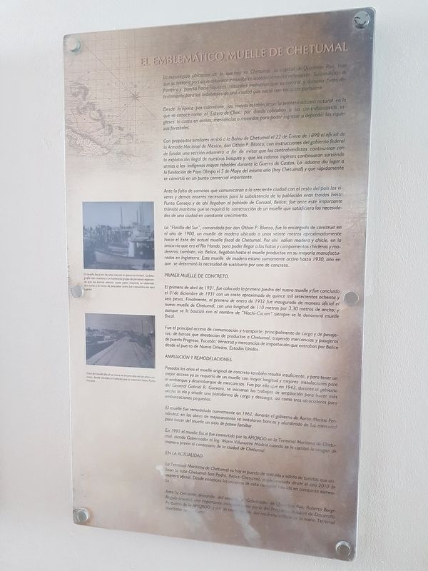
La estratégica ubicación de lo que hoy es Chetumal, la capital de Quintana Roo, hizo que su que su historia portuaria estuviera ernvuelta en acontecimientos relevantes. Su condición de frontera y puerta hacia riquezas naturales motivaron que su control y dominio fuera detreminante para los habitants de una ciudad que nació con vocación portuaria.
Desde la época pos colombina, los mayas establecieron la primera aduana natural en lo que se conoce como el Estero de Chac, por donde cobraban a los contrabandistas ingleses la cuota en armas, mercancias o monedas para poder ingresar a depredar las riquezas forestales.
Con propósitos similares arribó a la Bahía de Chetumal el 22 de Enero de 1898 el official de la Armada Nacional de México, don Othón P. Blanco, con instrucciones del gobierno federal de fundar una sección aduanera a fin de evitar que los contrabandistas continuaran con la explotación ilegal de nuestros bosques y que los colonos ingleses continuaran surtiendo armas a los indigenas mayas rebeldes durante la Guerra de Castas. La aduana dio lugar a la fundación de Payo Obispo el 5 de Mayo del mismo año (hoy Chetumal) y que rápidamente se convirtió en un punto comercial importante.
Ante la falta de caminos que comunicaron con la creciente ciudad con el resto del país los víveres y demás ensures necesarios para la subsistencia de la población eran traídos hasta Punta Consejo y de ahí llegaban al poblado de Corozal, Belice; fue ante este importante tránsito marítimo que se requirió la construcción de un muelle que satisficiera las necesidades de una ciudad en constante crecimiento.
La "Flotilla del Sur", comandada por don Othón P. Blanco, fue la encargada de construir en el año de 1900, un muelle de madera ubicado a unos veinte metros aproximadamente hacia el Este del actual muelle fiscal de Chetumal. Por ahí salían madera y chicle, en la única vía que era el Río Hondo, para poder llegar a los hatos y campamentos chicleros y madereros, también, via Belice, llegaban hasta el muelle productos en su mayoría manufacturados en Inglaterra. Este muelle de madera estuvo sumamente activo hasta 1930, año en que se determinó la necesidad de sustituirlo por uno de concreto.
Primer Muelle de Concreto.
El primero de abril de 1931, fue colocada la primera piedra del nuevo muelle y fue concluido el 31 de diceimbre de 1931 con un costo aproximado de quince mil setecientos ochenta y seis pesos. Finalmente, el primero de enero
de 1932 fue inaugurado de manera oficial el nuevo muelle de Chetumal, con una longitud de 110 metros por 3.30 metros de ancho; y aunque se le bautizó con el nombre de "Nachi-Cocom" siempre se le denominó muelle fiscal.
Fue el principal acceso de comunicación y transporte, principalmente de carga y de pasajeros, de barcos que abastecían de productos a Chetumal, trayendo mercancias y pasajeros de puerto Progreso, Yucatán; Veracruz y mercancías de importación que entraban por Belice desde el puerto de Nueva Orleans, Estados Unidos.
Ampliación y remodelaciones.
Pasados los años el muelle original de original también resultó insuficiente, y para tener un mejor acceso ya se requería de un muelle con mayor longitud y mejores instalaciones para el embarque y desembarque de mercancías. Fue por ello que en 1943, durante el gobierno del General Gabriel R. Guevara, se iniciaron los trabajos de ampliación para hacer más ancha la vía y añadir una plataforma de carga y descarga, así como tres atracaderos para embarcaciones pequeñas.
El muelle fue remodelada nuevamente en 1962, durante el gobierno de Aarón Merino Fernández; en las obras de mejoramiento se instalaron bancas y alumbrado de luz mercurial para hacer del muelle un sitio de paseo familiar.
En 1995 el muelle fiscal fue convertido por la APIQROO en la Terminal Marítima de Chetumal, siendo Gobernador
el Ing. Mario Villanueva Madrid cuando se le cambió la imagen de manera previa al centenario de la ciudad de Chetumal.
En la Actualidad
La Terminal Marítima de Chetumal es hoy la puerta de entrada y salida de turistas que utilizan la ruta Chetumal-San Pedro, Belice-Chetumal, implementada desde el año 2010 de manera oficial. Desde entonces los usuarios de esta conexion han ido en constant aumento.
Ante la creciente demanda del servicioel Gobernador de Quintana Roo, Roberto Borge Angulo anunció una importante inversion como parte del Programa Maestro de Desarrollo Portuario de la APIQROO para la construcción del modern edificio de la nueva Terminal Marítima de Chetumal.
Pie de dibujos:
El muelle fiscal en los años treinta en plena actividad. La fotografía nos muestra a un numeroso grupo de personas esperando que los barcos veleros, cuyos palos mayores se observan, den inicio a la venta de pescados como fue costumbre en esta capital.
Vista del muelle fiscal tal como se encontraba en los años cuarenta, donde iniciaba el malecón que se extendía hasta Punta Estrella.
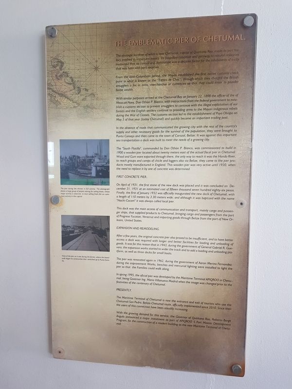
The Emblematic Pier of Chetumal.
The strategic location of what is now Chetumal, capital of Quintana Roo, made its port history involved in important events. Its boundary condition and gateway to natural sources motivated that
its control and domination was a decisive factor for the inhabitants of a city that was born with port vocation.
From the post-Columbian period, the Mayas established the first native customs check point in what is known as the “Estero de Chac”, through which they charged smugglers a fee in arms, merchandise or currencies so that they could enter to plunder forest wealth.
With similar purposes arrived at the Chetumal Bay on January 22, 1898 the officer of the Mexican Navy, Don Othón P. Blanco, with instructions from the federal government to establish a customs section to prevent smugglers to continue with the illegal exploitation of our forests and the English settlers continue to providing arms to the Mayan indigenous rebels during the War of Classes. The customs section led to the establishment of Payo Obispo on May 5 of that year (today Chetumal) and quickly became an important trading post.
In the absence of roads that communicated the growing city with the rest of the country’s supply and other necessary goods for the survival of the population, they were brought to Punta Consejo and then came to the town of Corozal, Belize; It was against this important sea transportation a dock was built to meet the needs of a growing city.
The “South Flotilla”, commanded by Don Othón P. Blanco, was commissioned to build in 1900 a wooden pier located about twenty meters east of the actual fiscal pier in Chetumal. Wood and Gum were exported through there, the only way to reach it was the Hondo River, to reach groups and camps of chicle and loggers also via Belize, they came to the pier products mostly manufactured in England. This wooden pier was very active until … the need to replace it by one of concrete was determined.
First Concrete Pier.
On April of 1931, the first stone of the new dock was placed and it was concluded on December 31, 1931 at an estimated cost of fifteen thousand seven hundred eighty-six pesos. Finally, the first of January 1932 was officially inaugurated the new dock of Chetumal, with a length of 110 meters by 3.30 meters wide; and although it was baptized with the name “Nachi-Cocom” it was always called local pier.
This dock was the main access of communication and transport, mainly cargo and passenger ships, that supplied products to Chetumal, bringing cargo and passengers from the port of Progreso Yucatan, Veracruz and importing goods through Belize from the port of New Orleans, United States.
Expansion and Remodeling.
After a few years, the original concrete pier also proved to be insufficient, and to have better access a dock was required with longer and better facilities for loading and unloading of goods. It was for this reason that in 1943, during the government of General Gabriel R. Guevara, the expansion works started to widen the track and to add a loading and unloading platform, as well as three docks for small boats.
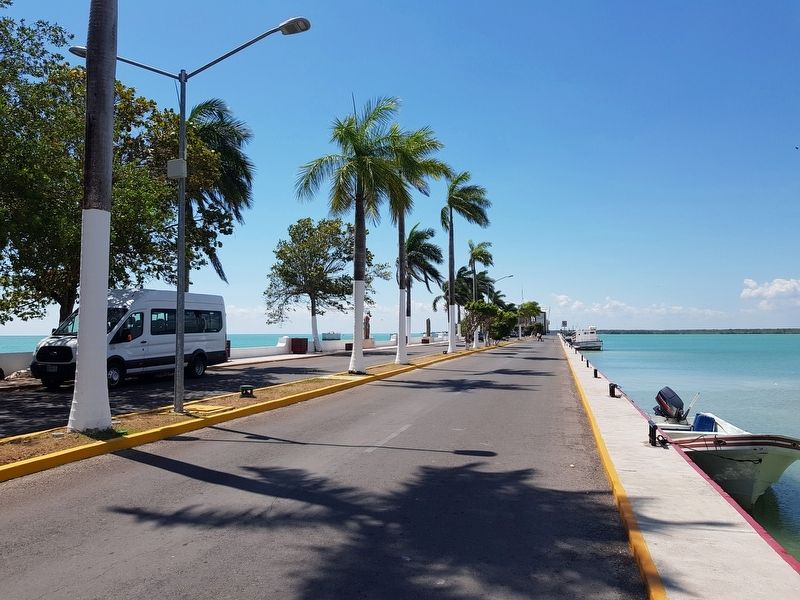
The pier was renovated again in 1962, during the government of Aaron Merino Fernandez; during the improvement Works, benches and mercurial lighting were installed to light the pier so that Families could walk along.
In spring 1995, the official pier was developed by the Maritime Terminal APIQROO in Chetumal, being Governor Ing. Mario Villanueva Madrid when the image was changed prior to the festivities of the centenary of Chetumal.
Presently.
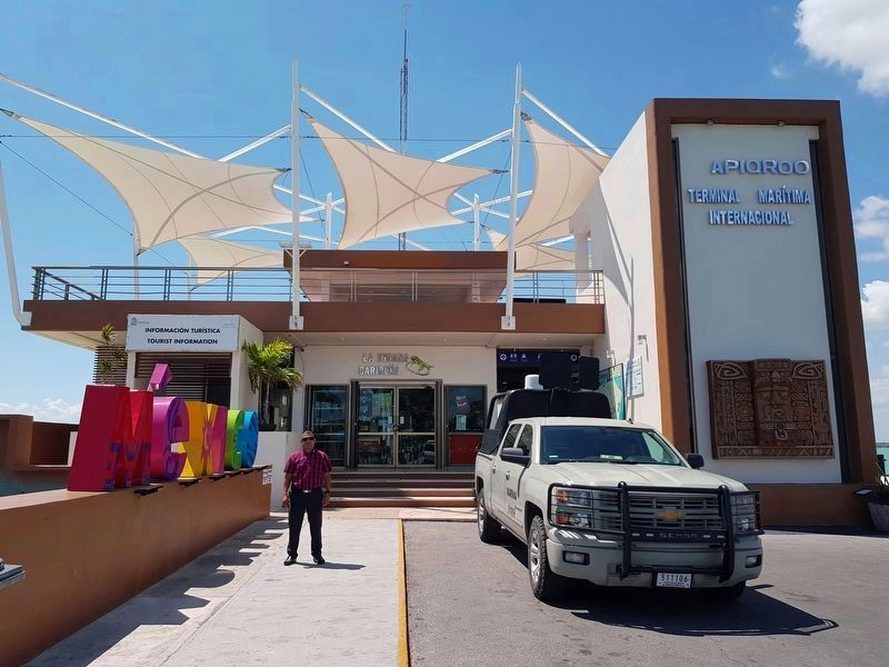
The Maritime Terminal of Chetumal is now the entrance and exit of tourists who use Chetumal-San Pedro, Belize-Chetumal route, officially implemented since 2010. Since then the users of this connection have been steadily increasing.
With the growing demand for this service, the Governor of Quintana Roo, Roberto Borge Angulo announced a major investment as part of APIQROO’s Port Master Development Program, for the construction of a modern building as the new Maritime Terminal of Chetumal.
Captions:
The pier during the thirties in full activity. The photograph shows a large group of people waiting for sailing boats, whose major activity is observed, to start selling fresh fish as customary activity in this capital.
Vista of the pier as it was during the forties, where the boardwalk began its construction that stretched up to Punta Estrella.
Topics. This historical marker is listed in these topic lists: Industry & Commerce • Man-Made Features • Settlements & Settlers. A significant historical date for this entry is January 22, 1898.
Location. 18° 29.43′ N, 88° 17.961′ W. Marker is in Chetumal, Quintana Roo, in Othón P. Blanco. Marker is on Boulevard Bahía just east of Avenida Independencia, on the right when traveling east. The marker is at the end of the main Chetumal pier. Touch for map. Marker is in this post office area: Chetumal QR 77000, Mexico. Touch for directions.
Other nearby markers. At least 8 other markers are within walking distance of this marker. Mr. Ignacio Filiberto Sabido Padilla (here, next to this marker); Life of the Lighthouse Keeper / Lighthouse Keepers of Chetumal (here, next to this marker); Monument to Nachi Cocom (approx. 0.3 kilometers away); Payo Enríquez de Rivera (approx. 0.3 kilometers away); Monument to the Mexican Flag (approx. 0.3 kilometers away); Joop Beljön (approx. 0.3 kilometers away); The Southern Fleet (approx. 0.3 kilometers away); Othón Pompeyo Blanco Núñez de Cáceres (approx. 0.4 kilometers away). Touch for a list and map of all markers in Chetumal.
Credits. This page was last revised on May 13, 2019. It was originally submitted on May 1, 2019, by J. Makali Bruton of Accra, Ghana. This page has been viewed 331 times since then and 74 times this year. Photos: 1, 2. submitted on May 1, 2019, by J. Makali Bruton of Accra, Ghana. 3, 4. submitted on May 2, 2019, by J. Makali Bruton of Accra, Ghana.


