Centre in Cherokee County, Alabama — The American South (East South Central)
Cherokee County
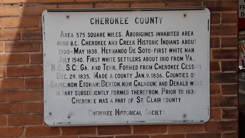
Photographed by Angela Nichols, May 1, 2019
1. Cherokee County Marker
Erected by Cherokee Historical Society.
Topics. This historical marker is listed in these topic lists: Indigenous Peoples and Communities • Settlements & Settlers.
Location. 34° 9.124′ N, 85° 40.723′ W. Marker is in Centre, Alabama, in Cherokee County. It is at the intersection of Cedar Bluff Road and West Main Street (Business U.S. 411), on the right on Cedar Bluff Road. This sign is hung on the side of the Historical Museum and can been seen from the Courthouse lawn. Touch for map. Marker is at or near this postal address: 101 E Main St, Centre AL 35960, United States of America. Touch for directions.

Regionally, this
this page online
Other nearby markers. At least 8 other markers are within walking distance of this marker: Jordan Big Store (here, next to this marker); Cherokee County Historical Museum (a few steps from this marker); Cherokee County Courthouse (within shouting distance of this marker); Cherokee County's Beginnings (within shouting distance of this marker); John Johnathan Pratt (approx. 0.2 miles away); Orville Estes Field (approx. 0.2 miles away); Cherokee County Veterans War Memorial (approx. 0.2 miles away); J.D. Jordan Jr. House (approx. 0.2 miles away). Touch for a list and map of all markers in Centre.
Another marker is no longer nearby.
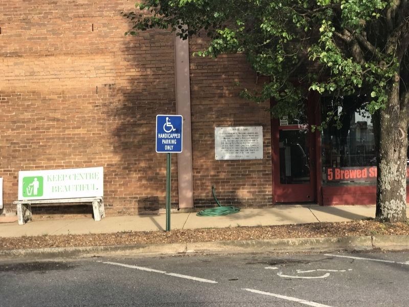
Photographed by Duane and Tracy Marsteller, May 5, 2022
2. Cherokee County Marker
Also see . . . Cherokee County, Alabama Cemetery List. Lists cemeteries in Cherokee County, Alabama, with most interments and some pictures. (Submitted on September 22, 2019, by Angela Nichols of Centre, Alabama.)
Credits. This page was last revised on May 12, 2022. It was originally submitted on May 3, 2019, by Angela Nichols of Centre, Alabama. This page has been viewed 818 times since then and 77 times this year. Photos: 1. submitted on May 3, 2019, by Angela Nichols of Centre, Alabama. 2. submitted on May 9, 2022, by Duane and Tracy Marsteller of Murfreesboro, Tennessee. • Andrew Ruppenstein was the editor who published this page.
